
ICEFIELDS PARKWAY: Literally Everything to do/see & Tips for Driving (Banff to Jasper)
The Icefields Parkway is the highway that connects Banff and Jasper. This stretch of road is an absolute mecca for outdoor adventurers looking for hiking trails, alpine lakes, wildlife, and beautiful views. If you’re visiting the Canadian Rockies, the Icefields Parkway is a bucket-list MUST!
The Icefields Parkway is rated as one of the most beautiful drives in the world. I’ve driven this highway multiple times and I can surely attest to this statement. Every straight away, turn, and stop along the Icefields Parkway will (literally) make your jaw drop.
In this guide I’ve compiled everything I’ve personally done along the Icefields Parkway along with everything I haven’t done. So, here’s literally everything you can do along the Icefields Parkway, tips for driving, optional tours, and so much more.
PS. I’ve put together a map with every Icefields Parkway stop. You can find it at the end of this post.
Skip Ahead:
- About the Icefields Parkway
- Tips for driving the Icefields Parkway
- Icefields Parkway: FAQ
- Accommodations along the Icefields Parkway
- Icefields Parkway tours
- 35+ stops along the Icefields Parkway
I have affiliate links in this post which means when you book a hotel or purchase a product, I may make a small commission ~ at no additional cost to you (full disclosure). These funds go back into The Holistic Backpacker and help me create more free content like this!
Thank you for supporting my work!
Related Content
- 50+ Things to do in Banff in summer
- How to plan the perfect trip to Jasper
- How to spend 1 day in Yoho National Park
- Step-by-step guide for planning a trip to Banff
- Ultimate guide to Waterton Lakes National Park
- Hiking gear guide for Banff
About the Icefields Parkway
The Icefields Parkway is a 232km fully paved two-lane highway that starts in Lake Louise and ends in Jasper. The drive takes around 3-3.5 hours of continuous driving (with no stops) to complete. The speed limit is 90km/hr and you can expect to see lots of mountains, lakes, glaciers, rivers, and potentially wildlife along the way.

The Icefields Parkway is open year round. There’s no “best” time of year to drive the Parkway as each season offers something entirely different:
- Spring (April to May): weather starts to warm up, abundant wildlife.
- Summer (June to August): lakes are melted, wildflowers bloom, hiking trails are open.
- Fall (September to October): Larch trees (fall colours), snow starts late October.
- Winter (November to March): snowcapped peaks, frozen waterfalls, northern lights, skating.
If you plan to drive the Icefields Parkway in winter, here are some driving tips from Parks Canada. Please also note that the gas station at Saskatchewan River crossing, campsites, and restaurants are closed from December to April. Be prepared and plan accordingly.
You’ll pass by the Parks Canada gates as soon as you turn onto the highway. At the gates you’ll have to purchase a Parks Pass for each day you plan on being in Banff and/or Jasper. You may want to purchase the Discovery Pass if you plan to spend multiple days in Canada’s National Parks.
Tips for driving the Icefields Parkway
- Fuel up in Banff or Jasper (depending where you’re starting from). There’s one gas station at the Saskatchewan River Crossing, but it’s grossly expensive.
- There’s no cell service (minus the Columbia Icefields Centre) on the Icefields Parkway, so make sure your maps are downloaded before hitting the road.
- Pack food! You can only purchase overpriced/mediocre food at Num Ti Jah Lodge, Saskatchewan River Crossing, and the Columbia Icefields Centre.
- Start your day early to avoid crowds and ensure you have ample time to fit in all the fun things to do along the Icefields Parkway.
- Budget extra time – you’ll want to make lots of stops along the way.
- Although driving in either direction is beautiful, I personally find the drive from Jasper to Banff more scenic. Driving this way allows you to see way more glaciers than you can see on the way to Jasper!
- You can find rest stops and drop toilets at almost every trailhead/parking lot along the Icefields Parkway. The Columbia Icefields center and the Saskatchewan River Crossing have full bathroom services.
Best Jasper Car Rental
Jasper is difficult and expensive to access via public transportation. Once you arrive the vast majority of lakes, hikes, and trails are inaccessible via public transportation.
My favourite Jasper car rental tool is this site. It compares all the local car rental companies to guarantee you the best rate.
Icefields Parkway: FAQ
Q: How long should I spend exploring the Icefields Parkway?
- I’d recommend spending minimum 2 days; there’s lots to see! If you can’t budget 2 days, give yourself at least 1 full day to take in the sights and make all the little pitstops. There are a few places that offer accommodations along the parkway which I’ll talk about next.
Q: When is the best time of year to drive the Icefields Parkway?
- The Icefields Parkway is beautiful year round, but my personal favourite months are June and September. In June you’ll see all the perks of summer (wildflowers, snow-less hiking trails, melted lakes) without the tourists. In September you’ll also see minimal crowds, the perks of summer, as well as all the beautiful fall colours later in the month.
Q: Where can I rent a car for the Icefields Parkway?
- Your best bet is to use Discover Car Hire and rent a car from Calgary or Edmonton (depending what city you fly into). Discover Car Hire compares multiple car rental companies to ensure you’re getting the best price.
Q: Is there wildlife on the Icefields Parkway?
- Yes! The best time of year to see wildlife is in the spring (end of April to May) or October. A few animals you can watch out for are deer, elk, goats and if you’re lucky a bear or coyote. Please be mindful of wildlife; don’t get too close and DO NOT feed the animals! Additionally, if you see wildlife on the highway don’t stop! This creates what we call a “bear jam” in which one car after the other pulls over to see the wildlife, creating a massive traffic jam. Stopping for wildlife is now an offence and you can be fined. If you’re particularly interested in wildlife, you may want to take a wildlife watching tour in Jasper.
Q: Can you drive the Icefields Parkway in winter?
- You bet, although the winter drive is only recommended for those who have experience with winter driving. Make sure you read these driving tips, have snow tires on your car, and a full tank of gas before hitting the highway. All amenities and accommodations along the Parkway are closed from December to April. Please be aware that the drive can be sketchy in snowy/icy conditions (there’s limited plowing and no salt is used on the road) and there are frequent whiteouts. Additionally many parking lots and pullouts are not plowed, rendering them inaccessible.
Q: Can you find hikes along the Icefields Parkway?
- Totally. There are plenty of trails along the Icefields Parkway. I’ll list all the hikes along the Parkway in this post. To help you prepare for hiking in the Rockies, here’s my guide for what to wear hiking and the gear I recommend taking with you.
Accommodations: Where to Stay Along the Icefields Parkway
Although limited, there are accommodations along the Icefields Parkway. If you’re looking to make your Icefields Parkway adventure span multiple days, this info is for you!
As I talk about all the stops and attractions along the Icefields Parkway I’ll make more detailed notes of these accommodations, however here’s a brief overview of the available options:
- Campsites offered in Banff and campsites offered in Jasper.
- The Crossing (Saskatchewan River Crossing)
- Glacier View Lodge (Athabasca Glacier)
- Num Ti Jah Lodge (Bow Lake)
- Sunwapta Rocky Mountain Lodge (Sunwapta Falls)
- Hostels along the Parkway: Mosquito Creek, Rampart Creek, Hilda Creek, HI Beauty Creek, HI Mt Edith Cavell
*note that these hotels, hostels, and campsites are CLOSED from December to April.
Camping Along the Icefields Parkway: More Info
- No random camping is permitted in the park. You must stay at a campsite.
- RV’ers and van travellers cannot sleep in their cars along the Parkway (although tempting).
- Many campsites along the Icefields Parkway operate on a first-come, first-serve basis.
Take an Icefields Parkway Tour
If you want to skip the headache of planning an itinerary, an Icefields Parkway tour might be for you. There are multiple companies and excursions who each offer something different.
Each tour is unique, however you can typically expect a knowledge guide, transportation, (sometimes) food and beverages, and a tried-and-true itinerary that’s sure to impress.
Here are a few of the tours that are offered for the Icefields Parkway:
Click here to
Use a Virtual Tour
Okay so this is something new I JUST found out about but I think it’s such a cool concept! There’s a company called GyPSy that creates virtual tours for road trips.
They have a tour specifically curated for the Icefields Parkway which points out different stops and viewpoints along the way. This is a great way to keep track of the things you’re seeing and to ensure you make note of all the important lakes, mountains, and glaciers along the way.
GyPSy has a variety of tours that cover locations all over the Rocky Mountains as well as different countries. They also have sample audio of the trip you’re looking at so you can get a taste of what the virtual tour will entail.
Most tours cost under $10! You can find all their tours, including the Icefields Parkway one here.
35 Beautiful Stops Along the Icefields Parkway
This guide for stops along the Icefields Parkway is going to start at Banff and end in Jasper. If you plan to drive it reverse (from Jasper to Banff), scroll to the bottom and start reading the opposite way.
This list is absolutely massive and you’d need a week+ to explore everything I’ve listed here. I’m totally one of those “I need to know all the options before I travel” people though, so I thought it’d be best to display literally everything to do along the Icefields Parkway just in case you’re the same.
1. Banff National Park (start)
The Icefields Parkway begins at Lake Louise which is situated just 40 minutes from the little mountain town of Banff. Lake Louise is the perfect place to fill your gas tank, grab some snacks, and spend the night prior to starting the Icefields Parkway drive.
More: How to hike EVERYTHING at Lake Louise in 1 day
Make sure you spend some time exploring Banff too! Banff is the crown jewel of the Canadian Rockies and is surely a place you don’t want to miss. I was fortunate enough to live in Banff for over a year which allowed me to go on soooo many incredible adventures there.
You can explore all my guides for Banff here, however here’s some of my top Banff-content you might want to check out before your Icefields Parkway adventure:
- Plan your trip to Banff: A step-by-step guide
- Hiking trails in Banff
- 30+ Thing to do in Banff: winter
- A local’s guide to skiing Sunshine Village
- Destinations near Banff: Kananaskis (my favourite hiking destination in the Rockies), Yoho, and Kootenay.
Where to Stay in Banff
Banff offers a plethora of hotels, hostels, and campsites. Here are a few options for every budget:
- Budget stays: The Dorothy Motel, Blue Mountain Lodge, and the Banff Rocky Mountain Resort.
- Luxury stays: Fairmont Banff Springs (the castle in the sky), Sunshine Mountain Lodge (ski-in/ski-out at Sunshine Village), and the Rimrock Resort.
- Popular hotels: Banff Caribou, Mount Royal, and the Elk + Avenue.
- Hostels: Banff International Hostel, HI Banff, Samesun Banff,
- Here are the local campsites in Banff.
- Lake Louise: Fairmont Chateau Lake Louise (luxury), HI Lake Louise (hostel), Paradise Lodge and Bungalows (500m away from Lake Louise), Baker Creek Mountain Resort (cabins)
When planning your itinerary, plan to spend at least couple a days in the town of Banff and one day at Lake Louise before driving the Icefields Parkway to Jasper.
2. Herbert Lake
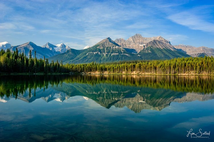
I’m deeming Herbert Lake one of the best lakes for swimming in Banff! Herbert Lake is significantly warmer than the rest of the alpine lakes in the Canadian Rockies (it’s not glacially fed).
Herbert Lake is the perfect first stop on the Icefields Parkway if you want to start your morning out with a refreshing swim. If you’re not one to swim, you can opt for a quick 1.6km walk around the lake instead.
Distance from Banff: 62km
Distance from Jasper: 226km
3. Hector Lake
Hector Lake is yet another beautiful lake you’ll find along the Icefields Parkway. There’s a great photo-op for the lake not far from the parking lot and the Mosquito Creek first-come, first-serve campground is located just down the road if you want to spend the night here.
Backing Hector Lake you’ll find the stunning Mount Pulpit which gives the lake a super dramatic Rocky Mountain look.
Distance from Banff: 78km
Distance from Jasper: 210km
Accommodation: HI Mosquito Creek Wilderness Hostel
If you want to really take your time exploring the Icefields Parkway (and you’re not a camper), the Mosquito Creek hostel is just down the road from Hector Lake.
BOOK YOUR STAY
Distance from Banff: 84km
Distance from Jasper: 205km
4. Crowfoot Glacier
The Crowfoot glacier is the first of many glaciers you’ll find along the Icefields Parkway! This glacier is (obviously) massive and makes for a great photo-op.
You can see the glacier from the Icefields Parkway, however the glacier is best viewed from a pullout you’ll find on the left of the highway.
Distance from Banff: 91km
Distance from Jasper: 197km
5. Cirque Peak via Helen Lake
Cirque Peak via the Helen Lake trail is the first (and one of the most fabulous) hikes along the Icefields Parkway. This trail is an advanced hike/scramble and is only recommended to those with lots of previous hiking experience.
More: What to wear hiking in the Rockies
More: Recommended hiking gear for the Rockies

The hike is 17km in length with a grand total of 1,147m of elevation gain. The trailhead can be found directly across the road from the Crowfoot Glacier lookout.
This hike boasts incredible overhead views of Crowfoot Mountain and Bow Lake (the next stop on the Icefields Parkway). But to get there you must endure a long scramble which is only recommended in the later summer months. Before late July/early August there’s still lots of snow which makes for some extremely treacherous terrain.
If you’re not an experienced hiker you can opt to hike to Helen Lake instead! Helen Lake is situated 7km from the trailhead and does not require any scrambling.
Here’s the Alltrails map for Cirque Peak.
Distance from Banff: 91km
Distance from Jasper: 197km
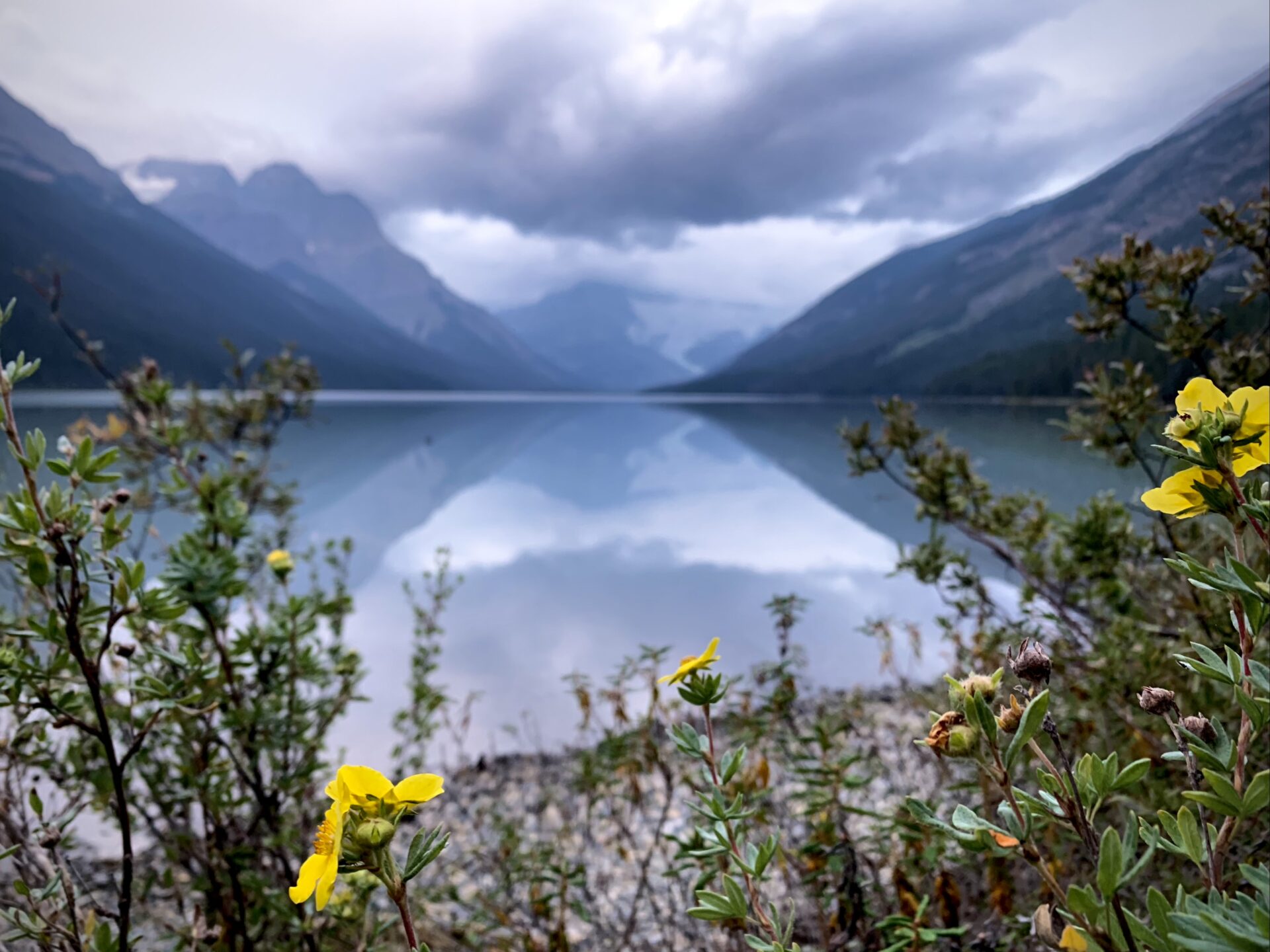
6. Bow Lake: Bow Glacier Falls, Cirque Peak, The Onion & Mount Jimmy Simpson
If you make one extended stop at any of the lakes on the Icefields Parkway, it’s gotta be at Bow Lake. Bow Lake offers multiple hiking trails and the bluest water I’ve ever seen.

Unfortunately there’s no rental facility here, but if you’ve got the means of transporting a canoe, kayak, or SUP Bow Lake is the perfect place for a quick paddle. I’d recommend getting here early to see the morning reflection and, if possible, to visit on a sunny day. This is when the water will be bluest.
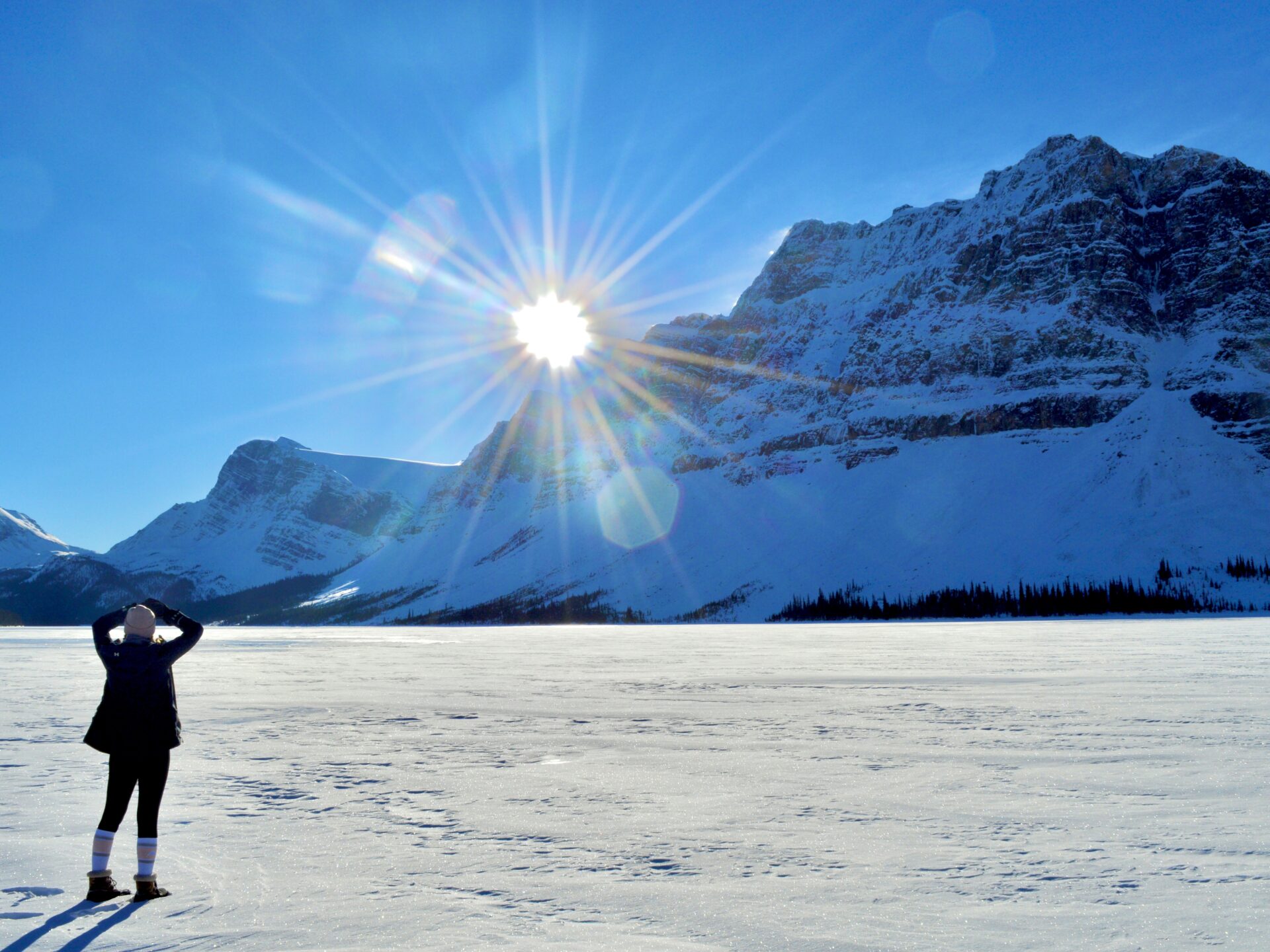
In winter you’ll find plenty of people cross country skiing and snowshoeing around Bow Lake.
Distance from Banff: 94km
Distance from Jasper: 194km
7. Bow Glacier Falls
Bow Glacier Falls is one of the 4 hiking trails accessed via the Bow Lake parking lot and is one of the most family friendly hikes along the Icefields Parkway.
More: What to wear hiking in the Rockies
More: Recommended hiking gear for the Rockies

The Bow Glacier falls trail is about 9km in length with 300m of elevation gain. The trail is easy to follow and well trafficked which makes it perfect for beginner hikers, families, and dogs (just keep them on a leash).
At the end of the trail you’ll find Bow Glacier Falls; the water source for Bow Lake. The water of these falls comes from the Bow glacier which is an outflow glacier from the Wapta Icefield. The minerals from these glaciers are what gives Bow Lake its blue colour.
Here’s the Alltrails map for the Bow Glacier Falls hike.
Distance from Banff: 94km
Distance from Jasper: 194km
8/9. Iceberg Lake and the Onion
Just above Bow Glacier Falls sits Iceberg Lake. Iceberg Lake is only accessible via hiking in the later summer months – DON’T attempt this one in winter.
You’ll need waterproof boots and some scrambling experience to complete this hike. Advanced/semi-advanced hikers only!
Here’s the Alltrails map for Iceberg Lake.
If you want a mesmerizing birds-eye view of Iceberg Lake you must scramble up the onion. The Onion is a longer branch off of the Iceberg Lake trail that clocks in at 17.5km with over 900m of gain; this one isn’t for the faint of heart.
For this hike you’ll want waterproof shoes, a range of warm clothing, as well as some prior hiking experience. The first section of the hike isn’t overly challenging, however there’s a daunting scramble at the end. Again, I’d recommend this trail only to experienced hikers.
Here’s the Alltrails map for The Onion.
Distance from Banff: 94km
Distance from Jasper: 194km
10. Mount Jimmy Simpson
Mount Jimmy Simpson is the fourth hiking trail accessible from the Bow Lake parking lot. Like The Onion and Cirque Peak, Mount Jimmy Simpson is a scramble and is only recommended to experienced hikers.
Beginner hikers and view seekers hang in there! I’ll be recommending more view points and hiking trails that are suited to a range of ability levels next.
Mount Jimmy Simpson is totally an off-the-beaten path hike. I haven’t personally attempted this one, however I have friends who have taken 9+ hours to complete it. The challenge is big – this trail clocks in at 17.4km with 1,275m of gain – but the reward is oh-so-worth-it.
Along the way you’ll find unnamed tarns, glaciers, plenty of mountain views, and untouched wilderness.
The trail isn’t well marked and scrambling is required. You’ll want good footwear, warm clothes (no matter the season), and plenty of water and food in case the hike takes longer than expected. Wait until at least mid July to scramble up Mount Jimmy Simpson, as you’ll find winter conditions until late in the season.
Here’s the Mount Jimmy Simpson Alltrails map.
Distance from Banff: 94km
Distance from Jasper: 194km
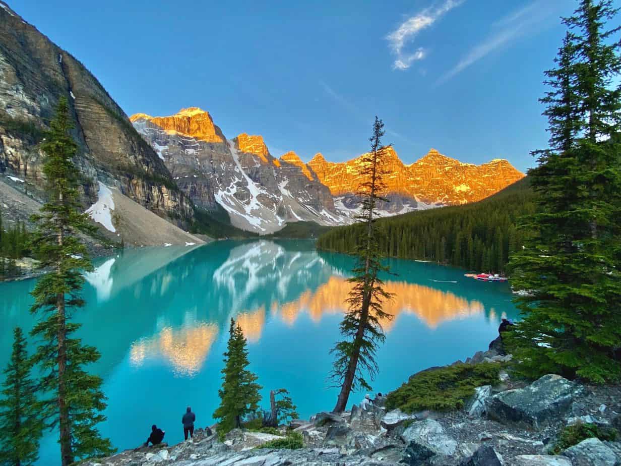
11. Peyto Lake
Peyto Lake is one of the famed Banff lakes. It sits right up there on the pedestal with Moraine Lake and Lake Louise.
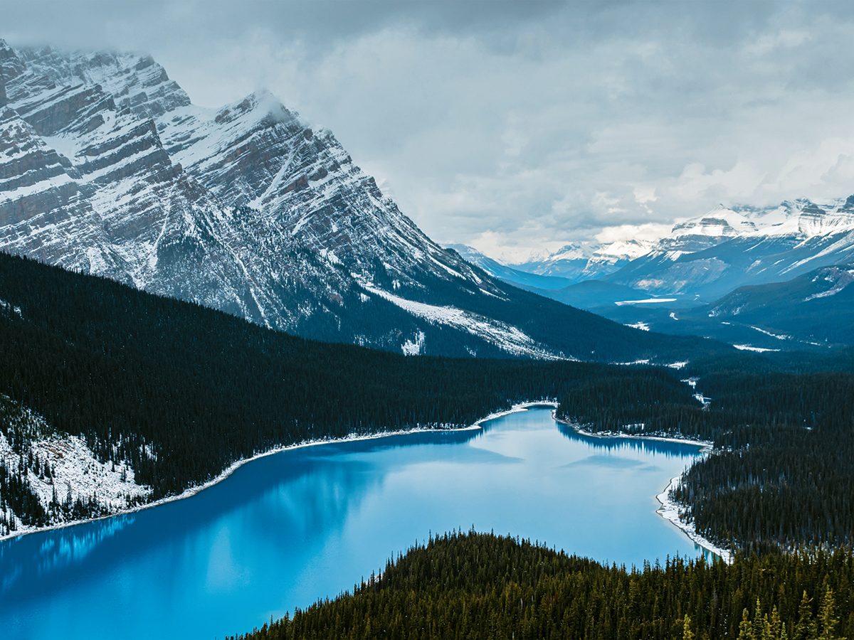
Peyto Lake is that wolf shaped lake with the pretty blue water and unbelievable mountains. The famous viewpoint you see here is only a quick 2.4km (roundtrip) walk from the parking lot. Here’s the Alltrails map.
Peyto Lake is an extremely popular tourist spot, so if you want some solitude or a better photo-op arrive early (for sunrise) or late (for sunset). Silverhorn campground is located just 11km down the road to help you with the whole sunrise/sunset thing. If you’re not a camper, the closest accommodations are The Crossing Resort or the HI Mosquito Creek Hostel.
Peyto Lake is also a prime location to see the northern lights during the winter months.
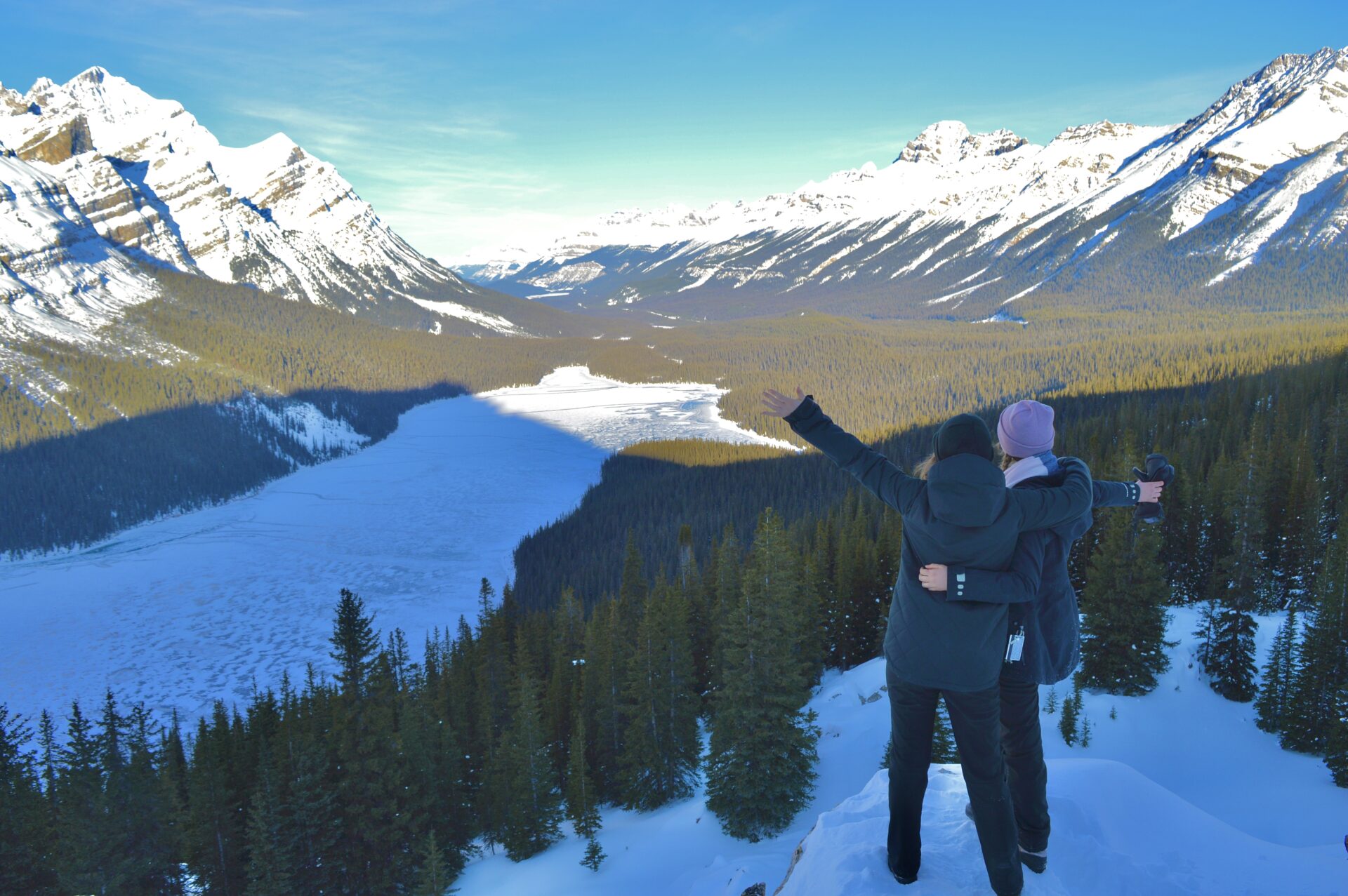
Peyto Lake isn’t as impressive in winter UNLESS you visit for the first snowfall. If you do this, then you’ll see the bright blue water encased by light fluffy snow. It’s honestly incredible.
Distance from Banff: 100km
Distance from Jasper: 188km
12. Observation Peak Scramble
Want to see Peyto Lake from above? Hike up Observation Peak!
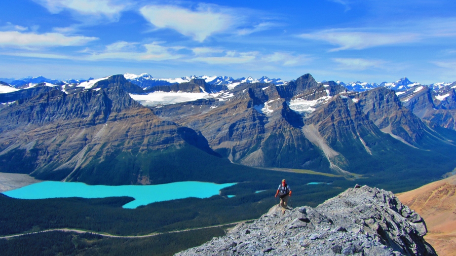
Observation Peak is another advanced hike/scramble along the Icefields Parkway. You’ll have to cross the road from the Peyto Lake parking lot to find the trailhead.
This trail is short, but steeeeeep. In 7.8km you can expect to gain 1,152m of elevation. For this hike in particular it’s super important you download the Alltrails map ahead of time as the route isn’t well travelled or marked. It’s easy to get lost or cliffed out if you venture off-trail.
Bring proper hiking footwear, warm clothes, and any necessary gear. A helmet is recommended on this hike due to the loose scree and it’s recommended you wait until late in the season for this hike to avoid any winter conditions up on the mountain.
Aside from all my scary warnings, this hike is absolutely breathtaking and features the best view you can get of Peyto Lake!
Here’s the Alltrails map for Observation Peak.
Distance from Banff: 100km
Distance from Jasper: 188km
13. Waterfowl Lakes
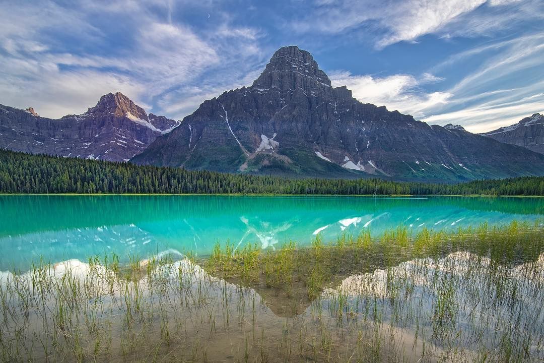
Waterfowl Lakes has a first-come, first-serve campground and is the perfect place to take a break and stretch your legs.
The Waterfowl Lakes are a series of 2 lakes fed by the Mistaya River. Behind the two lakes you’ll find multiple captivating peaks that make for the perfect Rocky Mountain scenery.
This is a quick and easy stop along the Icefields Parkway that’s great for photographers or for those looking to get that perfect Instagram photo.
Distance from Banff: 115km
Distance from Jasper: 173km
14. Cephren Lake
The impressive Cephren Lake is only accessible via hiking. The trailhead is conveniently located in the Waterfowl Lakes parking lot though which makes this a 3 lakes in 1 hike typa deal.
The trail to Cephren Lake is 8km long with 243m of elevation gain. It’s rated as moderate and it’s suitable for people of all hiking abilities. The trail should take around 2 hours to complete, but it’s recommended that users bring waterproof hiking boots as the trail is low-lying and subject to minor flooding.
Here’s the Cephren Lake Alltrails map.
Distance from Banff: 117km
Distance from Jasper: 172km
Connect via socials:
STAY CONNECTED
Sign up for emails to receive a 25% discount on my travel maps.
Taylor ♡
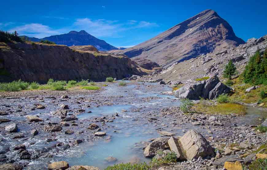
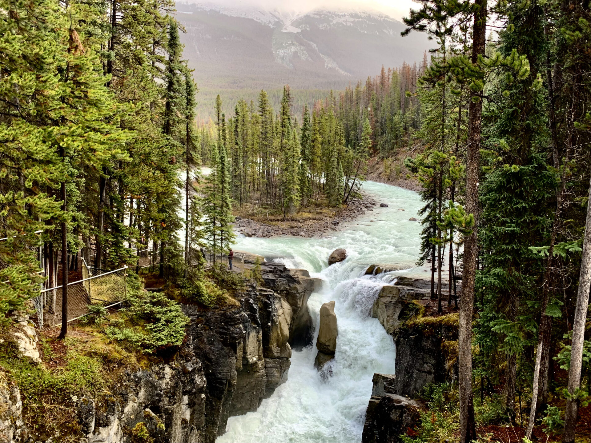
15. Mistaya Canyon
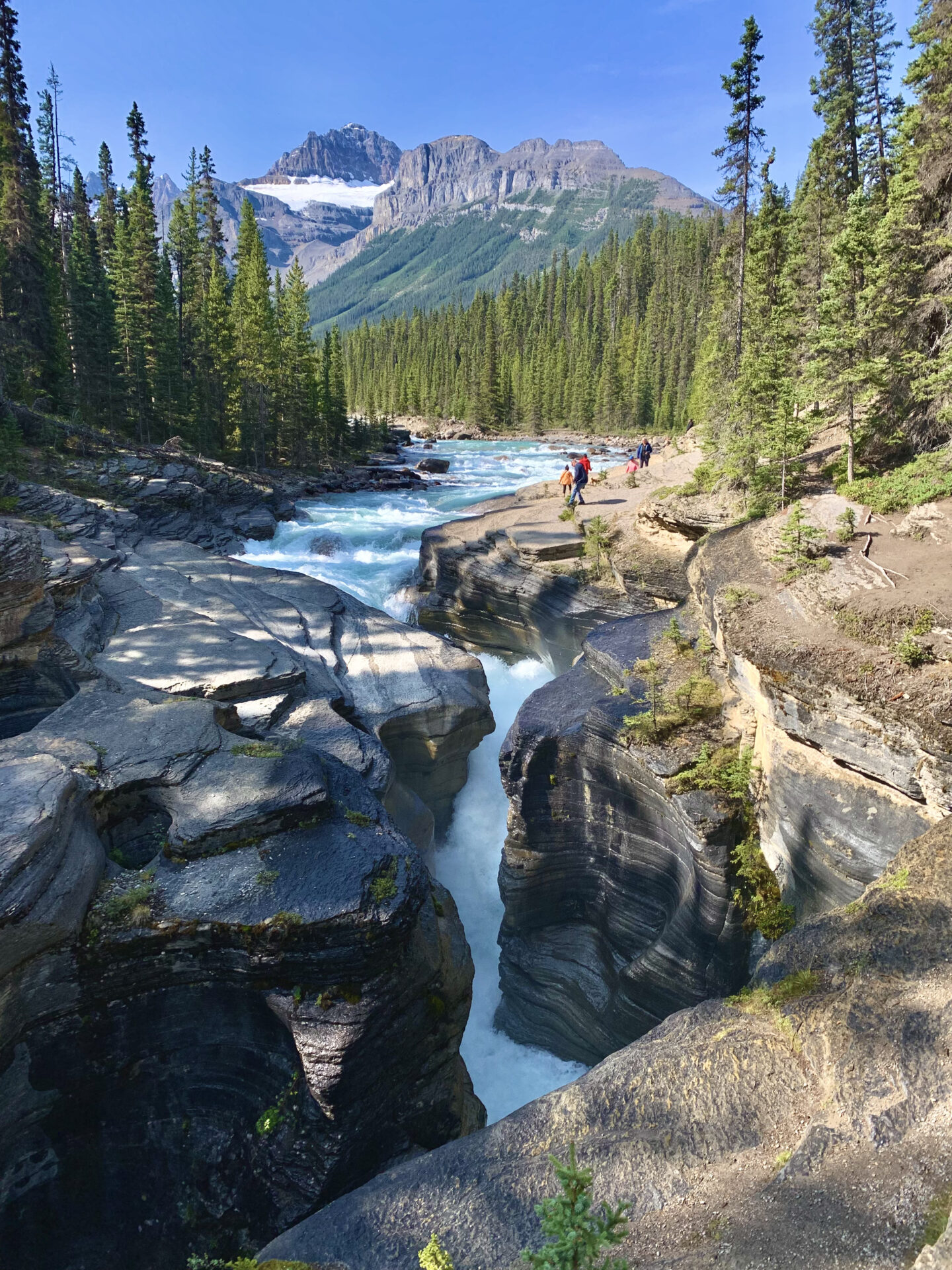
Mistaya Canyon is another great photo-op along the Icefields Parkway. From the parking lot it’s only a quick walk to the canyon where you’ll find gushing rapids and bright blue water stemming from the Mistaya River.
This is a great picnic location and a great spot to stretch your legs. You’ll find a couple trails running alongside the Mistaya River; you can follow these for a while if you’re after a quick hike, but don’t go too far because they connect to summit routes and backcountry campsites!
Distance from Banff: 130km
Distance from Jasper: 158km
16. Abraham Lake
Abraham lake isn’t technically on the Icefields Parkway, but I had to include it on this list because it’s SO beautiful!
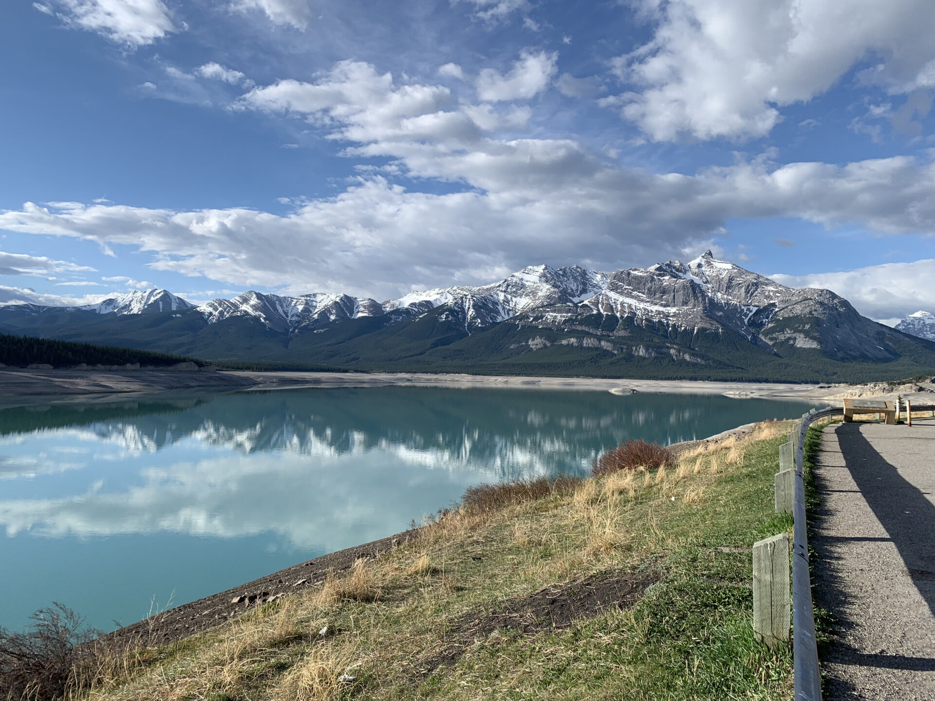
Right before the Saskatchewan River Crossing you’ll find a turn off for the David Thompson Highway that leads to Nordegg/Rocky Mountain House. There are lots of great hiking trails and little waterfalls along the David Thompson Highway, but the prize is Abraham Lake.
Abraham Lake is absolutely massive and has the prettiest blue water. In winter this lake is famous for it’s methane bubbles in the ice, however in summer it’s well known for its free camping.
Yup, you read that right! Abraham lake is outside of the National Park and is deemed a free camping zone. You can park your car, trailer, or pitch a tent anywhere you want along this lake.
If you’re a free-camper and want to split up your Icefields Parkway adventure into 2 days, you must camp here.
*note that the dirt roads leading down to the lake can be pretty sketchy. It’s recommended to bring vehicles with high clearance or 4×4 for some areas although you can absolutely take a small car (like I did).
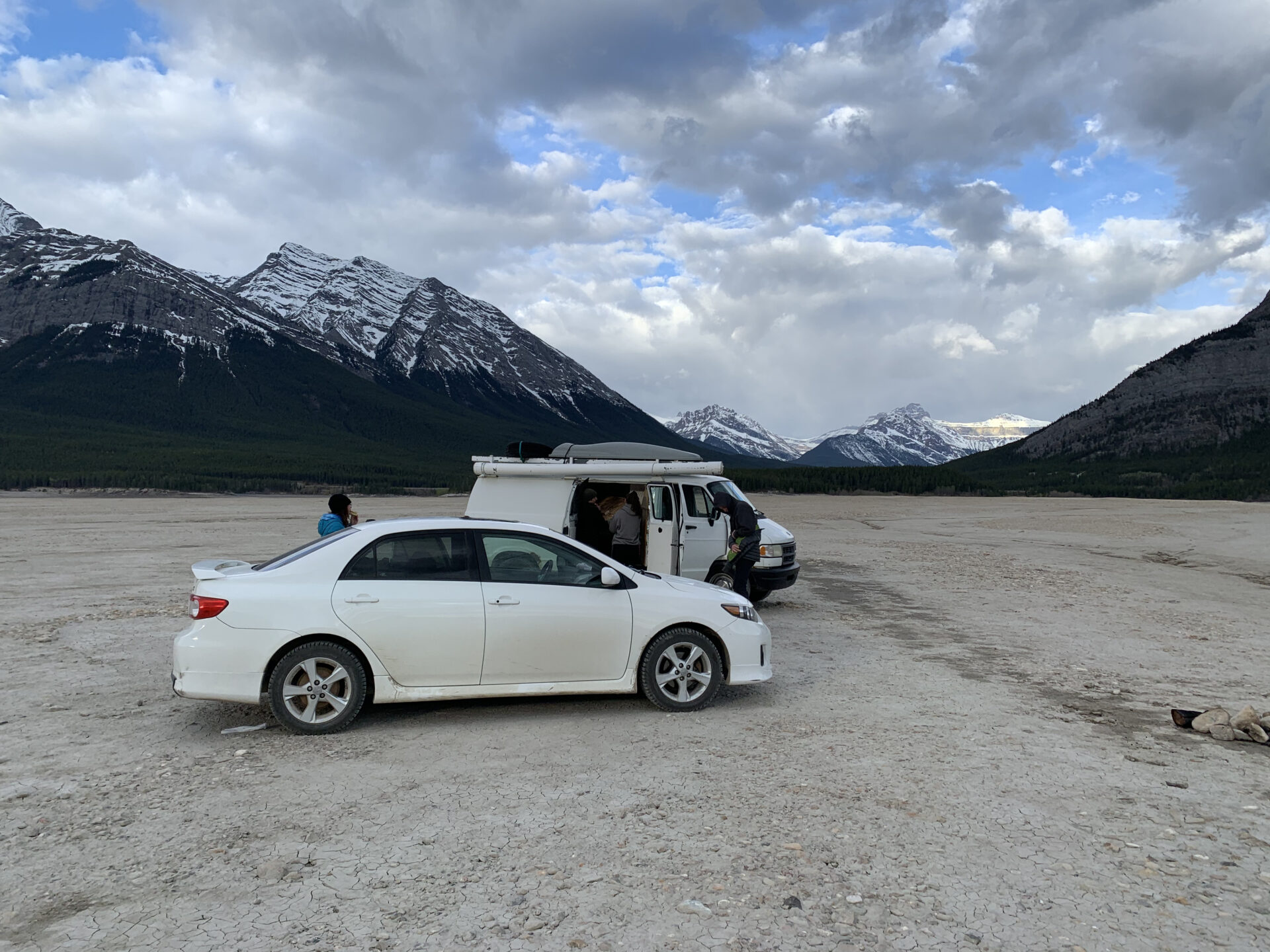
My friends and I went camping at Abraham lake early in the season. We quickly found out the lake drains before it refills in the spring which is super interesting.
We actually drove into the lakebed and camped there for the night where we were lucky enough to see the northern lights dance between a dip in the mountains.
Later we found out you’re totally not allowed to drive out onto the lakebed, so definitely don’t do this. Oops.
Distance from Banff: 184km
Distance from Jasper: 202km
17. Saskatchewan River Crossing
The Saskatchewan River Crossing is a hotel, gas station, shop, and restaurant all rolled into one. This marks the half-way (ish) point on the Icefields Parkway.
You can find overpriced and mediocre food here as well as ridiculously expensive gas. But hey, sometimes we’re not prepared and don’t plan accordingly. The Saskatchewan River Crossing may just be your saving grace.
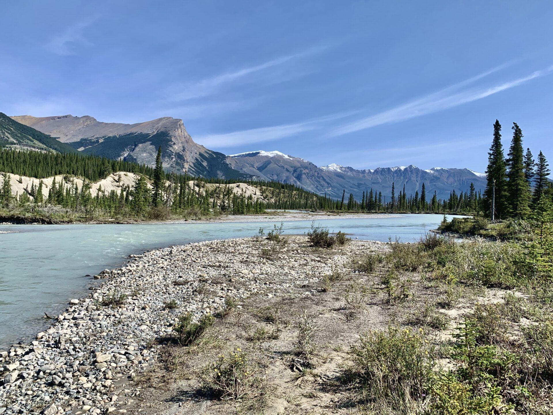
My favourite part about the Saskatchewan River Crossing is the little lookout point featured above. To get here you’ll need to take the tiny dirt road pull-off right before the bridge leading to the Crossing (or right after the bridge if you’re coming from Jasper).
There’s only room for one or maybe 2 vehicles, but this is a secret spot that no ones knows about (shhh don’t tell anyone) so you likely won’t be fighting for a parking spot.
I’ll mark this spot on the map at the bottom of this post.
Distance from Banff: 135km
Distance from Jasper: 153km
Accommodation: The Crossing
The Crossing marks the halfway point on the Parkway. If you plan to spend 2 days exploring the Icefields Parkway, this would be a great place to spend the night.
BOOK YOUR STAY
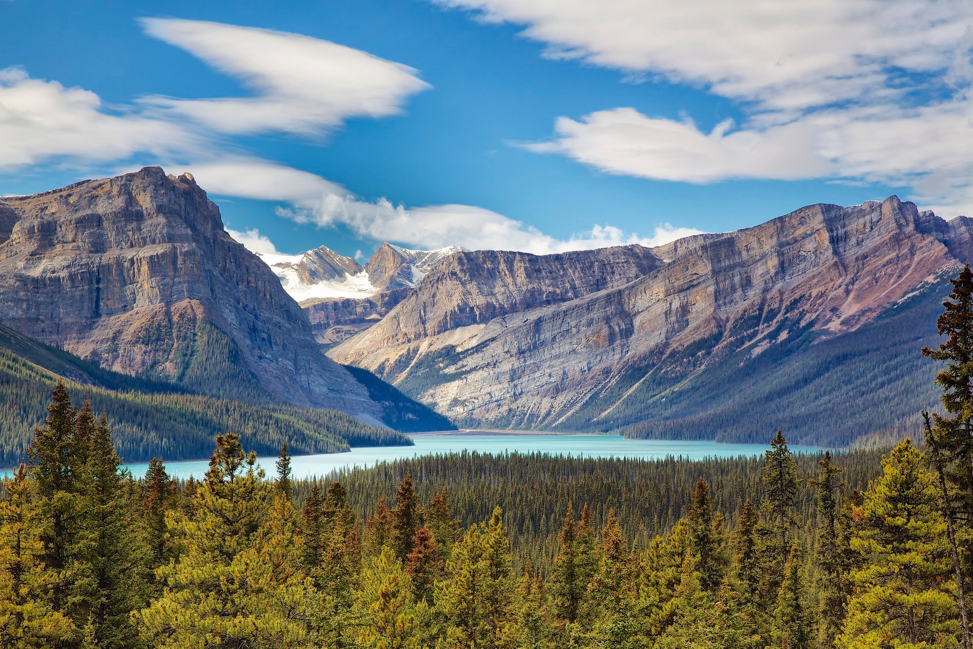
18. Glacier Lake
Glacier Lake is primarily a backpacking trail, but it can also be hiked in a day if you’re ambitious. The trail to Glacier Lake is 17km long with 870m of gain.
I completed this backpacking trip the summer of 2021 and was blessed with a perfect early morning reflection before the wind and rain set in.
This hike is great for beginner backpackers, trail runners, or for those looking for a lengthier day-hike along the Icefields Parkway.
Here’s my Glacier Lake trail guide and a list of all my backpacking essentials for the Rockies.
Distance from Banff: 138km
Distance from Jasper: 150km
Accommodation: HI Rampart Creek Wilderness Hostel
The HI Rampart Creek is located just past the Glacier Lake trailhead and the Saskatchewan River Crossing. Staying at the hostel is a cheaper option than staying at the Crossing if you’re looking for accommodations at the halfway point.
BOOK YOUR STAY
Distance from Banff: 147km
Distance from Jasper: 141km
19. The Weeping Wall
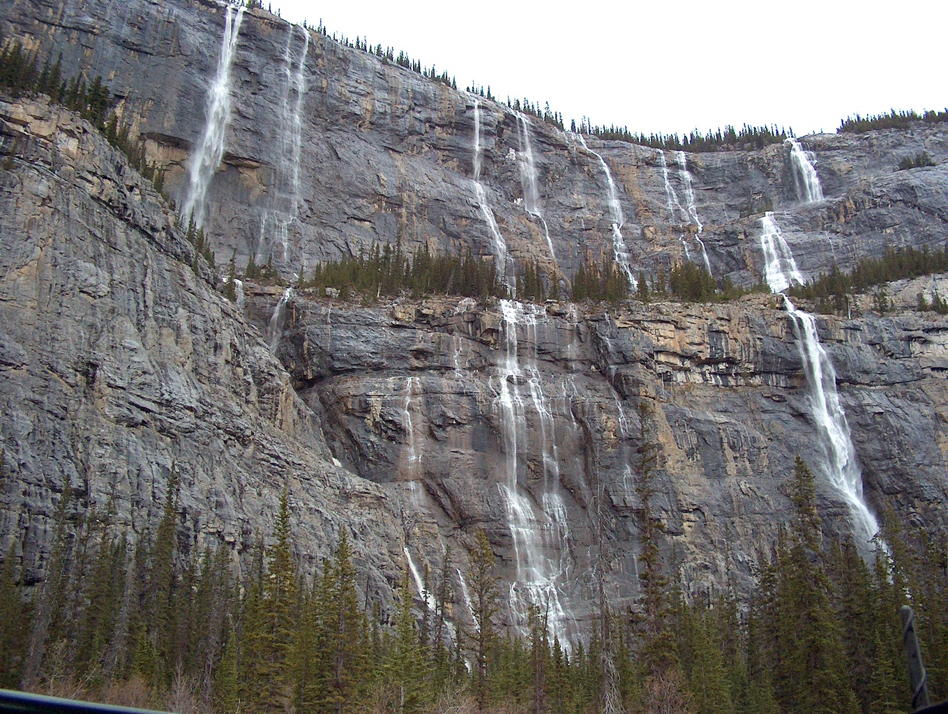
The Weeping Wall is a series of waterfalls across a massive rock face. The falls are best seen from the Icefields Parkway early in the season; when the glacial melt is at its highest.
In winter the Weeping Wall becomes a very popular ice climbing destination.
Distance from Banff: 164km
Distance from Jasper: 124km
20. Big Hill & Big Bend
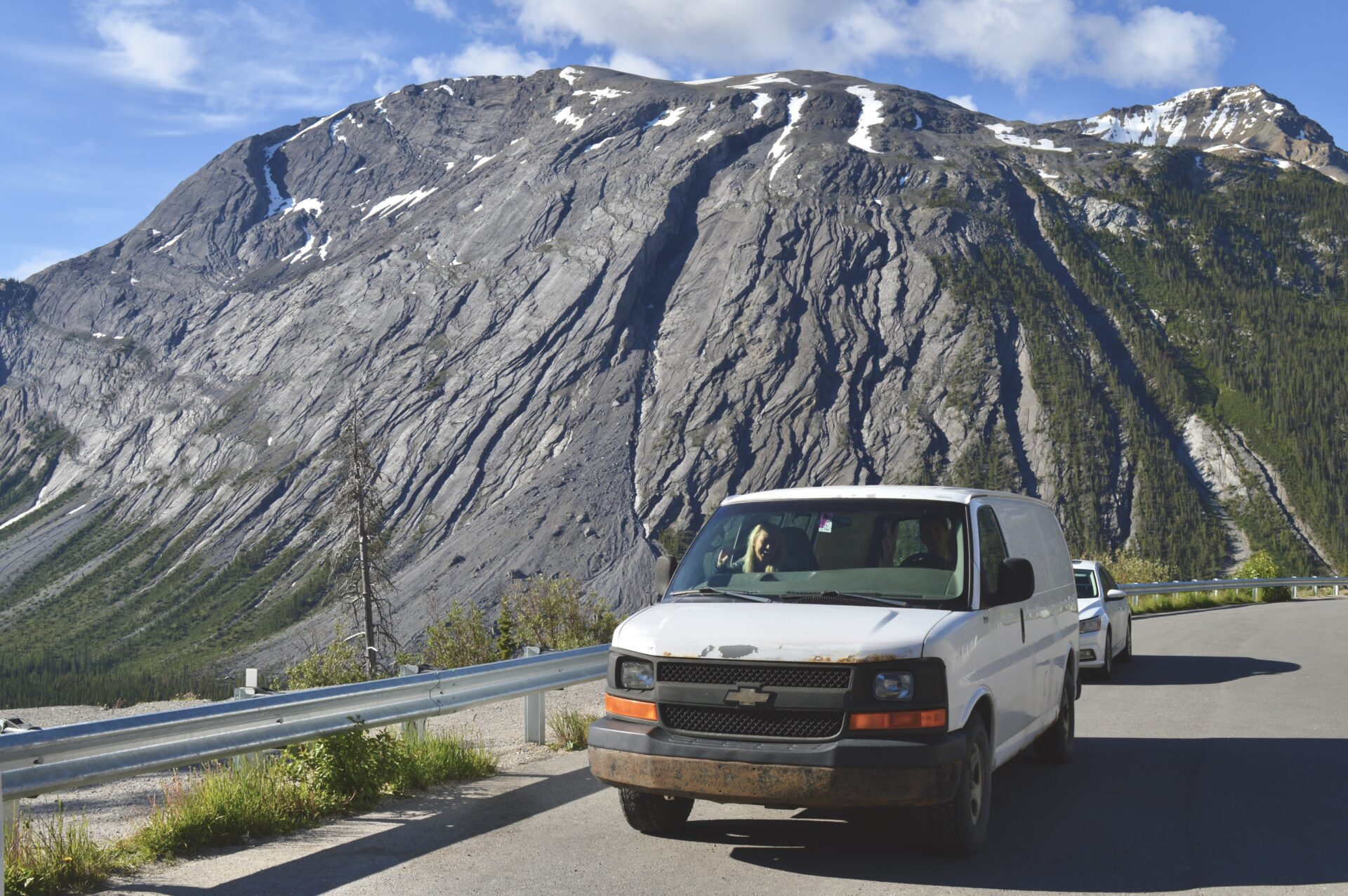
Eventually you’ll come to Big Bend which is literally big bend in the Icefields Parkway. The road follows a giant, stretched out horseshoe shape until it rounds the final corner and you’re faced with the perfect view of Big Hill.
This mountain you see in the picture is seriously one of the most interesting mountains I’ve seen. It’s got so many intricate details and crevasses.
I can hear you laughing at me for being such a mountain nerd, but I’m telling ya – once you spend time in the mountains they start to have their own personalities. They’re not just big rocks anymore.
Anyways, there’s a little pullout where you can take some photos and enjoy the views before moving on.
Distance from Banff: 169km
Distance from Jasper: 119km
21. Panther & Bridal Falls
Right after Big Bend you’ll find the trailhead for Panther and Bridal Falls. This is a quick hike that’s great for everyone.
The trail is only 1.3km (roundtrip) and features not 1, but 2 waterfalls! This hike only takes max. 30 minutes so I’d definitely recommend checking it out.
Here’s the Alltrails map.
Distance from Banff: 171km
Distance from Jasper: 117km
22. Nigel Pass Hike
The Nigel Pass trail isn’t an overly steep or difficult hike, but it is lengthy; 15.9km long to be exact. Roundtrip the hike takes around 4.5 hours to complete and it’s suitable for mountain biking.
The trail follows Nigel Creek and is home to some pretty incredible Rocky Mountain scenery.
If you’re looking for another backpacking route along the Icefields Parkway, you can extend the Nigel Pass trail to complete the Brazeau Loop; an 82.2km trail through Jasper National Park.
Here’s the Alltrails map for Nigel Pass.
Distance from Banff: 172km
Distance from Jasper: 115km
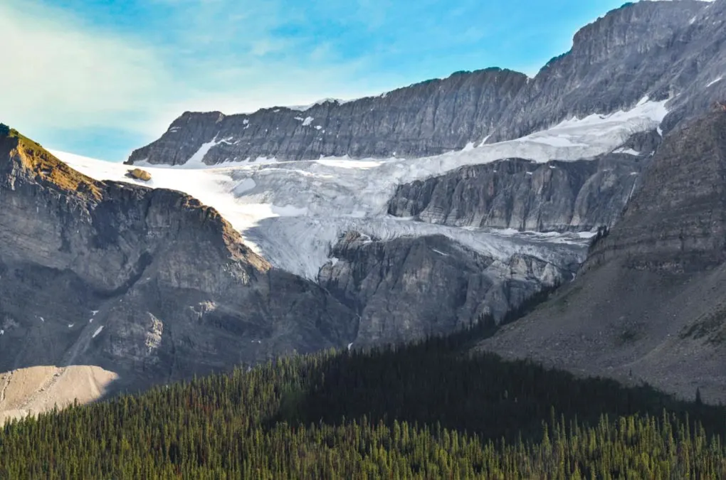
23. Parker Ridge
The Parker Ridge trail is a fan favourite on the Icefields Parkway. The Parker Ridge trail is 6.4km long with 338m of elevation gain and is suitable for all ages/ability levels.
You can expect to follow switchbacks through a forested section until you come out on top of Parker Ridge. Here you’ll find the beautiful and unique North Saskatchewan Glacier.
Parker Ridge should only be hiked in summer. In winter you’ll find deep, deep snow on the trail.
Here’s my complete trail guide for Parker Ridge.
Distance from Banff: 176km
Distance from Jasper: 112km
Jasper South Boundary
Between the Parker Ridge trailhead and the Wilcox Pass trailhead you’ll pass Jasper’s south boundary. From this point forward you’ll be exploring the beautiful Jasper National Park!
24. Wilcox Pass
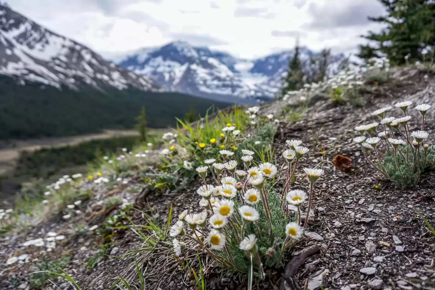
Wilcox Pass is a beautiful hike that’s full of wildflowers in the summer months (July to August). At the end of this trail you’ll find the Wilcox Pass lookout which overlooks the impressive Columbia Icefield.
This trail is relatively easy and it’s highly recommended to anyone venturing down the Icefields Parkway.
On this hike you have a higher chance of seeing wildlife and you’ll find Parks Canada’s red chairs!
Here’s the Alltrails map for Wilcox Pass.
Distance from Banff: 182km
Distance from Jasper: 105km
Accommodation: Glacier View Lodge
Glacier View Lodge is attached to the Columbia Icefields Center and is the most up-scale accommodation you’ll find along the Icefields Parkway. If you’re looking for a place that’s a little more “luxurious” rather than “backpacker trash,” this is where you’ll want to stay.
BOOK YOUR STAY
Distance from Banff: 185km
Distance from Jasper: 103km
Alternatively, there are 3 first-come, first-serve campgrounds located just down the road: Wilcox (for small motorhomes and RV’s), Icefield Tent (tenting only), and the Icefield Center RV (Rv’s only).
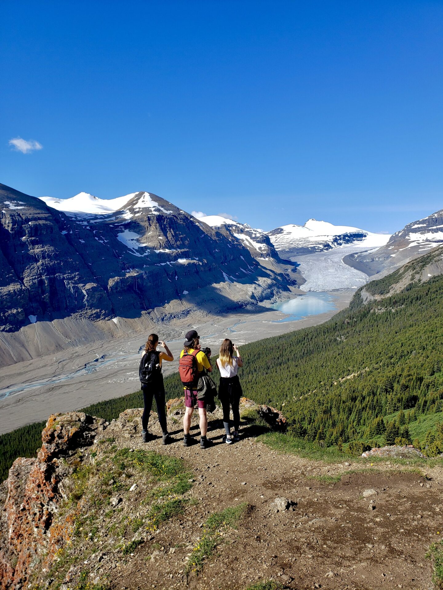
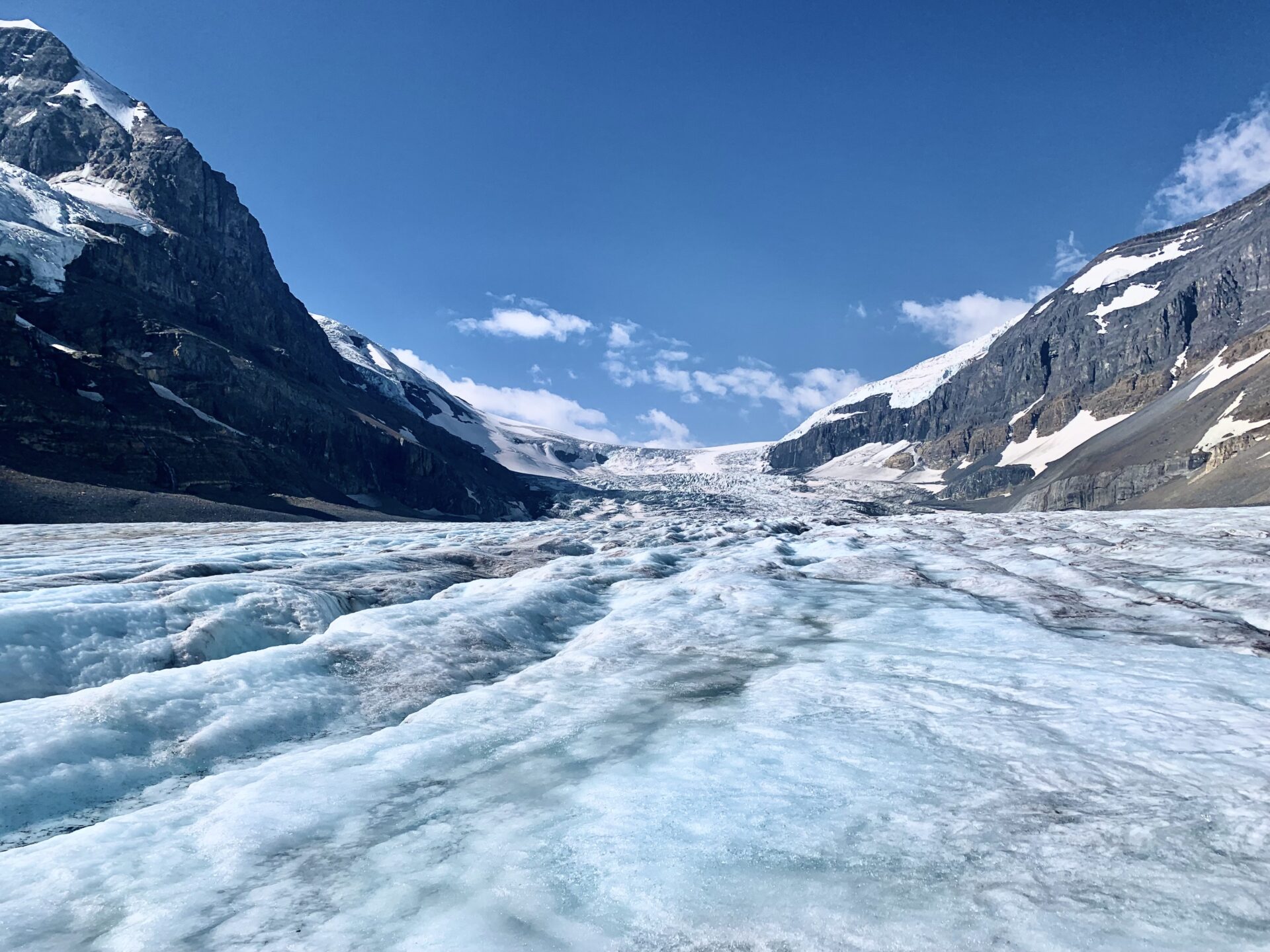
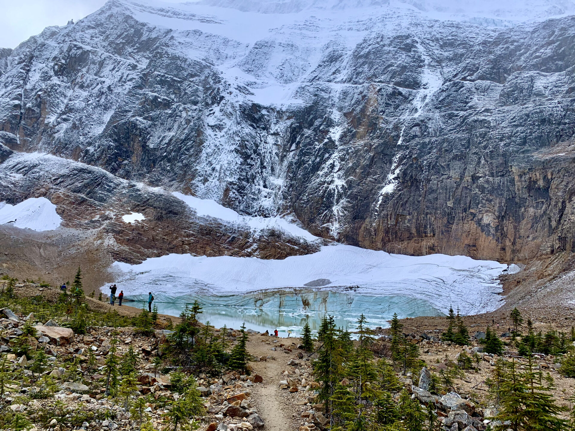
25. Athabasca Glacier & Columbia Icefield
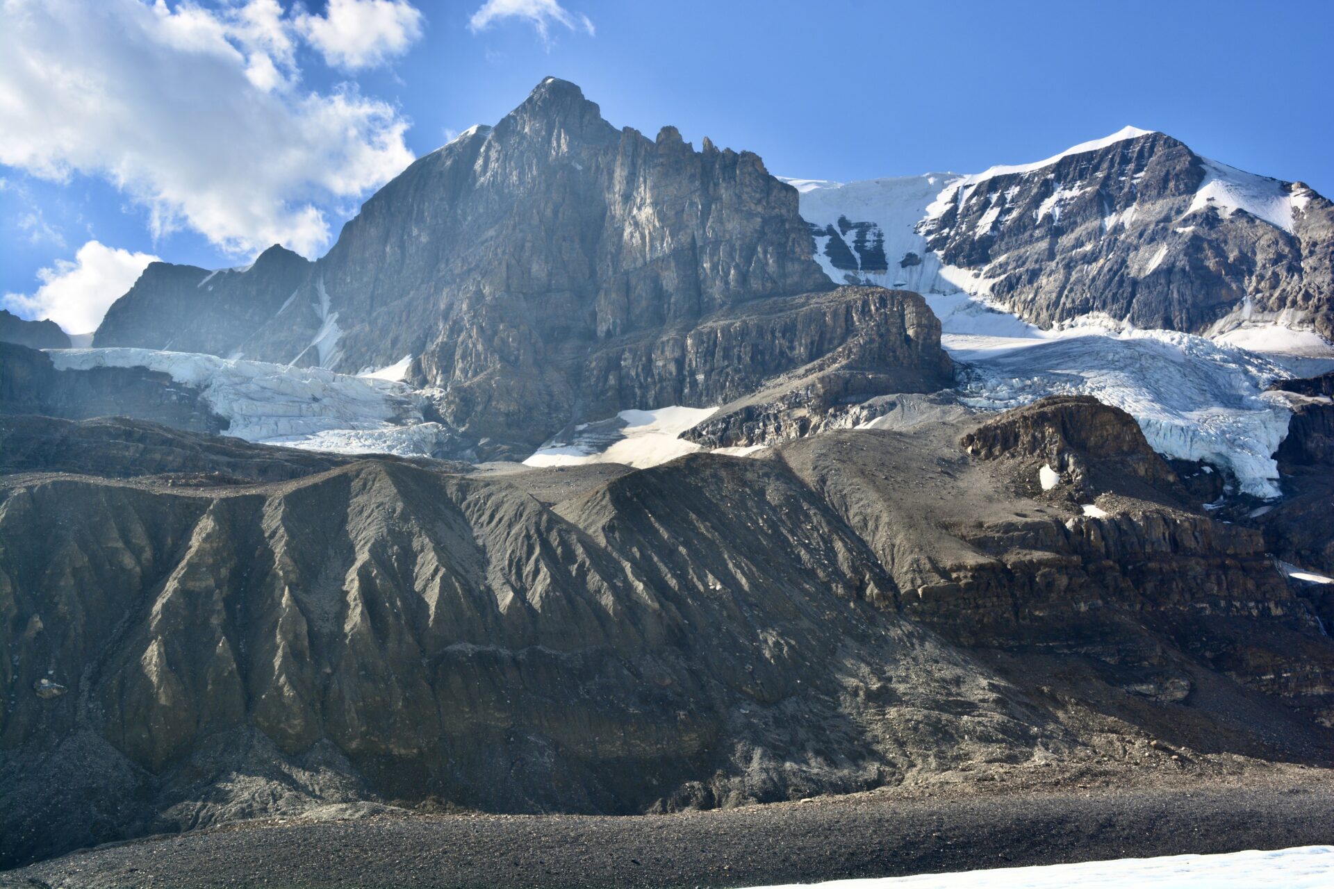
The Columbia Icefields is an impressive display of glaciers and happens to be the most accessible way to experience any glacier in the Rockies.
There are two tour options for the Icefields, however I’d like to note that the tours up the glacier are very destructive and are causing the glaciers to melt much quicker than they should be. I’m not telling you to not do the tour, however I’d just like to bring awareness to our fragile nature in hopes that we better respect it and make conscious choices whilst exploring.
Here are the tour options:
- Guided ice walk – this tour encompasses an ACMG certified guide who will fit you with proper crampons and ice climbing gear before taking you trekking across the glacier.
- Ice Explorer tour – this tour is combined with the Glacier skywalk experience, BUT it’s essentially transportation via a large bus with massive ice wheels (the Ice Explorer) onto the glacier. You’ll be able to get off the bus and step foot on the glacier.
My personal opinion of the Ice explorer tour is overpriced. This tour is super expensive and isn’t worth it, in my opinion. I only did it because myself and my friends (at the time) worked for Pursuit so we got the tour complimentary.
If you want a good view of the glacier, I’d recommend hiking up to Wilcox Pass instead.
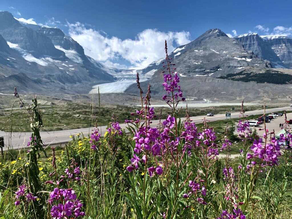
Across the highway from the Icefields you’ll find the Columbia Icefields Center. This is where tours for the Icefields and the Skywalk depart. You can also find food, fully serviced washrooms, cell service, and the Glacier View Lodge here.
Distance from Banff: 187km
Distance from Jasper: 105km
26. Glacier Skywalk

The Glacier Skywalk is a glass platform situated directly over the Athabasca River. From the Skywalk you’ll get a wicked view of the Columbia Icefields as well as countless waterfalls cascading down into the river below.
I have the same opinion of this as the Columbia Icefields adventure: overpriced. Though overpriced the view is quite beautiful and the skywalk is the only place where you can see the Icefields/Athabasca River from this angle. There’s no pullout on the Parkway.
You can book tickets for the Skywalk here or you can bundle your Skywalk admission ticket with the Columbia ice adventure here.
Distance from Banff: 191km
Distance from Jasper: 97km
27. Tangle Creek Falls
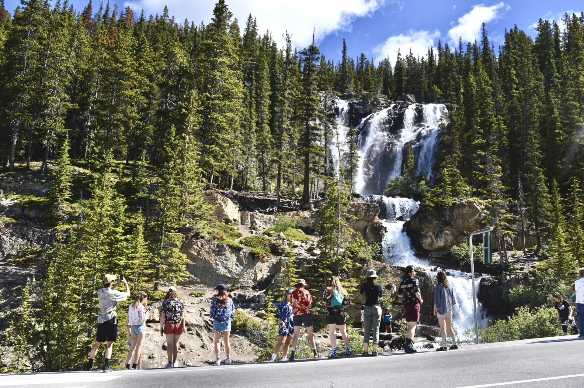
Tangle Creek Falls is yet another waterfall along the Icefields Parkway that makes for a quick and easy photo-op. There’s a fairly large parking lot to the left of the highway and a pedestrian crossing so visitors can safely cross the highway to see the falls.
You can easily see these falls, snap a few photos, and be back in the car within a few minutes, so definitely add this stop to your itinerary.
Distance from Banff: 192km
Distance from Jasper: 96km
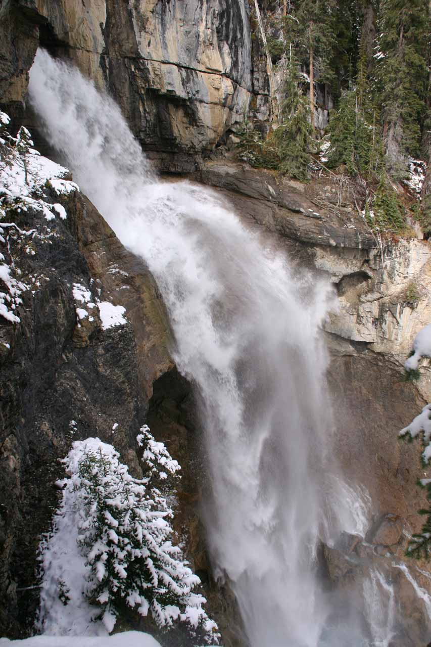
28. Beauty Creek to Stanley Falls Hike
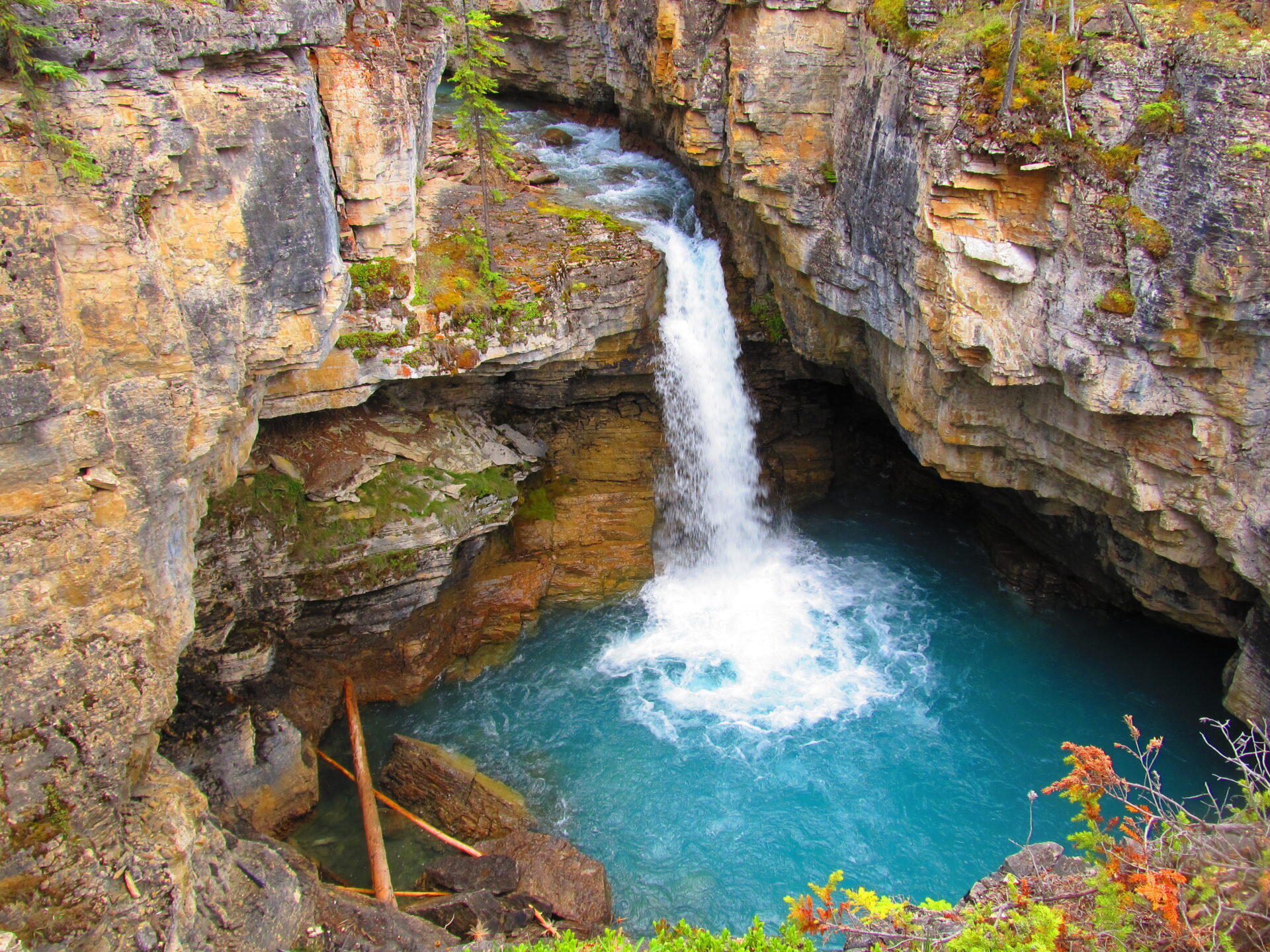
The hike to Stanley Falls is quick, easy, and great for people of all ages and abilities. The hike is 4km (roundtrip) with minimal elevation gain and has been compared to Johnston Canyon in Banff as well as Maligne Canyon in Jasper.
This trail follows Beauty Creek and features multiple waterfalls along the way. This is a highly recommended trail for all visitors of the Parkway, but it’s advised that users carefully monitor their children as some of the ledges in the canyon can be dangerous.
In the winter you’ll find frozen waterfalls.
Here’s the Alltrails map for Stanley Falls.
Distance from Banff: 200km
Distance from Jasper: 87km
Accommodation: HI Beauty Creek Wilderness Hostel
Another option for accommodations along the Icefield Parkway is the HI Beauty Creek hostel which is located right by the Stanley Falls trailhead.
Book your stay
Distance from Banff: 202km
Distance from Jasper: 86km
Alternatively, you can find the first-come, first serve Jonas Creek campground just down the road. This campground is best suited for tenting and small motorhomes/RVs.
29. Sunwapta Falls
Sunwapta Falls is another great photo-op along the Icefields Parkway. The Sunwapta waterfall is located just steps from the parking lot which makes it a quick and easy pitstop.
There’s a hiking trail that branches off from Sunwapta Falls. This trail follows the Athabasca River all the way to Fortress Lake which makes for a 46km backcountry camping trip. If you’re looking to make this Icefields Parkway stop into a hike, you can follow the Fortress Lake trail for a while before turning back.
More: Explore my backpacking trail guide
Distance from Banff: 234km
Distance from Jasper: 55km
Accommodation: Sunwapta Falls Rocky Mountain Lodge
Sunwapta Falls offers a more rustic stay along the Icefields Parkway. This Rocky Mountain Lodge is actually a popular destination for seasonal summer work. The lodge offers accommodations for their employees.
BOOK YOUR STAY
Distance from Banff: 233km
Distance from Jasper: 55km
Alternatively, you can find the first-come, first-serve Honeymoon Lake campground 5kms down the road.
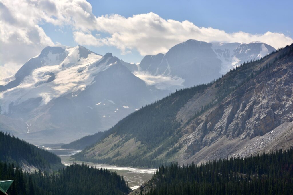
30. Goats & Glaciers Lookout
This photo was taken just before the stop for Goats and Glaciers, buuuut it gives you a great picture of what the mountains from this lookout point are like.
Here you’ll find the Athabasca River backed by the dramatic Fryatt Peaks. If you’re lucky, you might even see some goats!
Located just 3.5kms down the road you’ll find the first-come, first-serve Mount Kerkeslin campground if you need accommodations.
Distance from Banff: 250km
Distance from Jasper: 38km
31. Athabasca Falls
Athabasca Falls is a super popular stop along the Icefields Parkway. If you plan to visit here, expect crowds of people unless you visit early or late.
Athabasca Falls is a series of small waterfalls that pass through a dramatic canyon. There are two lookout points located right next to each other.
The “star of the show” here is Mount Kerkeslin; that beauty mountain featured in the picture above.
Distance from Banff: 257km
Distance from Jasper: 32km
32. Edith Cavell
Edith Cavell is another one of those stops that isn’t quite on the Parkway, but it’s so beautiful I had to add it to the list.
Mount Edith is a massive mountain in Jasper that’s home to the Angel Glacier and Cavell Pond; a mint coloured green pond. Edith Cavell is located only 1km from the parking lot and makes for a picture perfect walk through a beautiful valley. If you’re feeling adventurous you could also summit the East Ridge.
To access Edith Cavell, you’ll want to detour off the Icefields Parkway to 93A then turn onto the windy Mt Edith Cavell road. Please note that the road is closed in winter (October to mid June). Edith Cavell is only accessible during the summer months.
Here’s my full trail guide for Edith Cavell.
Distance from Banff: 299km
Distance from Jasper: 27km
Accommodation: HI Mt Edith Cavell
This little hostel is tucked back from the Icefields Parkway and is therefore lesser known. I’d consider HI Mt Edith Cavell to be one of the more off-the-beaten-path accommodations along the Parkway.
BOOK YOUR STAY
Distance from Banff: 297km
Distance from Jasper: 26km
33. Horseshoe Lake
Horseshoe Lake offers the most adventurous thing to do along the Icefields Parkway! The lake is a beautiful blue colour and has lots of great picnic spots and walking trails, however it’s best known for cliff jumping.
If you hike around the left side of the lake you’ll find 2 ledges; the second ledge is higher. If you’re up for a little adrenaline, you can jump off these cliffs and plunge into the icy glacial water below! I did this a couple summers ago and can confirm the absolute rush you get once your free-falling body hits the frigid water.
Make sure you have an exit planned and a warm towel waiting for you – you’ll be freezing!
The lake is located just outside of the town of Jasper and has a very small parking lot. If you plan to visit the lake it’s advised to make an early or late appearance to ensure you get a spot. Horseshoe Lake is a local’s favourite!
Distance from Banff: 260km
Distance from Jasper: 28km
34. Valley of the 5 Lakes
The Valley of the Five Lakes trail is the last possible stop along the Icefields Parkway before you reach the town of Jasper.
This hike is user friendly and is great for families, beginner hikers, and people of all ages and ability levels. This trail is also one of the best hikes in Jasper during the winter months.
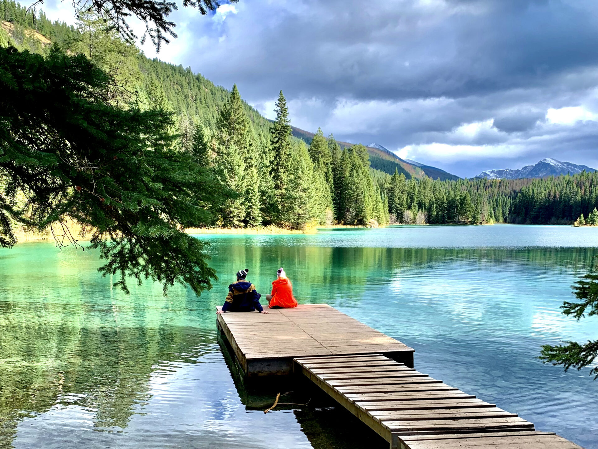
I’m sure by the name you can already guess what this hike is all about, but you’ll find 5 alpine lakes here – each a slightly different colour. The last lake (lake 5) was my favourite as it featured this cute little dock.
You’ll see a massive parking lot just to the side of the Parkway. The parking lot is massive because that’s how many people hike this trail. If you don’t like a crowded trail, this hike may not be for you!
Here’s my complete trail guide for Valley of the Five Lakes.
Distance from Banff: 278km
Distance from Jasper: 10km
35. Jasper National Park (end)
Welcome to Jasper!
Your adventures on the Icefields Parkway may be done, however your Jasper adventures are just beginning.
Jasper is home to spectacular alpine lakes, sparking glaciers, abundant wildlife, and dense wilderness. It’s the second most-famous National Park in Canada and it sees half the amount of visitors Banff does which makes it a slightly “quieter” mountain getaway.
You can explore all my Jasper content here, however the following posts are my featured Jasper content:
- How to plan the perfect trip to Jasper
- Hiking trails in Jasper
- Off-the-beaten path adventures in Jasper
- Best things to do in Jasper
- Multi-day canoe trip on Maligne Lake
Where to stay in Jasper
- Jasper offers multiple hostels. I’ve personally stayed at the Jasper downtown hostel and loved it! You could also opt for the HI Jasper.
- Here are the campsites in Jasper.
- Luxury stays: Fairmont Jasper Park Lodge, Pyramid Lake Resort, and the Mount Robson Inn.
- Cabins in Jasper: Miette Mountain Cabins, Patricia Lake Bungalows, Tekarra Lodge, and the Jasper East Cabins.
- Budget stay: Jasper Gates Resort and the Overlander Mountain Lodge.
- Popular hotels: Tonquin Inn, Lobstick Lodge, Whistler’s Inn and The Crimson (also stayed here and loved it).
Budget at least one full day in Jasper. Better yet, spend 2 or more days to fully take in the lakes, hiking trails, and mountain-town vibe.
Icefields Parkway Map
Here’s the map I promised with all the stops along the Icefields Parkway. Make sure you save this map before your Icefields Parkway adventure!
Think I missed something?
Let me know in the comments!
Happy adventuring!
Taylor ♡
Like This Post?
Share with friends or save it for later!
About the Author
HI, I’m Taylor – the voice behind The Holistic Backpacker.
After moving to Banff National Park in 2020 I became an outdoor adventure enthusiast and vowed to never stop exploring.
I now spend my days travelling the world, climbing mountains, and spending nights under the stars in the Canadian Rockies backcountry.
I created The Holistic Backpacker so I could share my adventures and help connect people like you with the same amazing experiences.


2 Comments
Twicsy
Great information. Lucky me I recently found your site by chance (stumbleupon).
I have saved as a favorite for later!
The Holistic Backpacker
Glad you found it helpful! Feel free to reach out if you have any questions 🙂