My Failed Attempt at Summiting East End of Rundle (EEOR)
Hahaha I’m literally starting out this trail guide laughing because my attempt at East End of Rundle (EEOR) was such a flop. Normally my trail guides consist of victorious hiking stories filled with gorgeous mountain top photos. I’ve definitely got the photos – but not the victorious story to go along with them.
In this post I’ll tell you all about how I didn’t reach the EEOR summit, but I’ll also tell you everything you need to know in order to successfully summit East End of Rundle. To this day I still can’t believe I let Rundle get the best of me.
DON’T MISS my trail guide for Ha Ling & Miner’s Peak – the “sister hike” to EEOR.
Now, let’s go hiking!
Skip Ahead:
- How to get to East End of Rundle (EEOR) trailhead
- About the East End of Rundle (EEOR) hike
- Hiking East End of Rundle (EEOR)
- Essential Hiking Gear for the Rockies
- What to wear hiking in the Rockies
- Best Places to stay in Canmore
I have affiliate links in this post which means when you book a hotel or purchase a product, I may make a small commission ~ at no additional cost to you (full disclosure). These funds go back into The Holistic Backpacker and help me create more free content like this!
Thank you for supporting my work!
How to Get to East End of Rundle (EEOR) Trailhead
The East End of Rundle is located in Bow Valley Provincial Wildland Park, just outside of Canmore and about 30 minutes from Banff. There’s no shuttle to the East End of Rundle trailhead, so if you don’t have a car you’ll need to rent one to get there.
Best Alberta Car Rental
Most of Alberta is inaccessible via public transportation. I 100% recommend renting a car here so you can fully enjoy all the mountains, lakes, and badlands.
My favourite Alberta car rental tool is this site. It compares all the local car rental companies to ensure you’re getting the best rate.
There’s very limited parking at the actual EEOR parking lot, so most people park at the Ha Ling trailhead (which I’ve marked on the map). This is only 1 minute down the road from the East End of Rundle trailhead.
Important – as of 2021 you need a conservation pass to hike in Kananaskis Country.
Quick Story
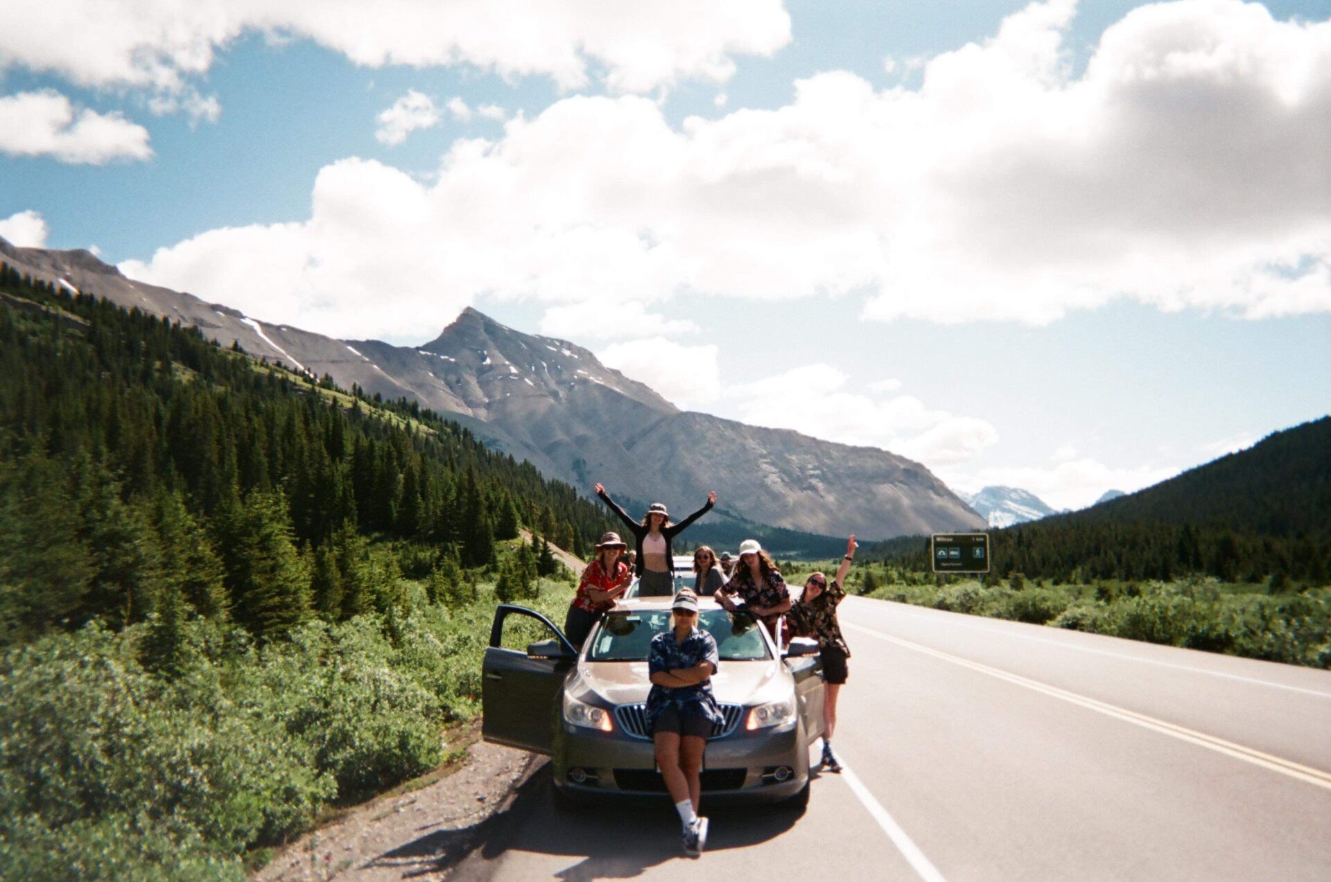
EEOR was my first real hike in Banff. I remember the morning I set off for EEOR my friend from Brazil and I hopped in my other friend’s camper van; he also happened to be from New Zealand. We drove from Banff to Canmore, then up a mountain road inundated with mountain goats licking salt off the ground.
We then met up with some other people from Australia and the UK and started hiking straight up a massive mountain. My only thought was “pinch me I’m dreaming.”
This was an “omg I can’t believe this is my life” moment and pretty much also the moment I realized I would spend the rest of my life bumming it in the mountains and travelling the world to meet new people.
More: I lived in Banff, here’s how you can too!
About East End of Rundle (EEOR) Hike
- Distance: 4.8km
- Elevation gain: 832m
- Rated: hard
- Type of trail: out & back
- Estimated time: 3hrs
Alternate Route – the EEOR traverse takes you from Rundle 8 (the East End of Rundle) to the true peak of Mount Rundle (peak 3). This is an intense scramble and should ONLY be attempted by very experienced hikers
The East End of Rundle is a challenging and steep hike. There are a few technical sections and a scramble toward the end that will definitely test your limits. For this reason it’s essential that you have proper hiking gear and sturdy hiking boots. I’ll talk about proper hiking gear and clothes for the Rocky Mountains next, but first I want to quickly go over appropriate footwear.
For scrambles you’ll want a boot that’s sturdy and provides ankle support. I have the Scarpa Kailash (men’s version) which I’ve used for 600km+ now in all types of terrain. They’re waterproof, they have excellent grip, and they stand the test of time. If you’re scrambling, this is the type of boot you want to ensure you feet stay protected and your ankles stay “untwisted.”
What You Can Expect
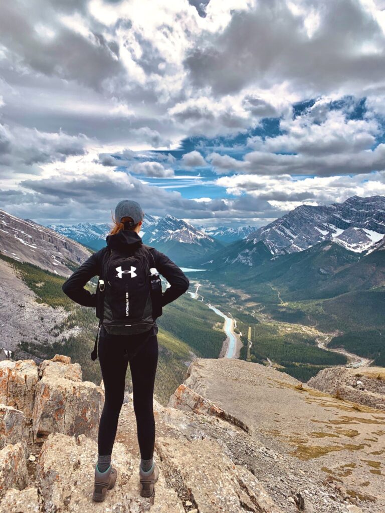
Initially, the East End of Rundle trail starts out in the trees with minimal views. Eventually the trail will turn rocky and may require some scrambling. After this you’ll have a short break in a meadow style area, then a steep ascent/scramble to the summit.
Oftentimes you may find snow/ice early or late in the season. If you plan to hike in these conditions make sure you bring micro-spikes and snowshoes if necessary.
A word on the descent – the decent can become quite confusing. Hikers oftentimes traverse too far right and end up on a different (and somehow even steeper) trail down. I’d recommend downloading the Alltrails map to ensure you stay on track and don’t get cliffed out.
Connect via socials:
STAY CONNECTED
Sign up for emails to receive a 25% discount on my travel maps.
Taylor ♡
Hiking East End of Rundle (EEOR)
Okay, oh boy. Now I’m reliving this nightmare of a hike – here we go.
The East End of Rundle trailhead is marked by two flagged power poles across from Whiteman’s Pond.
The EEOR trail goes straight up. Like not joking this hike is steep. I kept making excuses for the group to stop, saying lame stuff like I needed to “take my sweater off” or “put chapstick on.” Lies. It was more because I was f*ing dying. Like actually dying.
I had a bugger of a time adjusting to the altitude when I first moved to Banff AND I was totally not in the physical condition I needed to be in for hiking mountains; especially the East End of Rundle. I’m from Ontario, okay? The “steepest” thing I had access to before moving to Banff were the 2 stairs leading into my family room. Now you expect me to climb mountains!?
The Beginning
The trail initially follows switchbacks up a wooded area. The path is well worn and features downed trees from both human and goat use. For this reason it’s quite easy to follow, however keep an eye out for the odd piece of tape, painted rock, cairn, etc.
This part of the hike is a bit of a mixed bag which may require a few handholds here and there, but most hikers should be able to navigate this section with no problems.
The First Scramble
After the wooded area you’ll come to a quick and easy scramble.
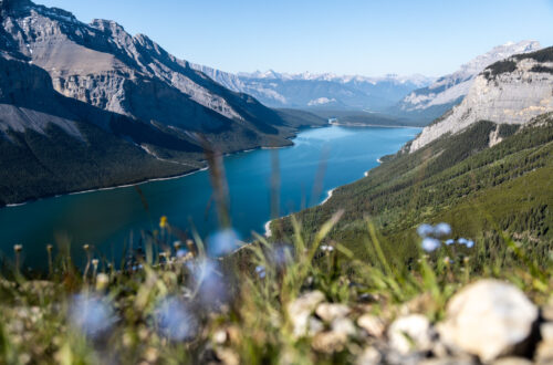
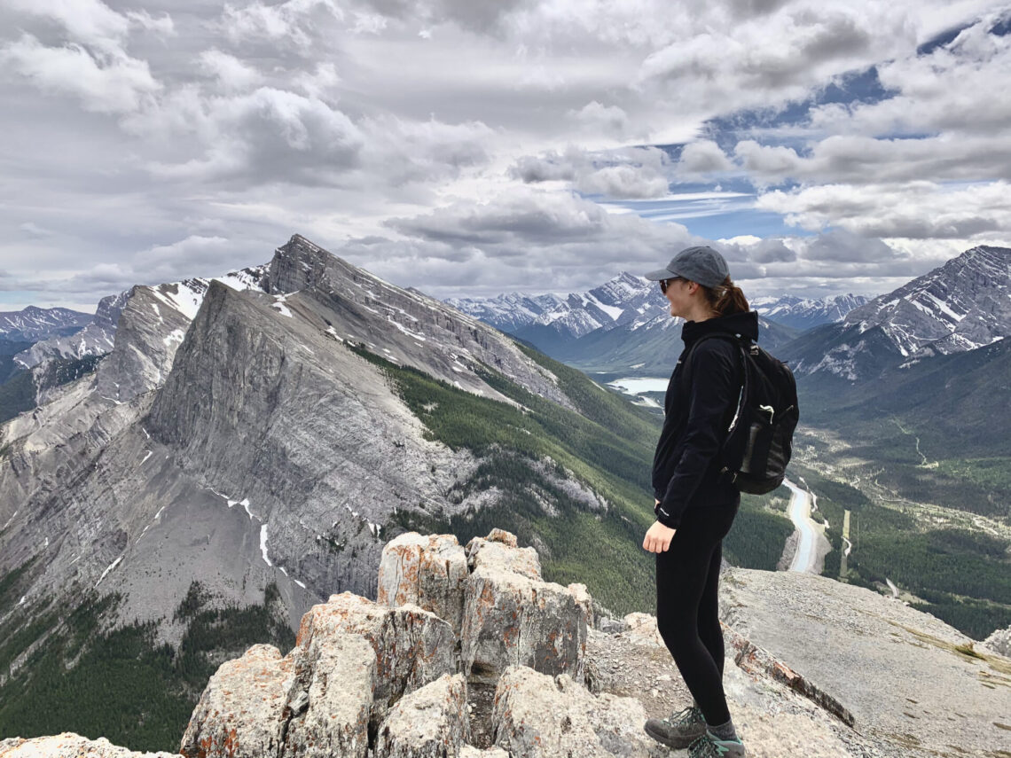
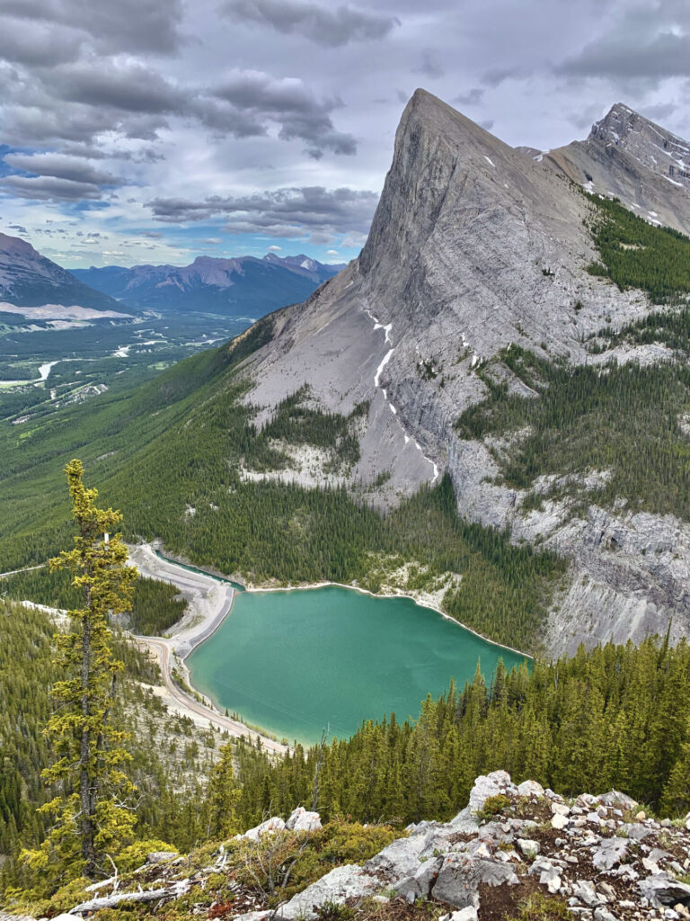
The first scramble begins when you’re still in the tree line. The terrain becomes rocky and you need to boulder up a few sections. It’s nothing too challenging though and there’s a classic viewpoint overlooking Whiteman’s Pond & Ha Ling – you’ll definitely need to stop and take some photos here.
^I say it wasn’t “too challenging” – reality is at this point I was so light headed from the altitude I thought I was going to pass out/throw up and fall straight off the mountain. We had to stop and take a long break so I didn’t die.
Also for reference, the EEOR hike isn’t actually that bad. In reality it’s totally doable, but at the time I was not ready at ALL for what the mountains throw at you.
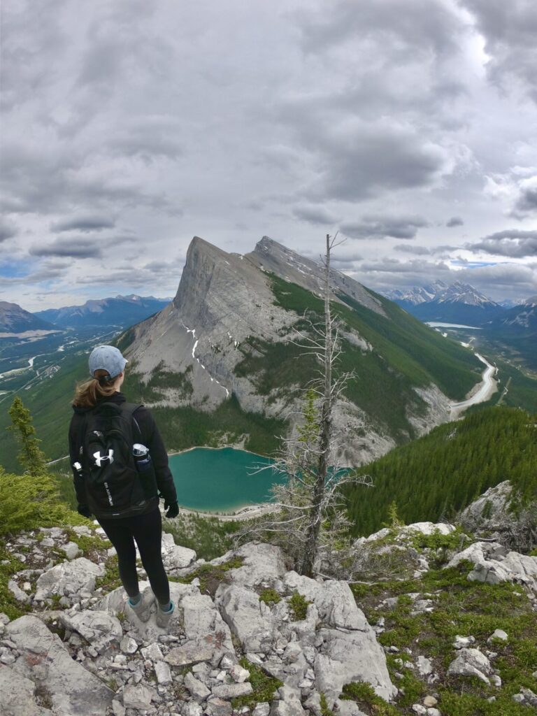
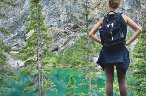
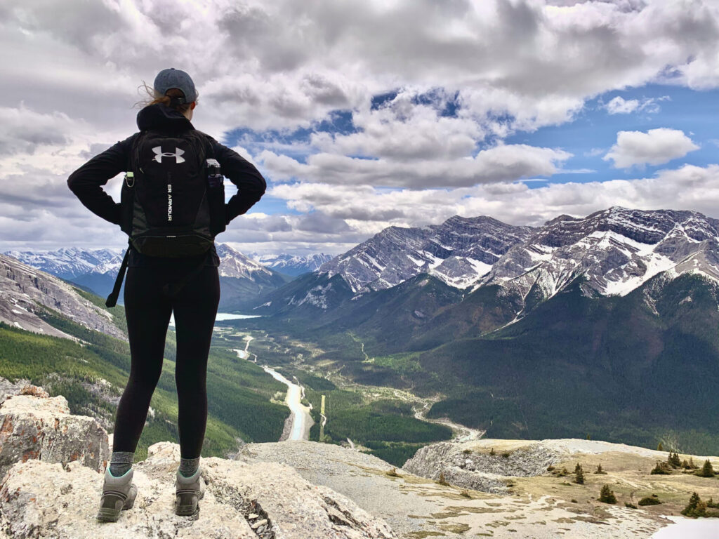
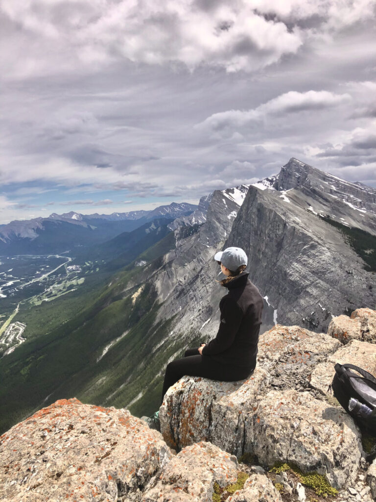
After this point you’ll come out in a meadow-style field in which you’ll find the false summit. I hate to say I, but this was the furthest I made it. My hiking partners were freakin’ trail running I swear to god and my body legitimately gave up on me. I just could not move any further.
I hung out at the false summit with the nice boy/driver from New Zealand who literally saved my life and kept me company until the others were done successfully summiting the East End of Rundle.
The Final Ascent
The final ascent is said to be the most challenging part of the EEOR. It’s a steep scramble where rockfall is common. Don’t be surprised if you find snow in this section until late in the season too – bring your micro-spikes!
I don’t want to lie and pretend I know everything about this section of the hike (because I don’t), so here’s a successful hiker’s experience completing the East End of Rundle Summit.
I swear I’m actually a great hiker (now) and have lot’s of trail guides that are 100% complete – right to the end! You can find all my successful trail guides here.
Next I’ll go over essential gear and clothes for hiking in the Rockies and I’ll outline the best places to stay in Banff for every budget.
Explore More Hikes In Kananaskis
Kananaskis is an area just outside of Banff that’s made up of multiple Wildland Areas and Provincial Parks. Kananaskis is my favourite hiking destination in the Canadian Rockies, so I urge you to explore more hikes in the area!
Click here to explore more of Kananaskis.
Featured Kananaskis Hikes:
- Cool Experiences: Yamnuska scramble, Mist Mountain hot springs, Grotto winter canyon walk.
- Ridge Walks: Pocaterra Ridge, Sarrail Ridge & Rawson Lake, Opal Ridge, Tent Ridge, and Wasootch Ridge.
- Summits: EEOR and Ha Ling.
- Incredible Scenery/Lakes: West Wind Pass, Picklejar Lakes, and Grassi Lakes.
Explore Kananaskis Country by Area:
Visit National Parks Nearby:
Looking for more hikes? Click here to explore all of my trail guides.
Best Place to Stay in Canmore
The “best” place to stay in Canmore depends on your price range. So, here are some suggestions for every budget:
Booking.com- Cheap accommodations – if you’re visiting the Rockies, you can bet the cheapest option for accommodations in alwayssss camping. Here are a few popular camping spots in Canmore.
- Mid-range accommodations – Canmore offers a slew of hotels, each coming in at a different price and each offering something a little different. I’d recommend utilizing Booking.com to compare said prices and amenities to determine which hotel best suits your needs. Some of the benefits of using Booking.com are their price match guarantee, free cancelation on almost all bookings, and clear pricing with no hidden fees.
- Luxury accommodations – for the bougie traveller (can’t relate), a couple “quote on quote” fancy hotels in Canmore are the Peak by Samsara Resort and the Stoneridge Mountain Resort.
- Accommodations nearby – another location offering accommodations close to Canmore is the famous Banff National Park. There are tons of hotels in Banff, the most notable being the castle in the sky (AKA the Fairmont Banff Springs).
Happy adventuring!
Taylor ♡
Like This Post?
Share with friends or save it for later!
About the Author
HI, I’m Taylor – the voice behind The Holistic Backpacker.
After moving to Banff National Park in 2020 I became an outdoor adventure enthusiast and vowed to never stop exploring.
I now spend my days travelling the world, climbing mountains, and spending nights under the stars in the Canadian Rockies backcountry.
I created The Holistic Backpacker so I could share my adventures and help connect people like you with the same amazing experiences.