
Best Hike Near Tirana: Maja e Tujanit (Dajti Ekspres Extension)
The best hike near Tirana is hands-down Maja e Tujanit (aka the Dajti hike) which is located atop the Dajti Ekspress cable car. For me, Maja e Tujanit personally ranks as the best hike near Tirana for a few reasons: it’s accessible, it’s not overly challenging, it receives low traffic, and the views are epic.
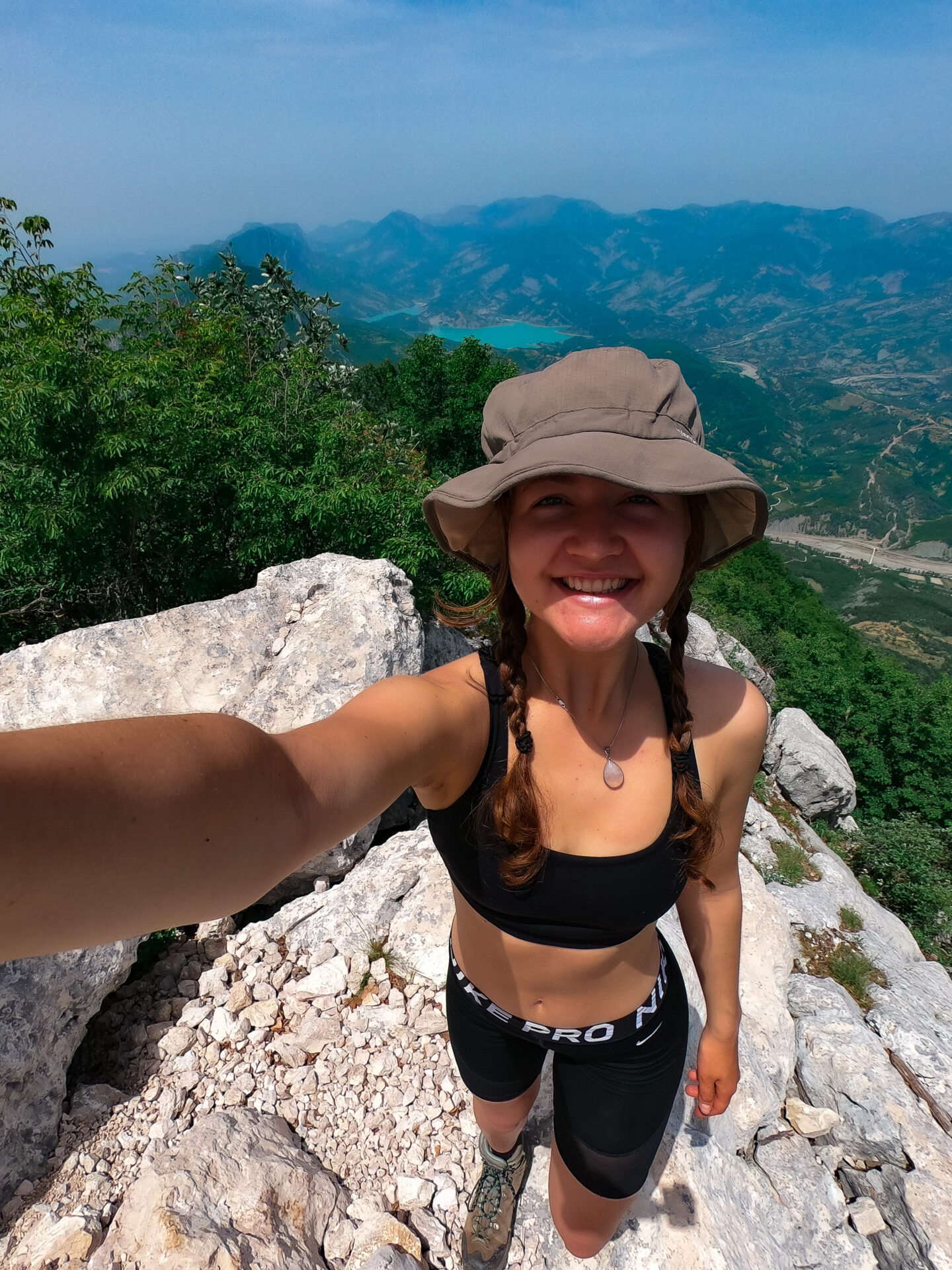
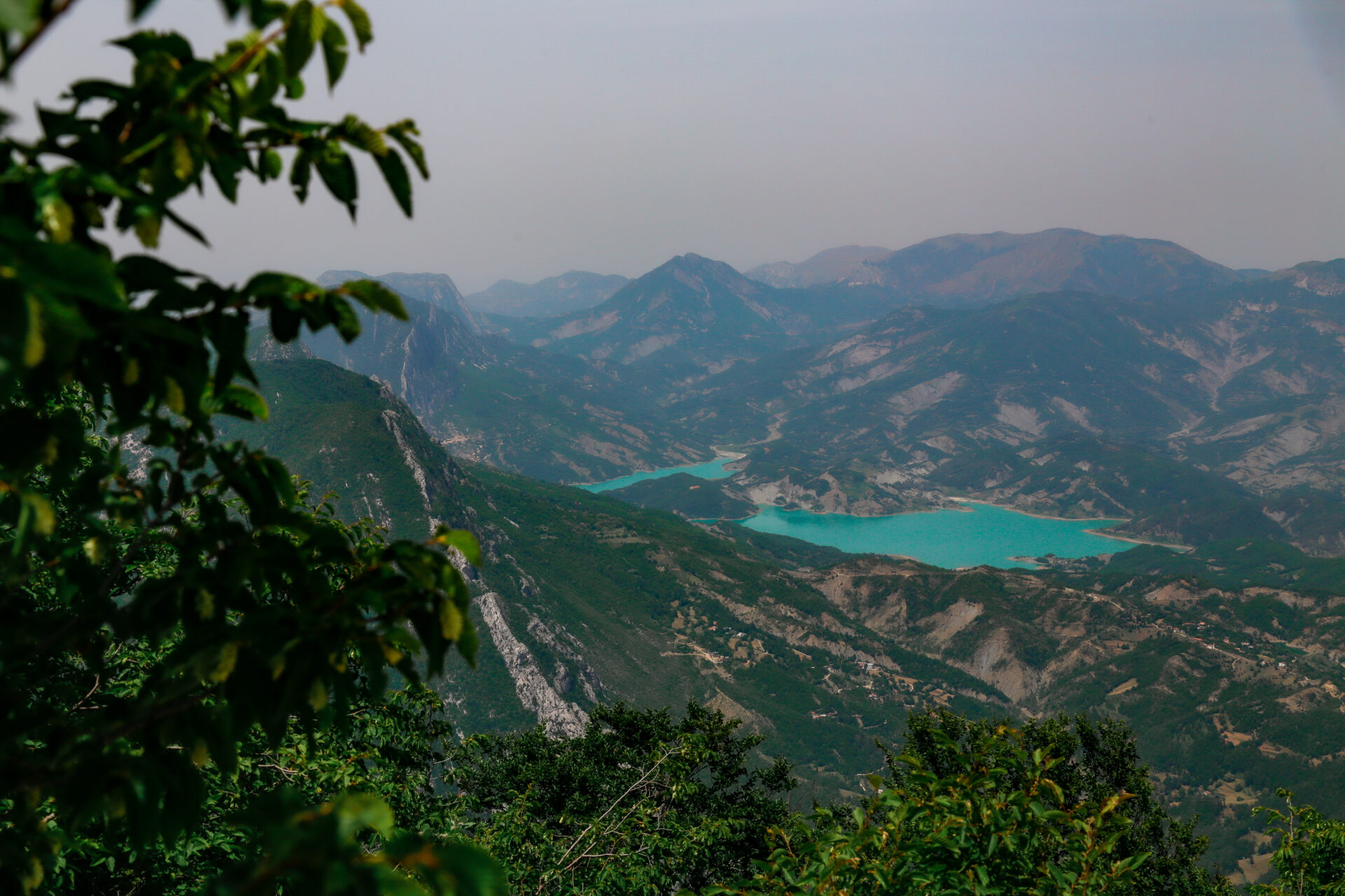
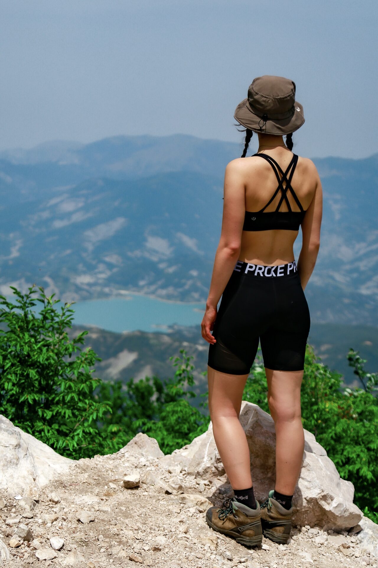
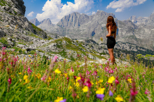
From the Maja e Tujanit summit you’ll find views looking into Dajti National Park and over the sparkling blue Bovilla Lake. This is the perfect place in Tirana to escape the busy city atmosphere for a bit of nature.
In this guide I’ll tell you everything you need to know about the Maja e Tujanit hike including how to get there, trail stats, and what to look out for on the way.
Skip Ahead:
- How to get to the Maja e Tujanit trailhead
- Where to stay in Tirana
- About the Tujanit summit hike
- Hiking Maja e Tujanit: what to expect
- Tips for hiking in Albania
I have affiliate links in this post which means when you book a hotel or purchase a product, I may make a small commission ~ at no additional cost to you (full disclosure). These funds go back into The Holistic Backpacker and help me create more free content like this!
Thank you for supporting my work!
Interactive Albania Google Map
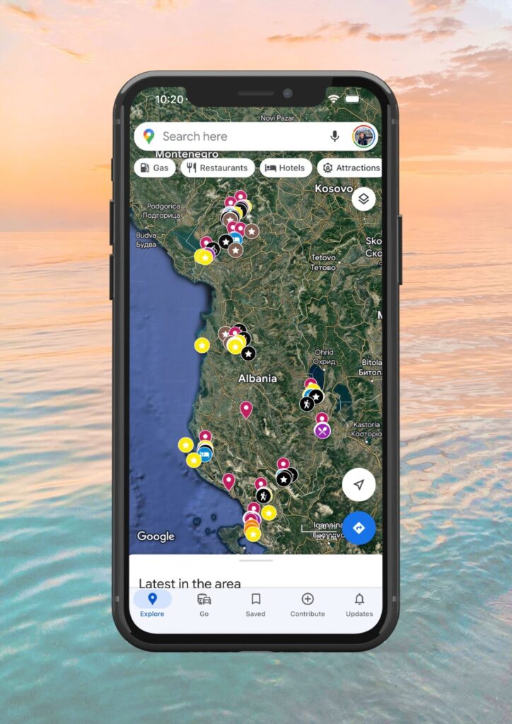
Get my 200+ Albania recommendations saved directly to your Google Maps app
I designed this map to help you save time planning & to quickly access travel tips & places when you’re on-the-go
- Outdoors: hiking trails, waterfalls, secret beaches & national parks
- Places: ancient cities, beach towns & historical sites
- Things to do: viewpoints, unique activities & tours
- Planning: lodging, restaurants, bus stops & tedious details
Quick Albania Travel Guide:
**Find my recommended Albania itineraries linked in the section below**
Travel Insurance: ALWAYS purchase reliable travel insurance before your trip. This insurance is trusted by backpackers and adventure sport enthusiasts around the world. You can also use my link to receive 5% off SafetyWing policies. Here’s a blog post with more trustworthy travel insurance options you can compare.
Purchase my Albania map which is interactive and downloadable to Google Maps on your phone. It has 200+ pinned locations around the country – all available at your fingertips.
Transportation: to enter the country you’ll find 1 international airport in Tirana, 1 port in Saranda (daily ferry arrivals/departures to Corfu, Greece), and a bus line from Montenegro. Buses are very cheap here, but unreliable. Taxis are pricey in comparison. There are no passenger trains in the country. If you’d like to rent a car, I recommend using this site to find the cheapest rates.
Best Activities: Looking for the best tours and activities around Albania? See my Viator shop for my top recommendations.
Best Time to Visit: May to September.
Currency: Albanian LEK (aka ALL). This is a closed currency so you’ll need to wait until you’re in Albania to withdraw/exchange money. Make sure you exchange any leftover money before you leave the country too. Credins ATMs don’t have a service charge.
Phone: purchase a local SIM card from Vodafone – the plans are cheap and they include lots of data, however international minutes are typically not available. Vodafone storefronts can be found in bigger cities (Tirana, Saranda, Shkoder, etc).
Language: Albanian, however you can get by with English. Google translate is recommended for smaller cities/villages.
Safety: I found Albania to be very safe. I and my fellow travellers had no trouble with theft and I felt comfortable walking around as a solo female at night. People are generally very welcoming here, but always keep your wits about you – no matter where you travel.
Helpful Info: don’t drink the tap water or bring a purifying bottle like this one. Most hostels/guesthouses/hotels have laundry facilities.
Packing Guide: here’s my ultimate packing guide/travel essentials.
Albania is one of the last “undiscovered” countries in Europe. Plan your trip while prices & tourism levels are low!
Helpful Albania Blog Posts
Albania Itineraries: 1 week south | 1 week north | 2 weeks whole country | 1 month for backpackers
- My Ultimate Albania Backpacker Guide
- 15+ Helpful Tips You Should Know BEFORE Travelling Albania
- 30+ Best Things to do in Albania: Excursions, Tours, and Destinations
- 17 Best Places in Albania
- Hiker’s Guide to the Albanian Alps
- Valbona to Theth Hiking Guide
- 10+ Albania hikes Worth Doing
- Lodging: best hostels for backpackers | luxury hotels
This is the best hike near Tirana.
How to Get to the Maja e Tujanit Trailhead
Getting to the Maja e Tujanit/Dajti hike in Tirana takes a couple steps.
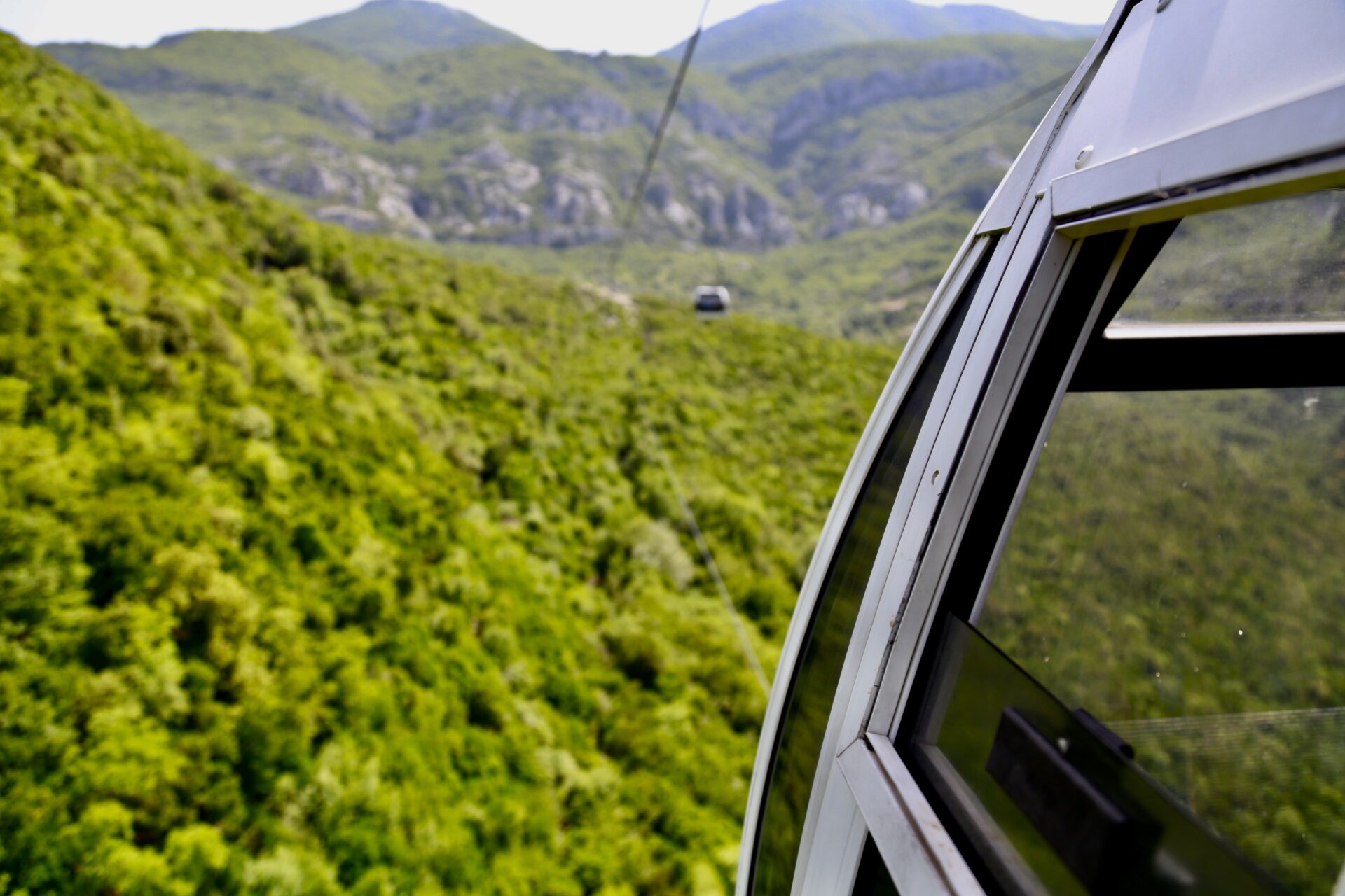
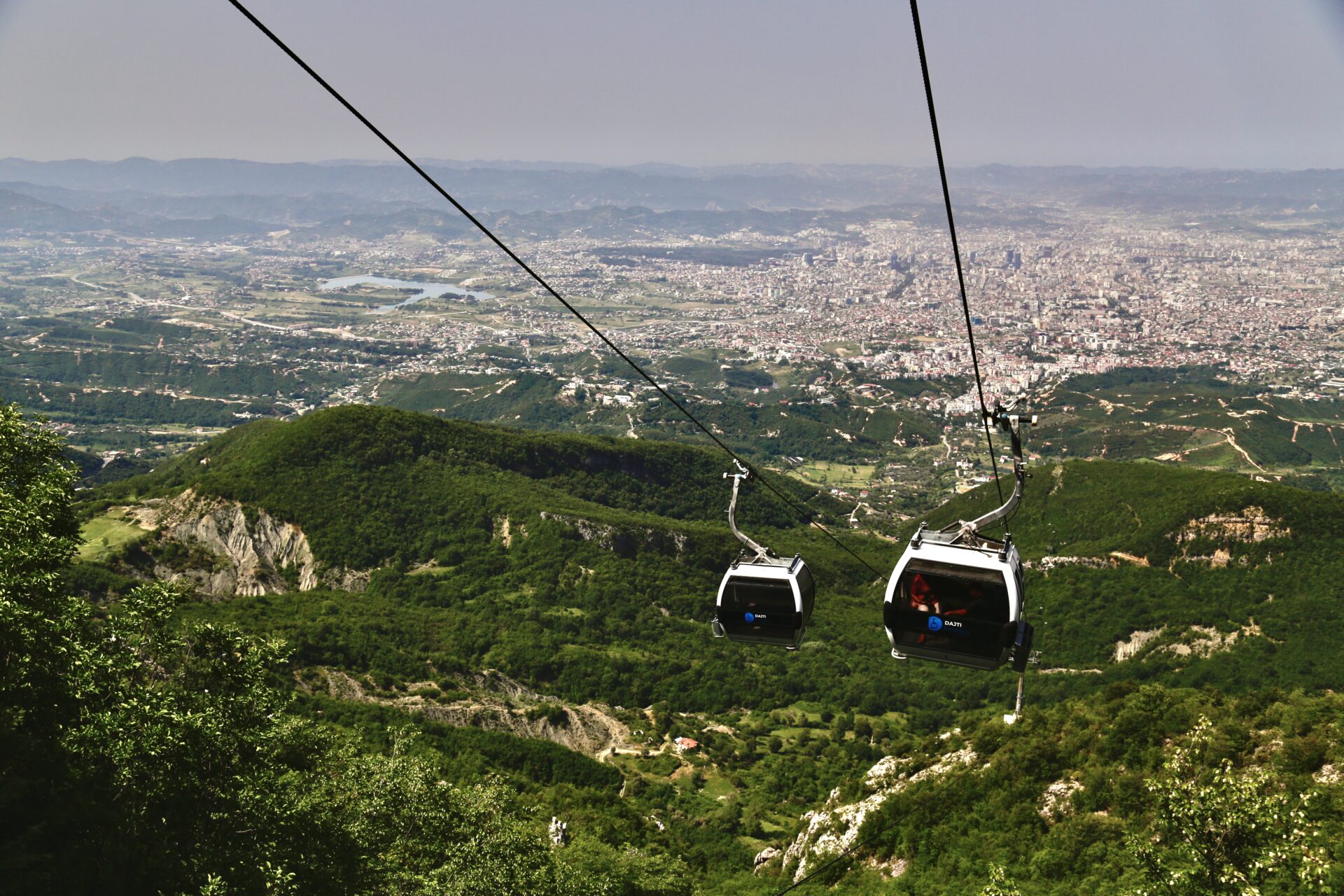
The first step being taking the bus to the base of Tirana’s gondola – the Dajti Ekspres. This video explains how to utilize local transit to get there better than I could write it out myself – so give that a watch before you go. Gondola tickets are cheap too which makes this a very affordable activity.
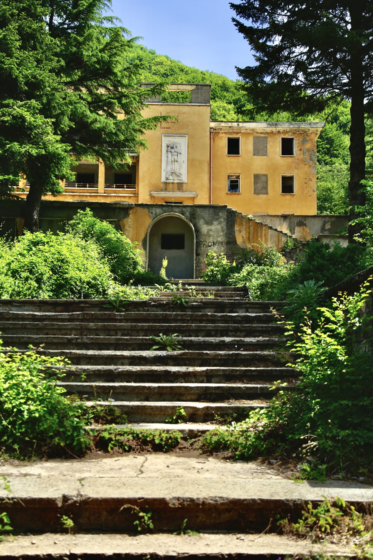
Once you reach the top of the Dajti Ekspres you’ll want to walk straight past the field of horses until you see the old, abandoned hotel. The Maja e Tujanit trailhead is located directly behind it (GPS location).
Best Albania Car Rental
Looking to rent a car to explore Albania’s remote beaches, mountain towns, and ancient cities not accessible via public transportation?
My favourite Albania car rental tool is this site as it compares all the local rental companies to find you the best rate.
Connect via socials:
STAY CONNECTED
Sign up for emails to receive a 25% discount on my travel maps.
Taylor ♡
Where to Stay in Tirana
Being Tirana is the capital city of Albania there are oodles of lodging options to choose from. Luxury hotels, hostels, guesthouses – you name it. Here are my top picks for each budget.
- Hostels – Trip’n’Hostel (party hostel) and the Tirana Backpacker Hostel are both popular choices among backpackers.
- Budget Guesthouses – Guesthouse NEO, Guesthouse Sense, Home Sweet Home 1
- Mid-range hotels – there are SO many mid-range hotels in Tirana. You can see them all here.
- Luxury accommodations – Plaza Hotel, Arté Boutique Hotel, and Rogner Hotel (one of the best hotels in Albania).
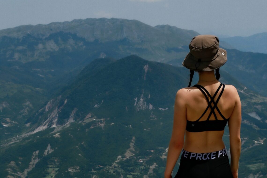
Best hike near Tirana
About the Dajti Hike in Tirana
- Distance: 5.3km
- Elevation Gain: 425m
- Type of Trail: out & back
- Estimated Time: 2-2.5 hours
- GPS Trailhead Location
Tirana’s best hike – Maja e Tujanit – begins atop the Dajti Ekspres cable car. I explain how to get here and how to find the trailhead above. The stats mentioned here are approximate, but relatively accurate.
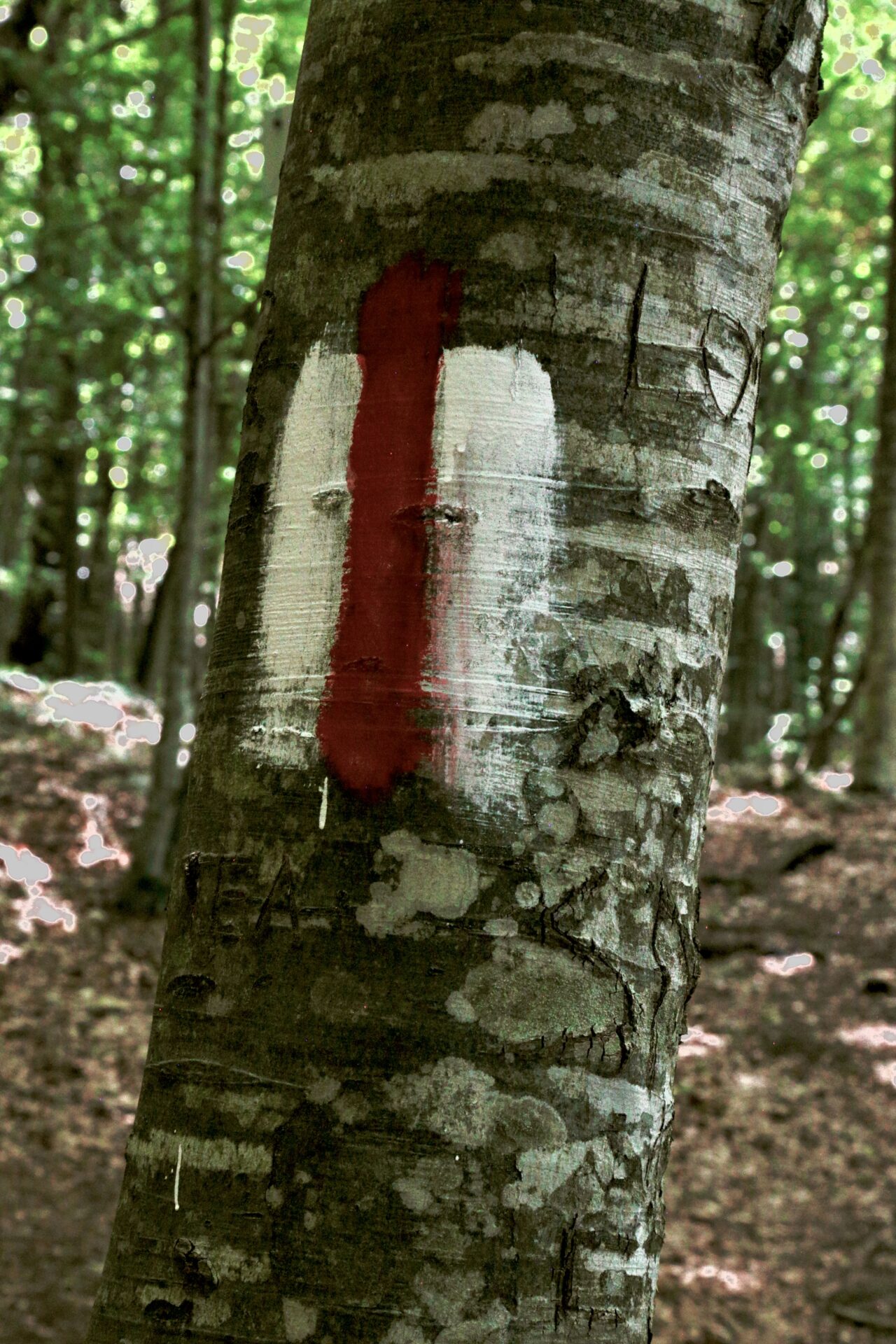
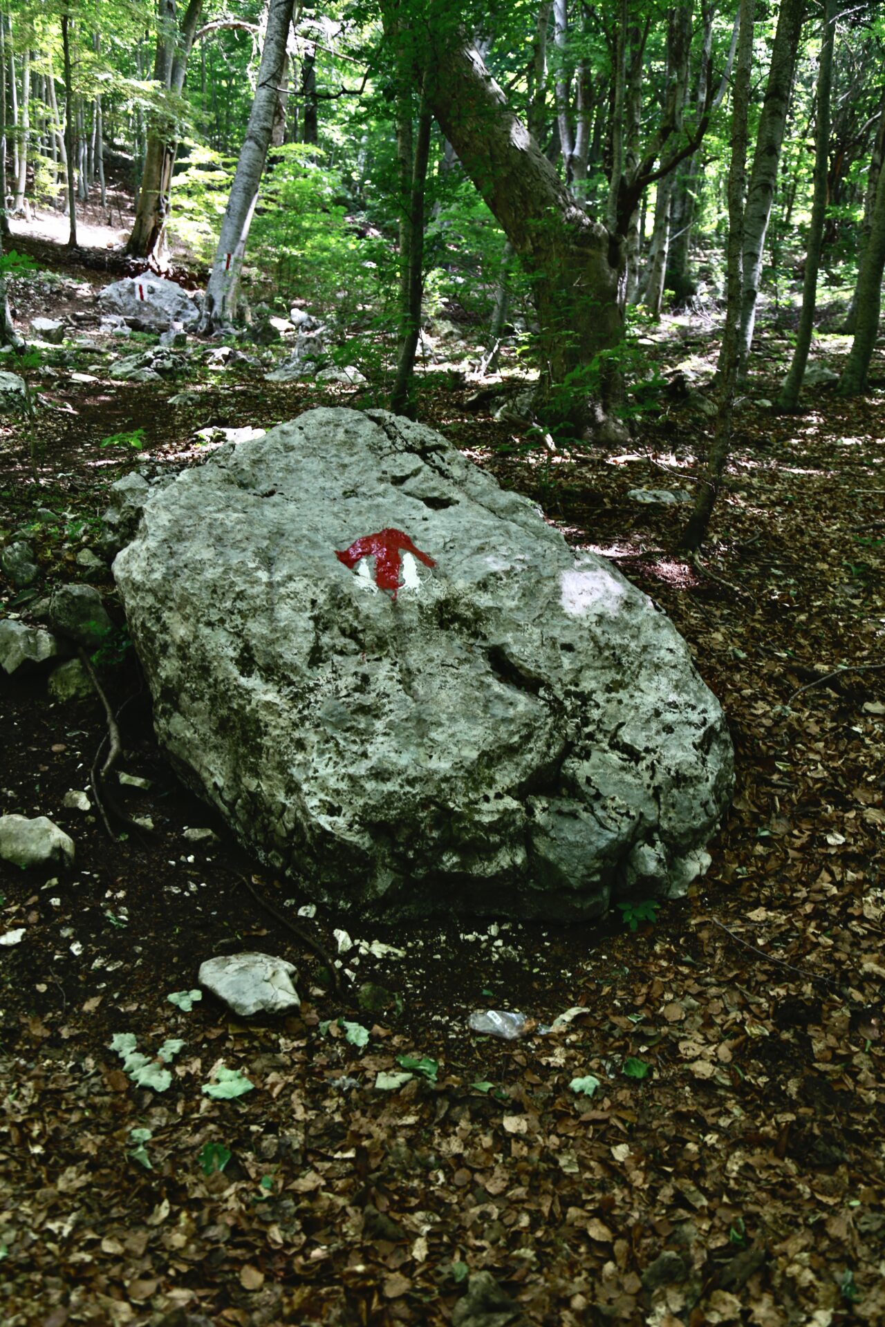
The trail to Maja e Tujanit is simple, completely wooded, and it’s marked by white and red trail markers (pictured below). The trees are nice as they keep the sun off you, but the trees also limit airflow so the hike up will still be sweltering mid-summer. Try to take the gondola up when it first opens so you can hike early before the afternoon heat kicks up.
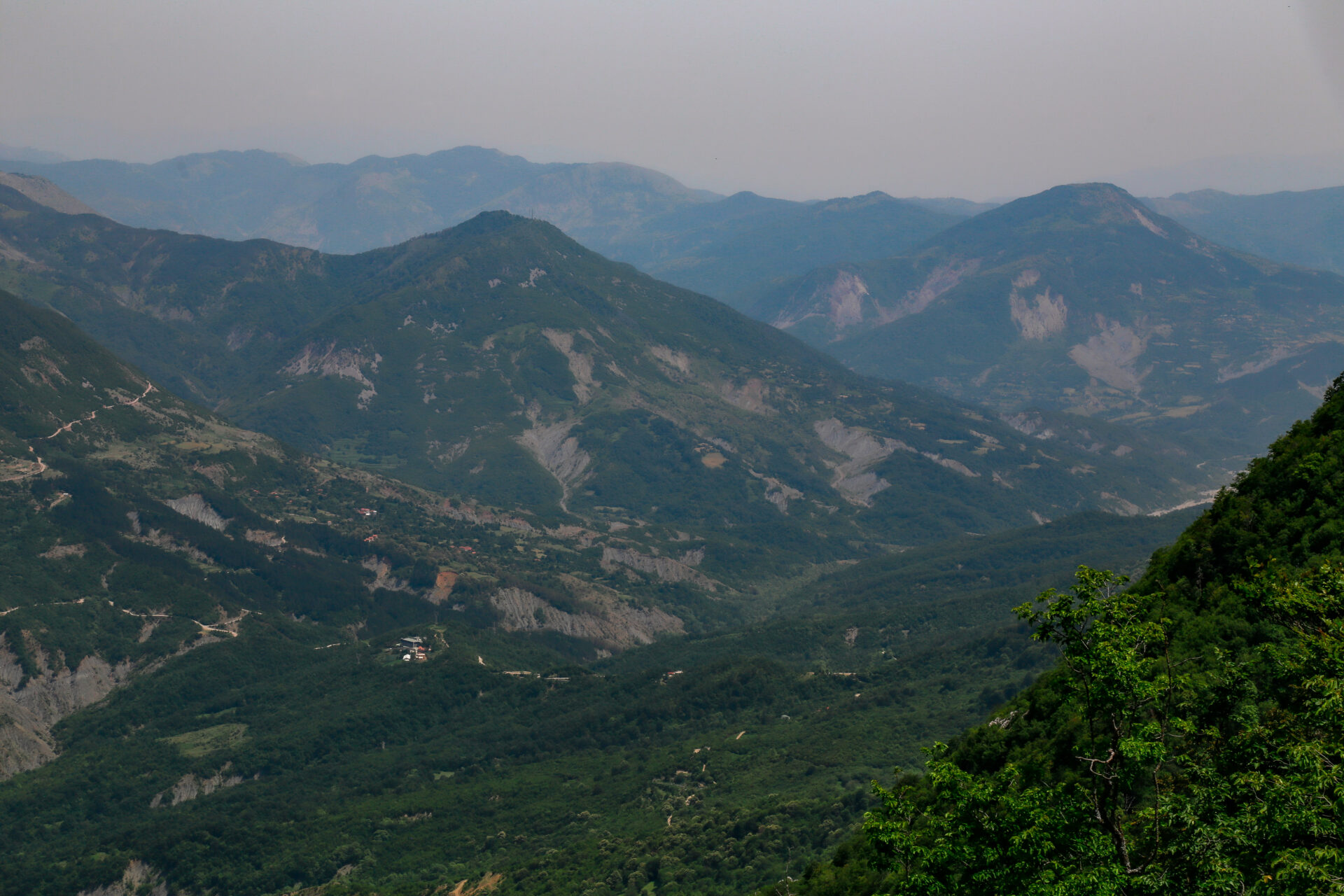
The peak elevation of the Dajti hike is 1,613m at Maja e Tujanit and the views make you feel like you’re far away from the city which is a nice break from the noise and busy atmosphere that exists at the base of the mountain.
The trail is fairly easy to follow as long as you keep an eye out for the markers. In saying this, I do imagine the trail would be a bit more difficult to follow once the leaves start falling in September/October. There aren’t many people around so you’ll likely have the area to yourself too.
I had cell service at the top of the gondola and at the summit however I lost it along the way. If you find an interactive map for this hike, I’d recommend downloading it before you go so you always have access to directions.
Best hike in Tirana.
Popular Albania Tours
From Berat: 4×4 tour: Mount Tomorr & Sotira Waterfall | Bogove Waterfall & Osumi Canyon | Osumi Canyon Rafting
From Permet: Benja Hot Springs & Lengarica Canyon | Horseback Riding | River Rafting
From Tirana: Gamti Mountain & Bovilla Lake Hiking Tour | Bike Tour | Traditional Cooking Class | Zipline
From Tirana or Shkoder: Day trip to the Blue Eye of Theth & Grunas Waterfall | Shala River Day Trip
From Vlora: Boat tour to Haxhi Ali Cave & Sazan Island – Karaburun | Snorkelling
From Saranda/Ksamil: Paddle boarding the Islands | Butrint, Ksamil, Blue Eye, Lekuresi Castle – 1 Day | Day Trip to Gjirokaster | Catamaran to Korez & Kokomo Beach
UNIQUE: Multi-day hiking tour: Peaks of the Balkans
You can find more Albania tours I recommend here
Maja e Tujanit Hike: What to Expect
Once you’re up the cable car you’ll come to the gondola station which has restaurants, mini golf, and nice viewpoints overlooking the city of Tirana.
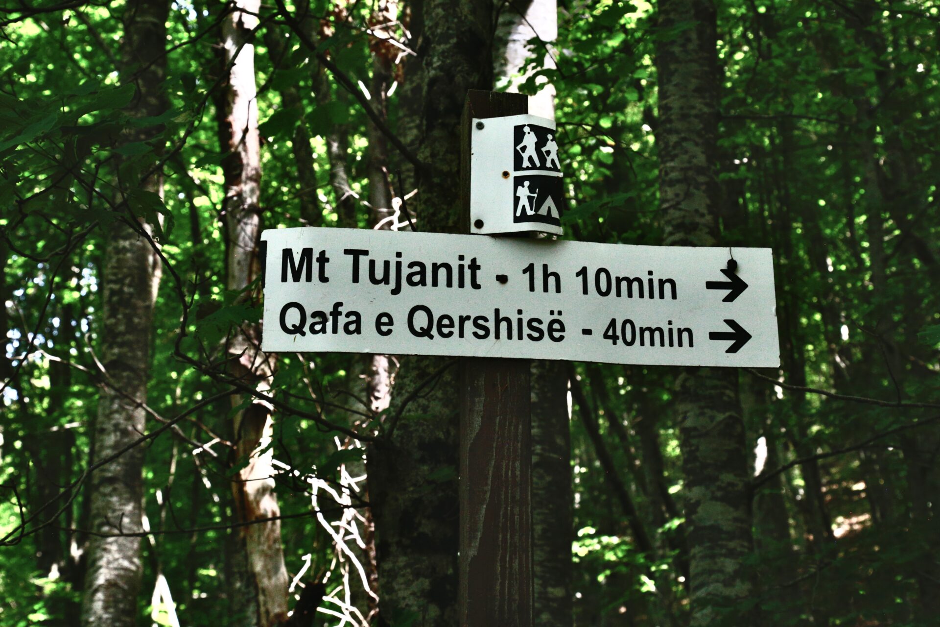
Once you find the abandoned hotel and enter the woods, keep your eyes peeled for the sign pictured below. Head toward Mt Tujanit and keep your eyes out for the red and white markers pictured above. These will keep you on the right track.
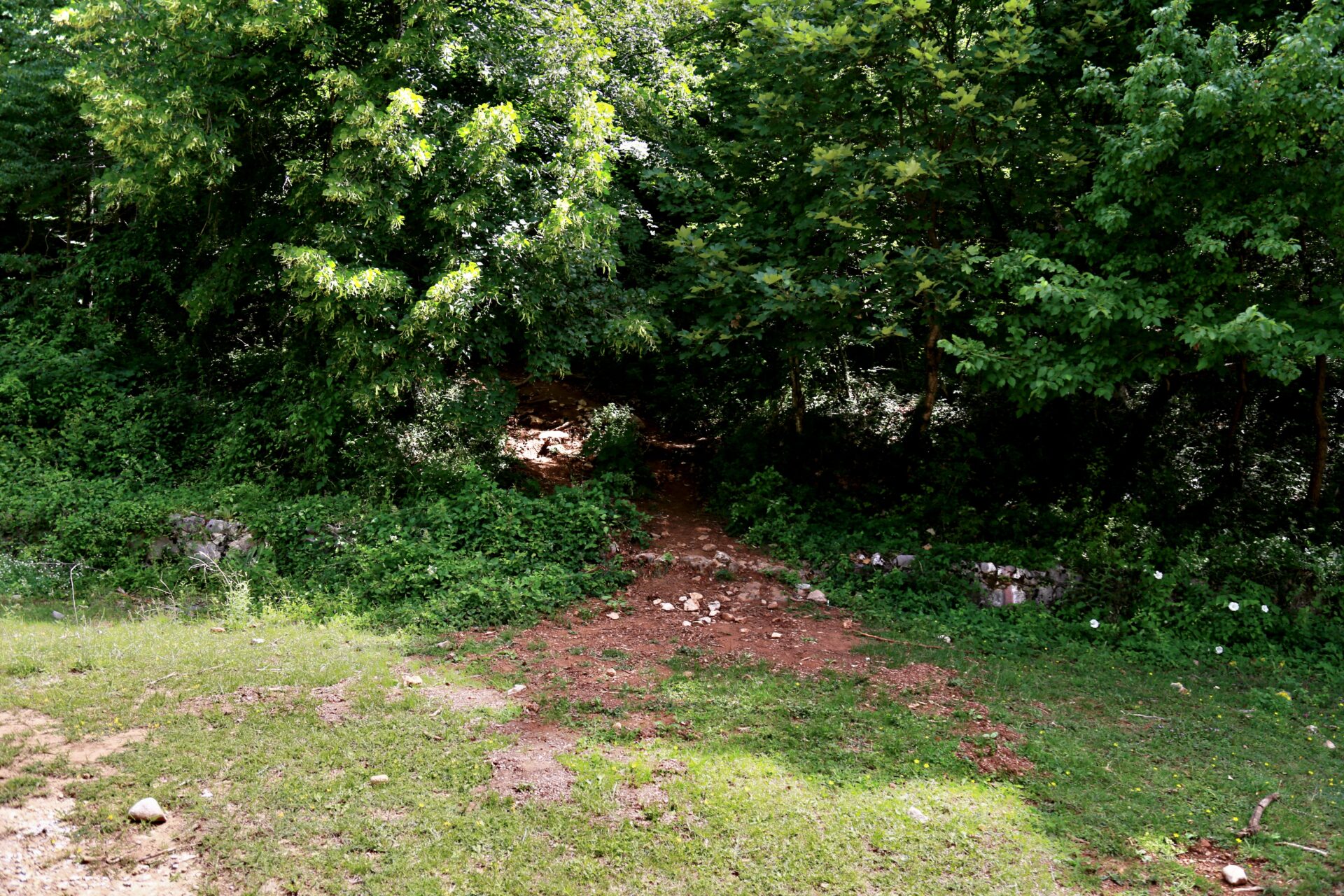
There’s honestly nothing to report for the first 2kms of the Maja e Tujanit hike. You’ll see lots of trees, hit a few steep sections, and a rocky area here or there, but the trail itself is basic and has next-to-no hazards.
Interactive Albania Google Map
Get my 200+ Albania recommendations saved directly to your Google Maps app
I designed this map to help you save time planning & to quickly access travel tips & places when you’re on-the-go
- Outdoors: hiking trails, waterfalls, secret beaches & national parks
- Places: ancient cities, beach towns & historical sites
- Things to do: viewpoints, unique activities & tours
- Planning: lodging, restaurants, bus stops & tedious details
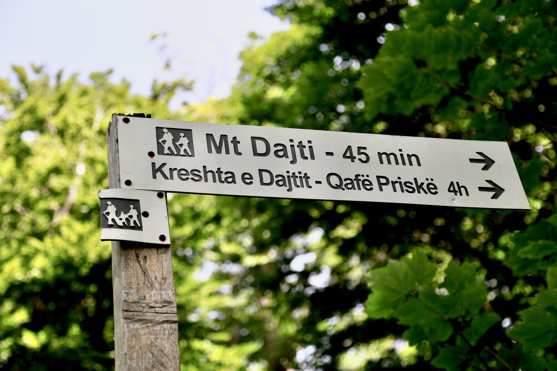
Eventually you’ll come across another sign. Despite initial thoughts, you’ll actually take a left in the direction of the ripped off sign. Walking toward Mount Dajti will take you to a much longer and taller hike. The Mt Dajti trail looks like it follows a long ridge and passes through a mountain village before descending to ground level at a location across the city, adding hours to your day.
Not too long after you pass the sign you’ll reach the Maja e Tujanit summit where you’ll find the view of Dajti National Park and Bovilla Lake.
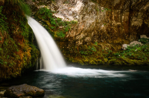
If you’re interested in seeing Bovilla Lake up-close and doing a hike to a viewpoint there, you can take this tour. There are no buses to the Bovilla Lake hike and if you drive, your vehicle must be 4×4.
Please pack out your garbage! When I completed the Dajti hike I picked up enough trash to fill an entire bag which was super disappointing to see.
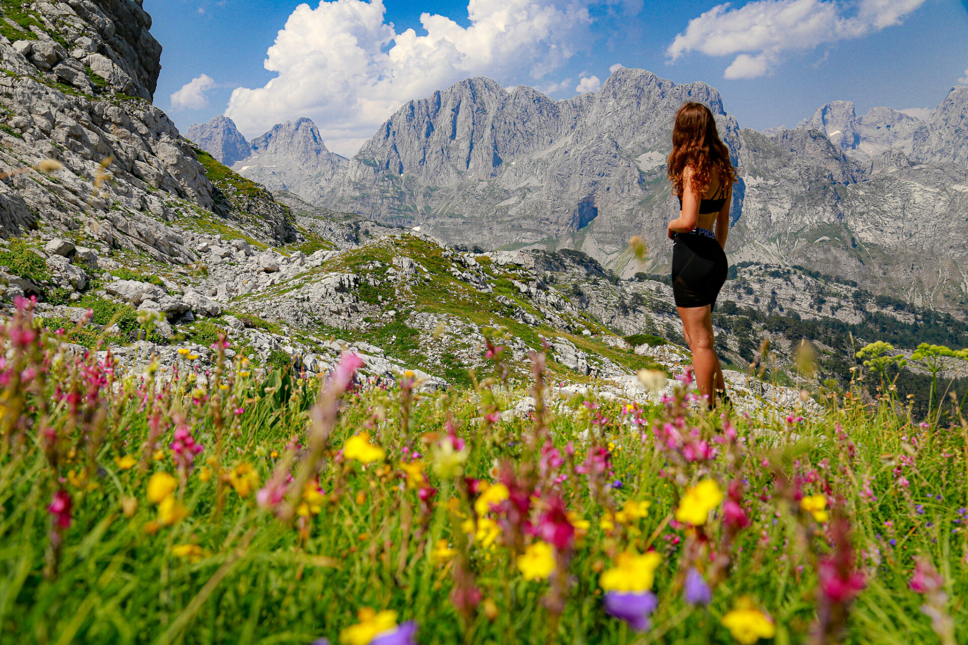
Hikes near Tirana.
Tips for Hiking in Albania
Hiking in Albania is exciting as many trails are quiet and the nature seems wild and undeveloped. It can be a bit tricky to find information about hiking trails in Albania online, so a lot of knowledge comes from locals. Talk to your accommodation providers as they’ll know best.
The best time of year to go hiking in Albania is definitely the shoulder seasons – May, June, and September being the best months. Hiking is popular in peak summer (July and August), but temperatures during these months can be brutal. When I hiked through the alps in July it was 35 degrees+ at altitude.
You’ll want to carry at least 3L of water with you – I always carry a water bladder like this as it helps me stay hydrated. Bring sun protection – I prefer long sleeves and hats rather than sunscreen – along with some extra snacks, electrolytes, and sweet treats to keep you motivated. These always help me!
I’m an avid Alltrails user, but unfortunately only the mega-popular trails (like the Valbona-Theth trail) exist on this app. In Albania Wikiloc seems to be the most common platform for hike-finding.
The best hiking trails in Albania are in the northern alps. Here’s my hiker’s guide to the Albanian Alps which outlines everything you need to know about hiking in this area.
Next: 10+ Albania Hikes Worth Doing
Interactive Albania Google Map
Get my 200+ Albania recommendations saved directly to your Google Maps app
I designed this map to help you save time planning & to quickly access travel tips & places when you’re on-the-go
- Outdoors: hiking trails, waterfalls, secret beaches & national parks
- Places: ancient cities, beach towns & historical sites
- Things to do: viewpoints, unique activities & tours
- Planning: lodging, restaurants, bus stops & tedious details
Maja e Tujanit is the best hike near Tirana.
Happy adventuring!
Taylor ♡
Like This Post?
Share with friends or save it for later!
About the Author
HI, I’m Taylor – the voice behind The Holistic Backpacker.
After moving to Banff National Park in 2020 I became an outdoor adventure enthusiast and vowed to never stop exploring.
I now spend my days travelling the world, climbing mountains, and spending nights under the stars in the Canadian Rockies backcountry.
I created The Holistic Backpacker so I could share my adventures and help connect people like you with the same amazing experiences.


2 Comments
Alex Tiffany
Thank you so much for this amazing guide! I’m actually going to do this hike today, and this is by far the best and most helpful guide I’ve come across to help me plan it. 🙂
The Holistic Backpacker
so glad you found it helpful! It’s a beautiful hike – hope you enjoyed 🙂