
Complete Maja Rosit Hike Guide, Valbona (Albania’s Prettiest Hike)
Maja Rosit is hands-down the prettiest hike in Albania and easily my favourite hike in the Albanian Alps. The Maja Rosit trail starts off in Valbona Valley National Park, then crosses the border into Montenegro’s Prokletije National Park.
The Valbona-Theth hike is the main trail in Albania that gets all the hype, however other hikes like Maja Rosit are slowly starting to gain traction. Add this one to your bucket list before the crowds catch wind.
In this guide I’ll go over important hiking information for the Albanian Alps, where to stay in Valbona, how to get to the Maja Rosit trailhead, plus everything you need to know about the Maja Rosit hike itself.
More: 3 day Valbona itinerary | 10+ hikes in Albania
Skip Ahead:
- Tips for hiking the Albanian Alps
- Best time of year to hike in Valbona
- How to get to Valbona
- Where to stay in Valbona
- About the Maja Rosit hike
- What to expect along the Maja Rosit hike
- What to wear hiking in Albania
I have affiliate links in this post which means when you book a hotel or purchase a product, I may make a small commission ~ at no additional cost to you (full disclosure). These funds go back into The Holistic Backpacker and help me create more free content like this!
Thank you for supporting my work!
Interactive Albania Google Map
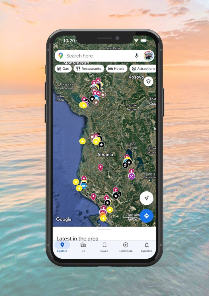
Get my 200+ Albania recommendations saved directly to your Google Maps app
I designed this map to help you save time planning & to quickly access travel tips & places when you’re on-the-go
- Outdoors: hiking trails, waterfalls, secret beaches & national parks
- Places: ancient cities, beach towns & historical sites
- Things to do: viewpoints, unique activities & tours
- Planning: lodging, restaurants, bus stops & tedious details
Quick Albania Travel Guide:
**Find my recommended Albania itineraries linked in the section below**
Travel Insurance: ALWAYS purchase reliable travel insurance before your trip. This insurance is trusted by backpackers and adventure sport enthusiasts around the world. You can also use my link to receive 5% off SafetyWing policies. Here’s a blog post with more trustworthy travel insurance options you can compare.
Purchase my Albania map which is interactive and downloadable to Google Maps on your phone. It has 200+ pinned locations around the country – all available at your fingertips.
Transportation: to enter the country you’ll find 1 international airport in Tirana, 1 port in Saranda (daily ferry arrivals/departures to Corfu, Greece), and a bus line from Montenegro. Buses are very cheap here, but unreliable. Taxis are pricey in comparison. There are no passenger trains in the country. If you’d like to rent a car, I recommend using this site to find the cheapest rates.
Best Activities: Looking for the best tours and activities around Albania? See my Viator shop for my top recommendations.
Best Time to Visit: May to September.
Currency: Albanian LEK (aka ALL). This is a closed currency so you’ll need to wait until you’re in Albania to withdraw/exchange money. Make sure you exchange any leftover money before you leave the country too. Credins ATMs don’t have a service charge.
Phone: purchase a local SIM card from Vodafone – the plans are cheap and they include lots of data, however international minutes are typically not available. Vodafone storefronts can be found in bigger cities (Tirana, Saranda, Shkoder, etc).
Language: Albanian, however you can get by with English. Google translate is recommended for smaller cities/villages.
Safety: I found Albania to be very safe. I and my fellow travellers had no trouble with theft and I felt comfortable walking around as a solo female at night. People are generally very welcoming here, but always keep your wits about you – no matter where you travel.
Helpful Info: don’t drink the tap water or bring a purifying bottle like this one. Most hostels/guesthouses/hotels have laundry facilities.
Packing Guide: here’s my ultimate packing guide/travel essentials.
Albania is one of the last “undiscovered” countries in Europe. Plan your trip while prices & tourism levels are low!
Helpful Albania Blog Posts
Albania Itineraries: 1 week south | 1 week north | 2 weeks whole country | 1 month for backpackers
- My Ultimate Albania Backpacker Guide
- 15+ Helpful Tips You Should Know BEFORE Travelling Albania
- 30+ Best Things to do in Albania: Excursions, Tours, and Destinations
- 17 Best Places in Albania
- Hiker’s Guide to the Albanian Alps
- Valbona to Theth Hiking Guide
- 10+ Albania hikes Worth Doing
- Lodging: best hostels for backpackers | luxury hotels
Tips for Hiking the Albanian Alps
For most people, hiking in Albania may seem intimidating. These tips should answer any questions you might have about hiking in this “unexplored” country of Europe.
- Hiking season runs from May-Oct, although the cooler temps & changing colours make May-mid June and September ideal months to visit.
- Stay at Wanderer’s Hostel in Shkoder prior to your trip to Valbona/Theth. You can store your extra luggage here while you’re away hiking.
- Water sources are limited on any trail, especially in the summer when sources dry up. Ensure you plan appropriately and pack lots of water. I always recommend bringing minimum 3L in a Hydrapak.
- If you stick to the popular hikes, trails are generally well-marked and easy to follow.
- The ideal length of time to spend hiking in the Albanian Alps is 3-4 nights (unless you want to explore more trails).
- There are no shopping markets in the alps. Bring your own food from Shkoder or plan to eat at the local guesthouses.
- Take advantage of your guesthouse’s packed lunch option if you want to get an early start hiking.
- You don’t need a guide in the alps, however I’ve linked some great tours in the section below.
- Solo hiking is totally safe in Valbona granted you stick to the main trails and feel comfortable hiking alone.
- I had a local SIM card and had cell service throughout mainly all of Valbona and theth. Wifi at the guesthouses is typically standard.
- Hiking in summer is HOT. Wear breathable clothes, a full-coverage hat, and wear sunscreen.
- Get an early start to beat the heat. I started hiking at 4am every day, but by afternoon (at elevation) the mountains reached 35 degrees celsius in July.
- Bring extra cash. You won’t be able to use your cards in the alps. No card = no food.
Aside from Maja Rosit, the Theth to Valbona hike is very popular, plus it’s the only way to get to Theth without backtracking to Shkoder.
Popular Albania Tours
From Berat: 4×4 tour: Mount Tomorr & Sotira Waterfall | Bogove Waterfall & Osumi Canyon | Osumi Canyon Rafting
From Permet: Benja Hot Springs & Lengarica Canyon | Horseback Riding | River Rafting
From Tirana: Gamti Mountain & Bovilla Lake Hiking Tour | Bike Tour | Traditional Cooking Class | Zipline
From Tirana or Shkoder: Day trip to the Blue Eye of Theth & Grunas Waterfall | Shala River Day Trip
From Vlora: Boat tour to Haxhi Ali Cave & Sazan Island – Karaburun | Snorkelling
From Saranda/Ksamil: Paddle boarding the Islands | Butrint, Ksamil, Blue Eye, Lekuresi Castle – 1 Day | Day Trip to Gjirokaster | Catamaran to Korez & Kokomo Beach
UNIQUE: Multi-day hiking tour: Peaks of the Balkans
You can find more Albania tours I recommend here
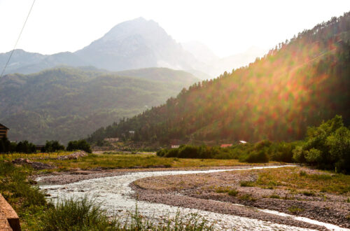
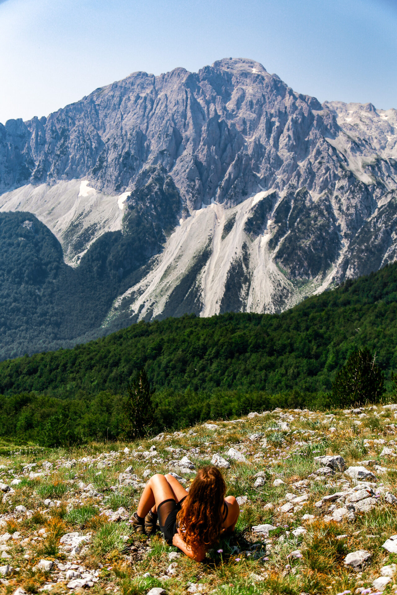
Best Time of Year to Hike in Valbona
The best time of year to hike in Valbona depends on what weather conditions you’re after. I personally think June and September are the best months to hike in Valbona Valbona, however below I explain each month so you can get the full picture.
In the winter months Valbona receives heavy snowfall. Snow begins to fall in Valbona from late October to early November/ The snow in Valbona begins to melt around late April to early May.
By late June the peaks and higher altitude zones should lose their snow and become accessible – aka a great time of year to go hiking in Albania’s mountains. June in the alps has slightly smaller crowds and cooler temperatures than the peak summer months. An average of 17-22 degrees during the day and 11 degrees at night; cooler at higher elevations if you’re hiking.
July and August are nice months to visit Valbona as this is when other backpackers will be around, fields of alpine wildflowers will bloom, and there’s next to no rain. I visited during July and temperatures at elevation reached 35 degrees+ which made hiking difficult though. I ran out of water and started hiking at 4:00am to beat the heat.
September and October is when autumn strikes Valbona. September is similar to June for temperatures and this is when the fall colours change. October’s weather varies year-to-year and is a bit unpredictable.
best time of year to hike Maja Rosit in valbona
How to get to Valbona
Valbona is one of the tricker places to access in Albania, however it’s well worth the effort.

As a very quick overview – you’ll begin the journey to Valbona from Skhoder (aka the access point to the Albanian Alps). I recommend staying at Wanderer’s Hostel in Shkoder as the hostel staff can help plan your trip to Valbona AND store your additional luggage while you’re away hiking.
More: Shkoder Guide + Things to do
From Shkoder you’ll have to catch an early morning minibus to the Komani Lake Ferry Fort, then catch a ferry to Fierza where you’ll then board another mini bus which will drop you off directly at your guesthouse of choice in Valbona. Mini buses and ferry tickets can be booked here. It’s recommended you book your spot in advance to ensure a successful and timely trip.
If you’re hoping to find a visual of where all these spots are located, I have them marked on my downloadable map of Albania.
This post goes into more detail regarding the trip to Valbona from Shkoder.
One thing I HIGHLY recommend is spending 1 night on the Shala River (aka the “Thailand of Albania”) prior to visiting Valbona. You can also visit the Shala River as a day trip.
Best Albania Car Rental
Looking to rent a car to explore Albania’s remote beaches, mountain towns, and ancient cities not accessible via public transportation?
My favourite Albania car rental tool is this site as it compares all the local rental companies to find you the best rate.
Where to Stay in Valbona
There are plenty of guesthouses in Valbona where hikers lodge during their travels. In addition to sleeping at the guesthouses, you’ll eat there too. All food in the alps comes from the locally operated guesthouses, not a supermarket.
Maja Rosit Hike, Valbona
- Upscale Option: Drino’s Guesthouse is absolutely lovely. I stayed here one night and thoroughly enjoyed my experience. Drino’s family owns a delicious restaurant nextdoor too.
- Luxury Stay: Valbona Resort & Spa
- Budget Stay: Bujtina Albjoni
- Popular Choice: Villas Jezerca
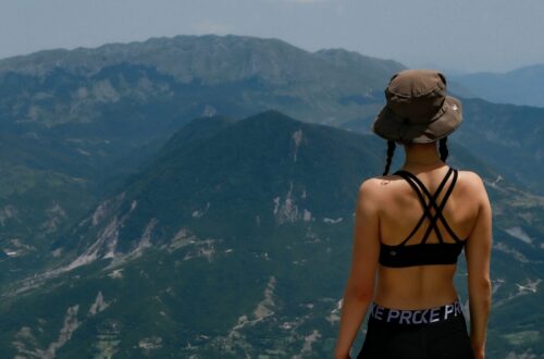
About the Maja Rosit Hike
- Distance: 16.1kms
- Elevation: 1,1200m
- Type of Trail: out & back
- Rated: hard
- Estimated Time: 6-8hrs
The map below goes to Rosni summit. I opted to go as far as the pass – the statistic above are to/from the pass only.
The trail up to Maja Rosit is easy to follow and doable for hikers of all abilities. The trail past the pass to Rosni Peak is a scramble and should only be attempted by experienced hikers. Speak to the locals in town if you’re hoping to acquire information about the Rosni Peak scramble.
The Maja Rosit trail passes through a few guest houses early on, then starts to quickly gain elevation. The elevation gain is fairly steep and continues steady up until the pass – there are no “breaks.” You’ll be very exposed to the elements on the Maja Rosit hike, so proper sun protection is a must.
There are no water sources along the Maja Rosit hike, so I recommend carrying minimum 3L in a pack like this. I hiked in July and ran out of water at the pass which is why I couldn’t continue on to the summit.
Currently (as of summer 2023) the Maja Rosit hike sees very low traffic – I only saw two other people the entire day I hiked. I imagine this hike will become much more popular as time progresses.
There are markers along the Maja Rosit trail, however they’re fairly confusing so I recommend using Alltrails+ which allows you to download offline maps. Cell phone service can be spotty up here, so having the ability to download the trail map is super helpful.
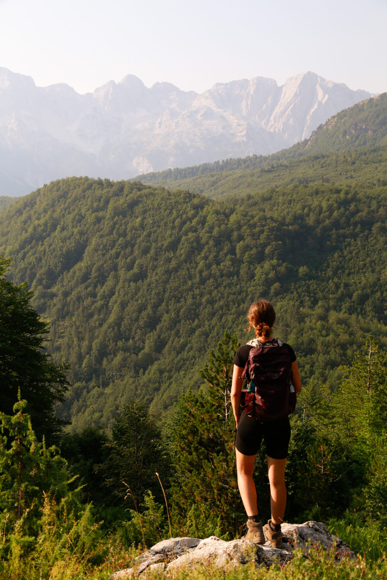
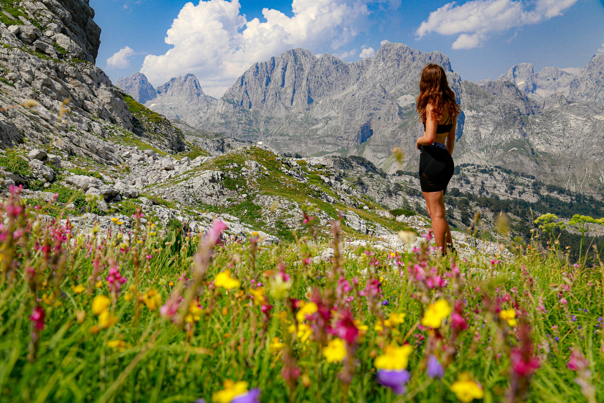
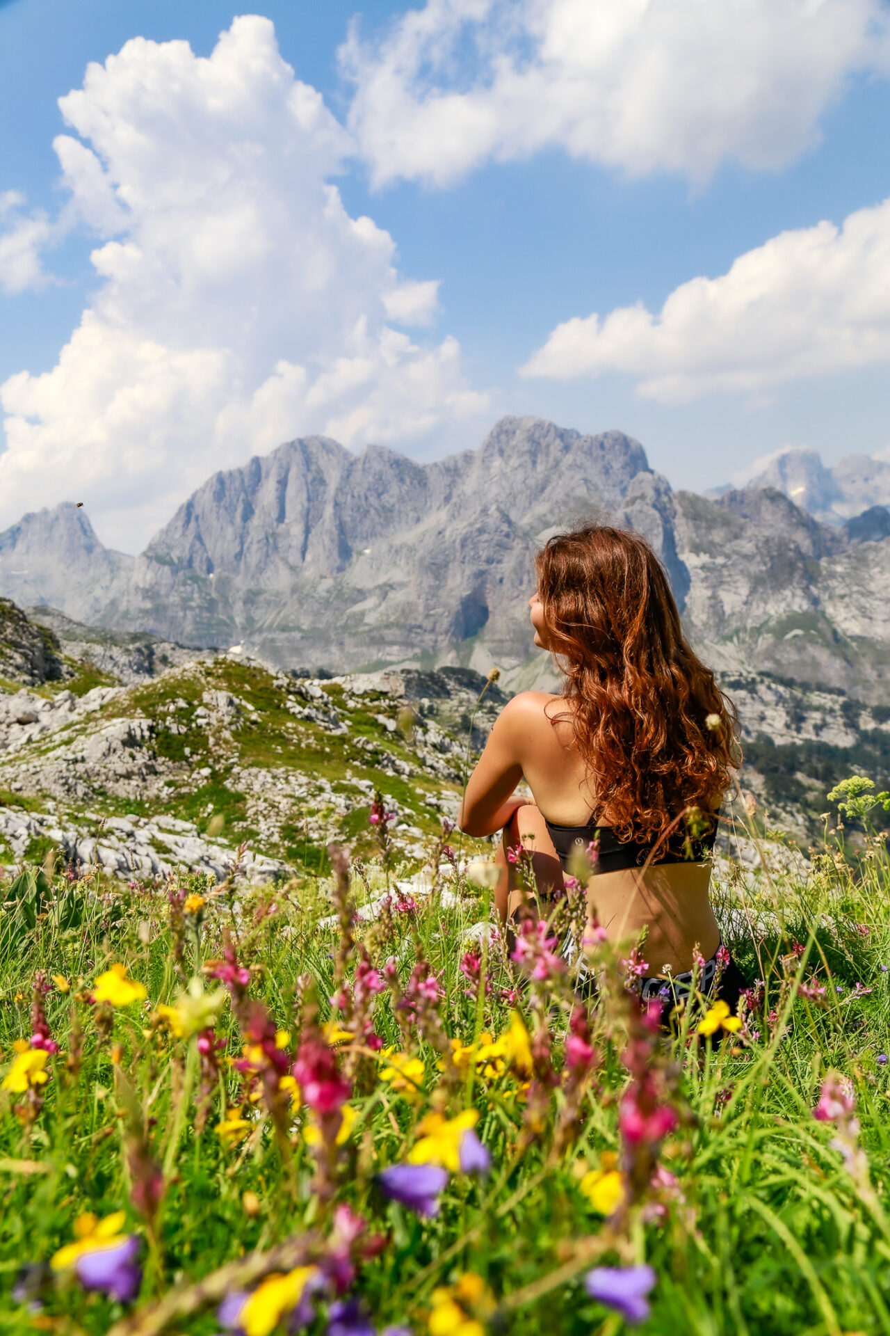
At the pass, the Maja Rosit trail crosses the border into Montenegro’s Prokletije National Park where you’ll find epic mountain views and vibrant wildflowers if you hike in July.
Interactive Albania Google Map
Get my 200+ Albania recommendations saved directly to your Google Maps app
I designed this map to help you save time planning & to quickly access travel tips & places when you’re on-the-go
- Outdoors: hiking trails, waterfalls, secret beaches & national parks
- Places: ancient cities, beach towns & historical sites
- Things to do: viewpoints, unique activities & tours
- Planning: lodging, restaurants, bus stops & tedious details
What to Expect Along the Maja Rosit Hike
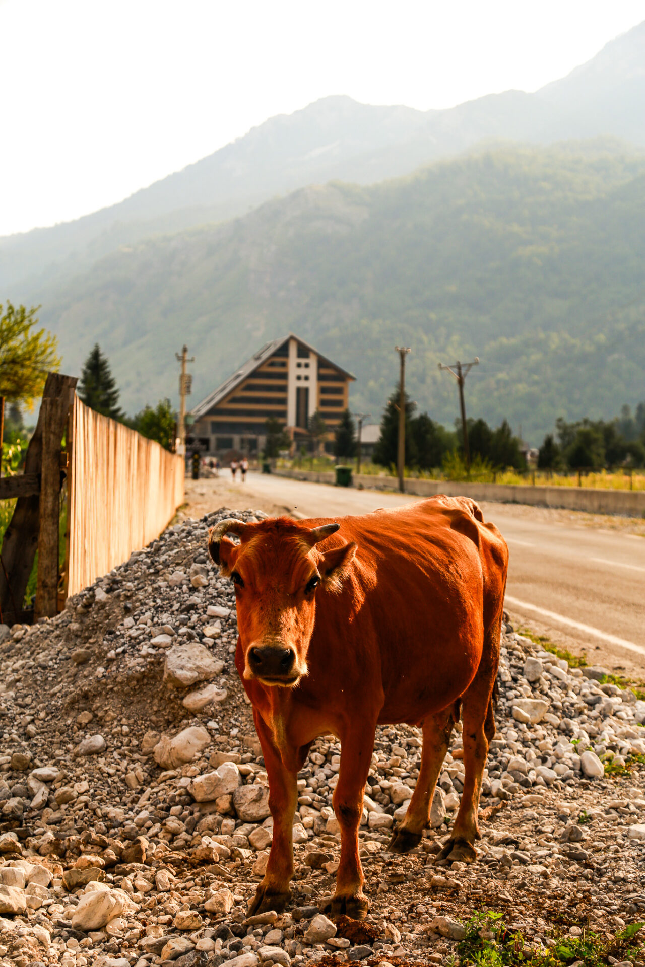
The Maja Rosit trail starts here, ventures through the forest, then passes by a couple guesthouses (Hotel Rosi and Guesthouse Kukaj) which commonly have cute pups and cows running around.
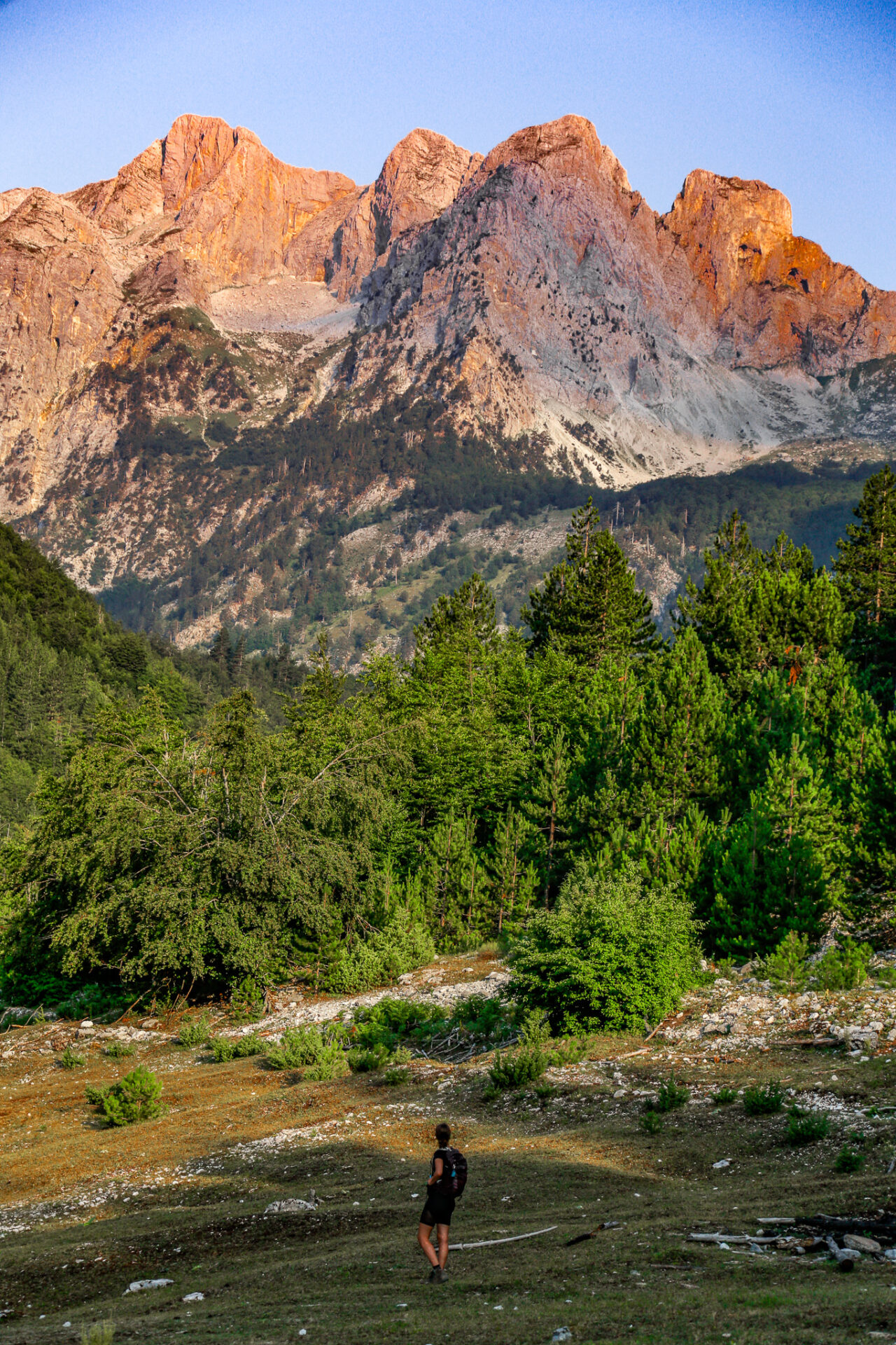
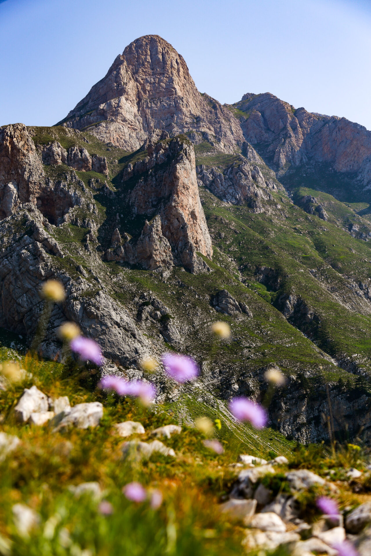
Quickly after the guesthouse, you’ll find a clearing with a wicked view of a handful of mountains; Maja Ete and Maja Eles being the show stoppers. If you’re able to get here in the early hours of the morning, the sun lights up these faces beautifully and it’s a great spot for breakfast. For timing purposes, this point of the trail is approx 3kms with 250m gain in.
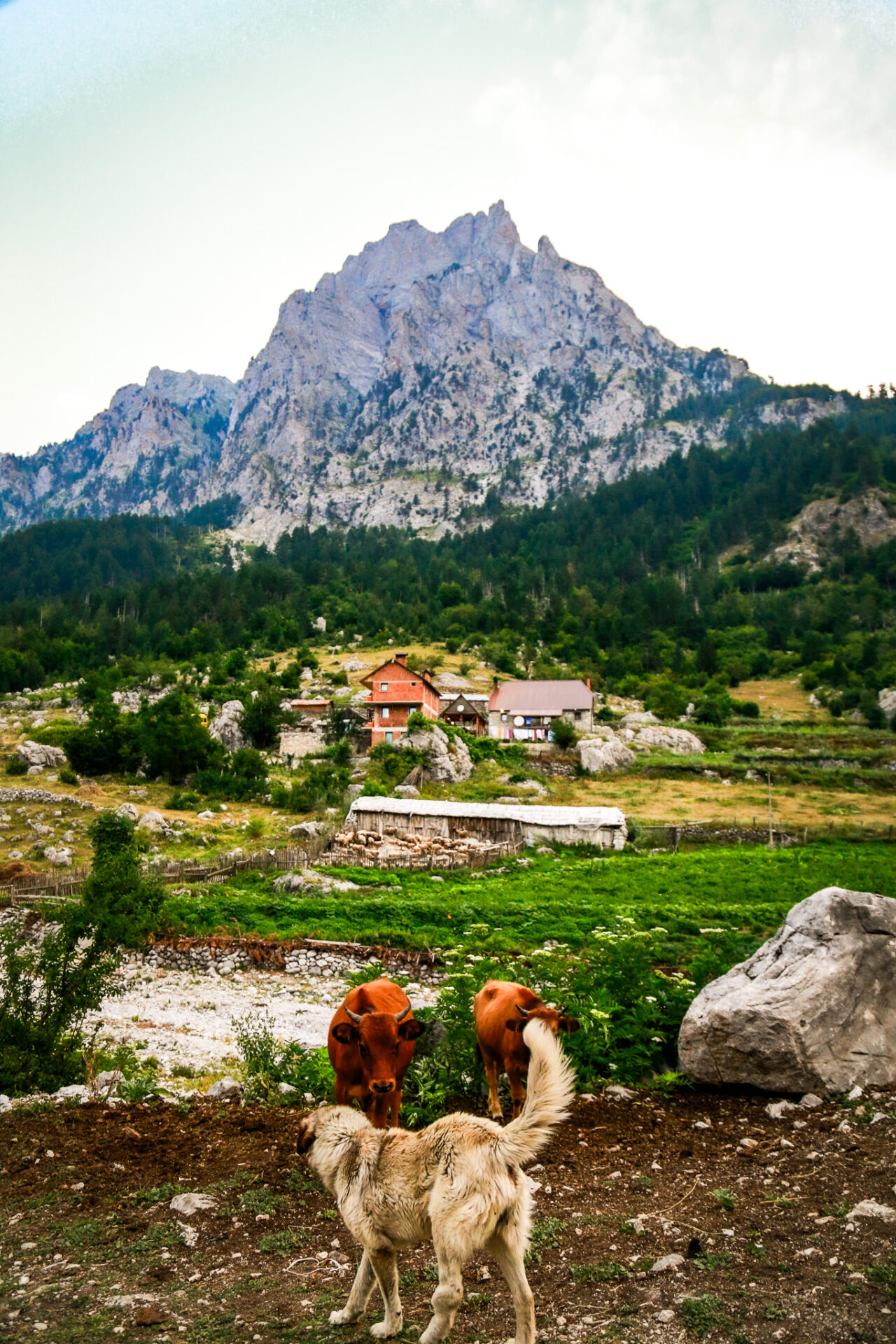
After this the trail relentlessly climbs uphill through various forested and open sections. The higher you climb the more the scenery opens up of Valbona Valley below you. You may see various cows roaming about and the trail is easy to spot as it’s packed down.
The 360 degree mountain scenery and the greenery here made me feel like I was hiking through the French or Italian Alps. Who knew Albania had mountains like this – let alone alps! This section of mountains is commonly referred to as the “Accursed Mountains.”
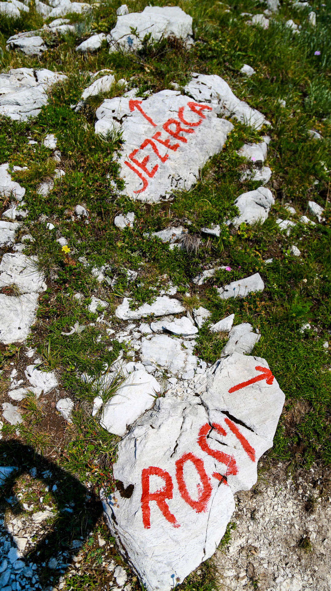
The closer you get to the pass, the more the trail will break off and go in different directions. There are many other unmaintained trails around here. I recommend downloading the Alltrails map so you can track your location and ensure you’re going the right way.
There’s one notably important intersection where the trail splits – one way to Maja Rosit, the other to Jezerca. This area is marked by rocks displaying names and arrows. Go in the direction of “Rosi.”
After this point you’ll hike around the peak you just walked up to. Approx 1km later you’ll venture left off the main trail toward the pass. With 30m more of elevation you’ll be up at the pass.
After this, head back down the exact same way you came up or venture up the scramble route for Rosni Peak (for experienced hikers only).
What to Pack/Wear Hiking in Valbona
What you pack for Valbona varies slightly depending on the season. Need a reminder of Valbona month-by-month? Scroll back.
Maja Rosit Hike, Valbona
Here’s my go-to packing guide/travel essentials
I think 30-35L is the perfect size backpack for Valbona. Generally you’ll need to pack your clothing, toiletries, travel towel, proper footwear (running shoes at the minimum – trail runners or hiking boots are best), snacks, and “camp shoes” – I like Crocs or sandals.
Keep in mind you can store your additional luggage at Wanderer’s Hostel in Shkoder if you opt to stay there before you leave for Valbona.
What to Pack for Valbona in Spring/Autumn (May-June/September-October)
This time of year can be chilly. You’ll want to pack pants, a long sleeve, a light jacket, and warmer sleeping clothes. I always like to have thin gloves and a toque on hand at this time of year too. Rain is unlikely, but possible so a waterproof layer may prove to be handy.
Gore-tex shoes and an extra pair of socks is ideal in spring as the snow melt can create muddy terrain.
What to Pack for Valbona in Summer (July-August)
This time of year is HOT. Shorts, T shirts, and light sleeping clothes are best. I brought a sweater but didn’t use it when I was there late July. You’ll want to bring sun protection, a hat, and sunglasses. A bathing suit is great if you want to take a dip in the river or jump in the Blue Eye once you get to Theth.
I recommend carrying minimum 3L of water in a bag like this.
What to pack for Valbona in Winter (November-April)
Visiting Valbona in winter is uncommon. If you do visit, plan for cold temperatures and lots of snow. Winter boots, plenty of layers, and warm accessories/base layers are required.sleeve. Bring a mid layer and a light waterproof jacket. At the end of the day, use common sense, check weather reports, and understand what your body needs in whatever temperature you’ll be hiking in.
Maja Rosit Hike, Valbona
Interactive Albania Google Map
Get my 200+ Albania recommendations saved directly to your Google Maps app
I designed this map to help you save time planning & to quickly access travel tips & places when you’re on-the-go
- Outdoors: hiking trails, waterfalls, secret beaches & national parks
- Places: ancient cities, beach towns & historical sites
- Things to do: viewpoints, unique activities & tours
- Planning: lodging, restaurants, bus stops & tedious details
Happy adventuring!
Taylor ♡
Like This Post?
Share with friends or save it for later!
About the Author
HI, I’m Taylor – the voice behind The Holistic Backpacker.
After moving to Banff National Park in 2020 I became an outdoor adventure enthusiast and vowed to never stop exploring.
I now spend my days travelling the world, climbing mountains, and spending nights under the stars in the Canadian Rockies backcountry.
I created The Holistic Backpacker so I could share my adventures and help connect people like you with the same amazing experiences.