Bitihorn Hike Guide & Trail Info, Beitostølen
The Bitihorn hike in Beitostølen is the perfect hike if you’re looking for a diverse trail with great mountain views. The Bitihorn hike has multiple trailheads and routes you can take to the summit varying from sherpa stairs to a packed, muddy trail.
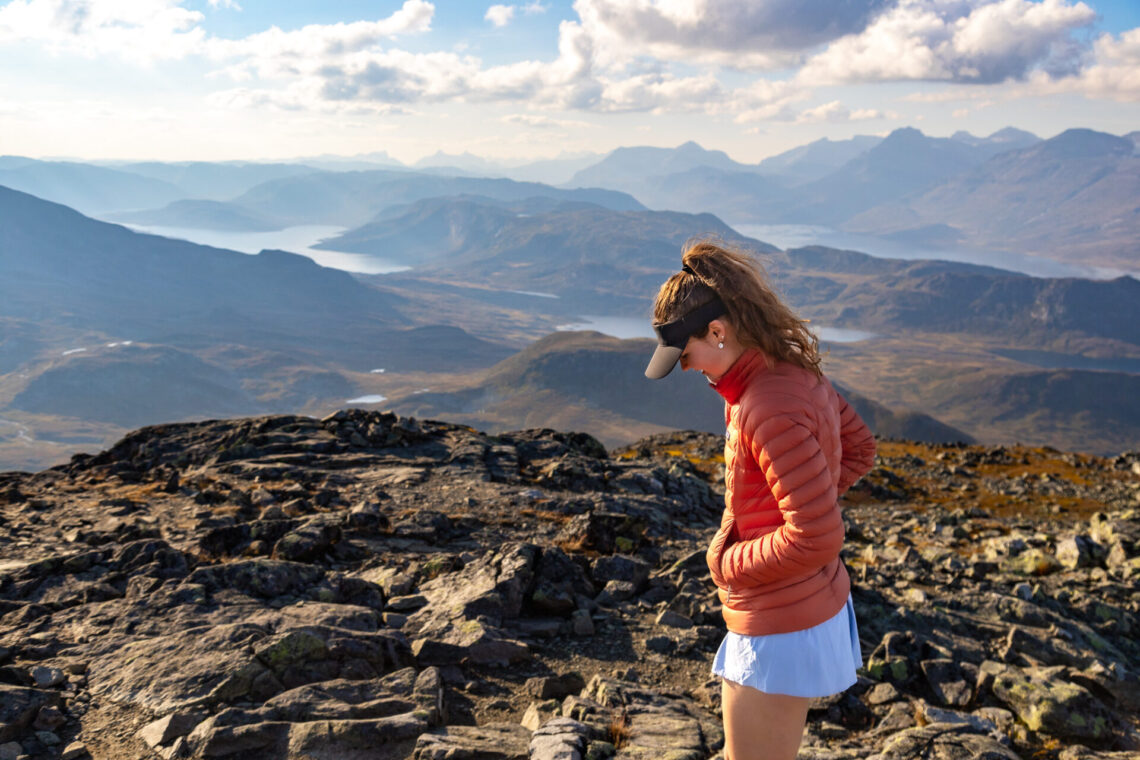
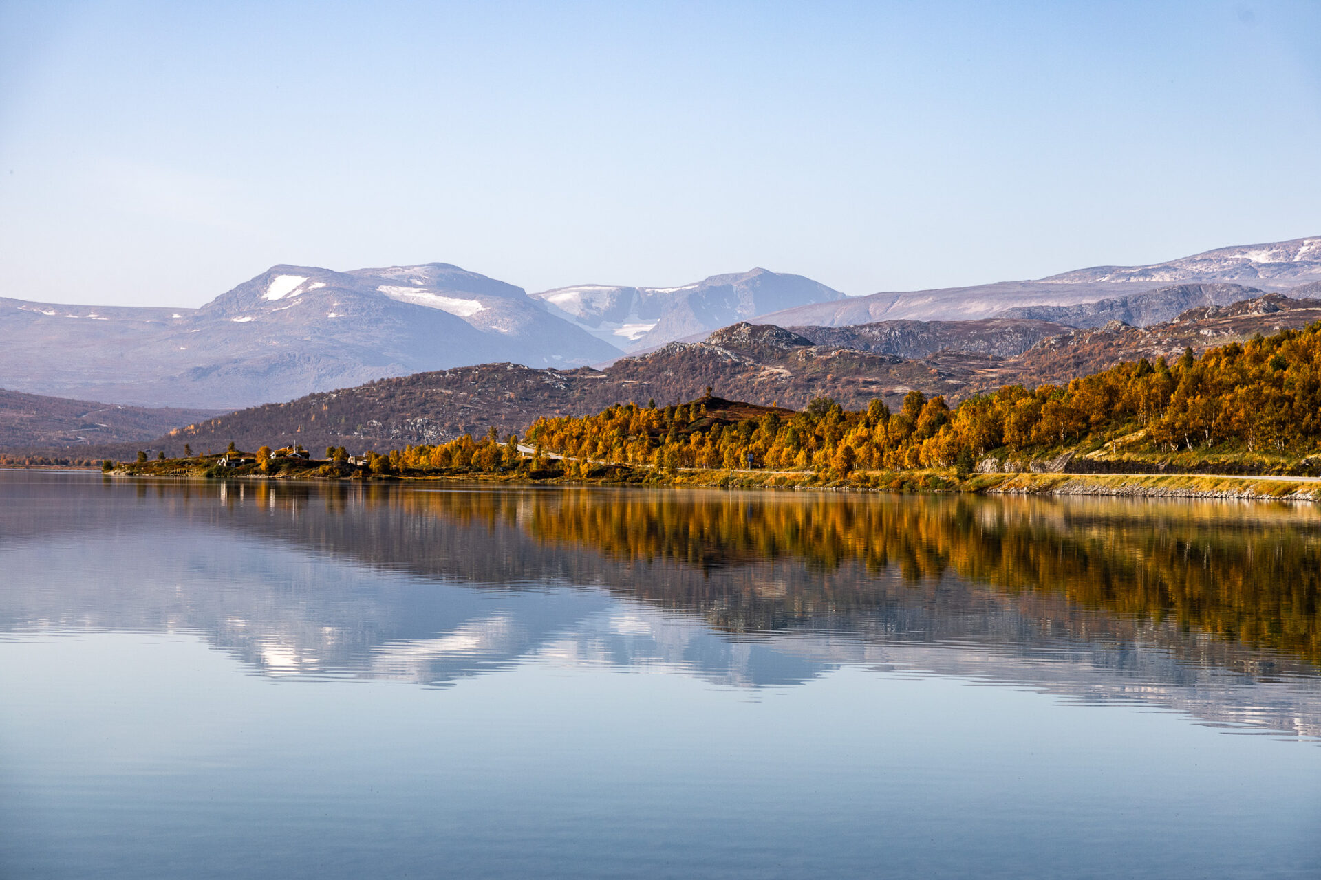
Located in Beitostølen, Bitihorn is a great trail for experienced and novice hikers alike. The trail is straightforward and the views overlooking Vinstervannet Lake are postcard worthy.
In this post I’ll tell you everything you need to know about the Biithorn hike including routes, trailheads, stats, and important things to know along the way.
Skip ahead:
I have affiliate links in this post which means when you book a hotel or purchase a product, I may make a small commission ~ at no additional cost to you (full disclosure). These funds go back into The Holistic Backpacker and help me create more free content like this!
Thank you for supporting my work!
How to get to the Bitihorn Trailhead
There are two Bitihorn trailheads. They’re located in Beitostølen which is in the Valdres region and very close to Jotunheimen National Park. The closest international airport to Beitostølen is in Oslo (3hrs, 15mins / 224kms) or Bergen (5hrs / 333kms). To get to the Synshorn hike you’ll need to rent a car as there’s no connecting bus or train.
Best Norway Car Rentals
Compare Rentals – I recommend using this site which compares the best rates for all local car rental companies in Norway.
Getaround – cost effective peer-to-peer car sharing platform. You can use my link to save $20 on your first rental.
I’ll speak more about this below, but there are two ways to summit Bitihorn and each route has different trailheads. You can complete the Bitihorn trail in a point-to-point fashion (requires a car drop/hitchhiking) or in an out-and-back fashion from either trailhead.
Bitihødn parkering, located here, is the Bitihorn trailhead for the longer hike.
Båtskaret trailhead, located here, marks the start of the shorter, airy trail up the sherpa steps.
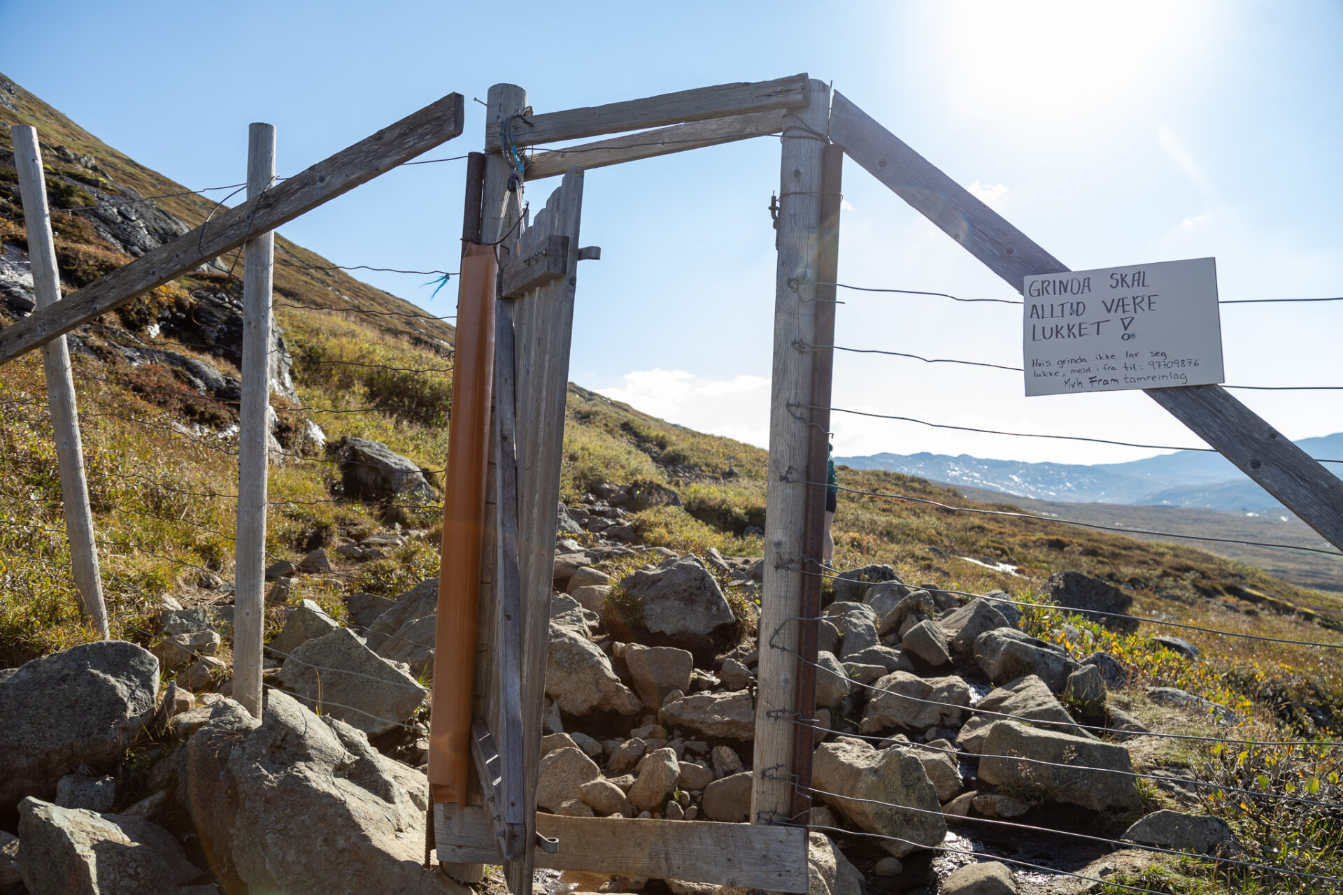
Both Bitihorn trailheads cost 60kr/day to park and can be paid in exact cash or via Vipps (Norwegian bank accounts only).
Connect via socials:
STAY CONNECTED
Sign up for emails to receive a 25% discount on my travel maps.
Taylor ♡
Where to Stay in Beitostølen
Budget Stays: private room with a sauna and this family home with a full kitchen (sleeps 2).
Hiking trails right out your door: Bygdin Høyfjellshotell (Synshorn).
Best Rated: Riddergaarden Mountain Lodge and the Radisson Blue Resort.
Peaceful Cabins: Frøy&Frøya Hyttetun is budget friendly and sleeps 4. This chalet sleeps 8, and this cozy/modern cabin sleeps 9. If you’re travelling with a large group this dreamy cabin sleeps 14.
Winter Ski Trips: this holiday home is pet friendly and located close to both skiing and hiking areas.
Stay in Nearby Jotunheimen National Park
Jotunheimen is very close to Beitostølen and offers plenty of hiking trails. I recommend the following stays in Jotunheimen which are right down the road from Beitostølen. These are great options if you’re visiting Jotunheimen or Beitostølen for a weekend or for a few days.
Cost Effective Stays: Sjodalen Hyttetun og Camping (chalet sleeps 5) and Bessheim Fjellstue og Hytter (double rooms or cottages)
Gjendesheim Turisthytte: is a hostel offering dorm, double, and quadruple rooms. You can check their availability here.
Hindsæter: hotel with a garden, terrace, a restaurant and bar. You can check their availability here.
About the Bitihorn Hike
- Distance: 7.3kms | 3.9kms
- Elevation gain: 540m | 411m
- Estimated time: 3-4hrs | 2hrs
- Type of trail: out & back or point-to-point
- Time of year: June to October
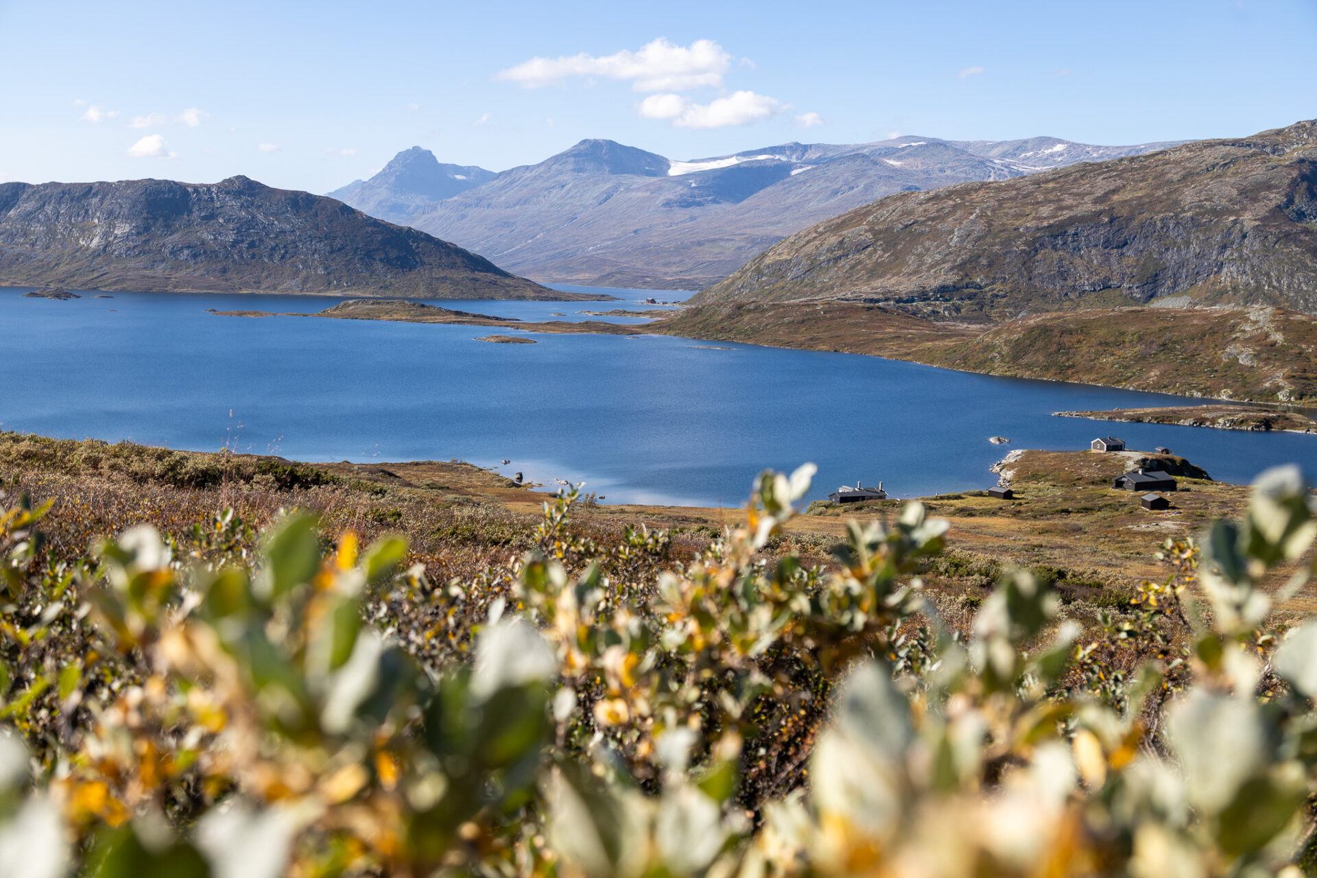
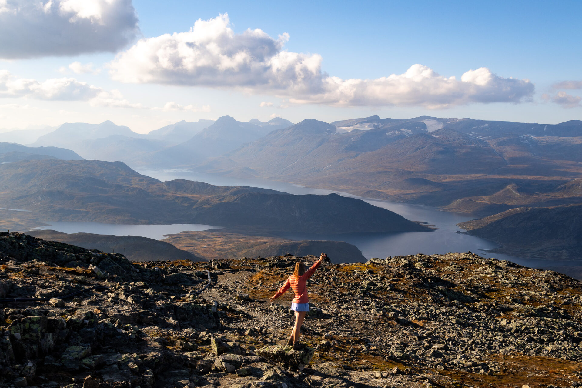
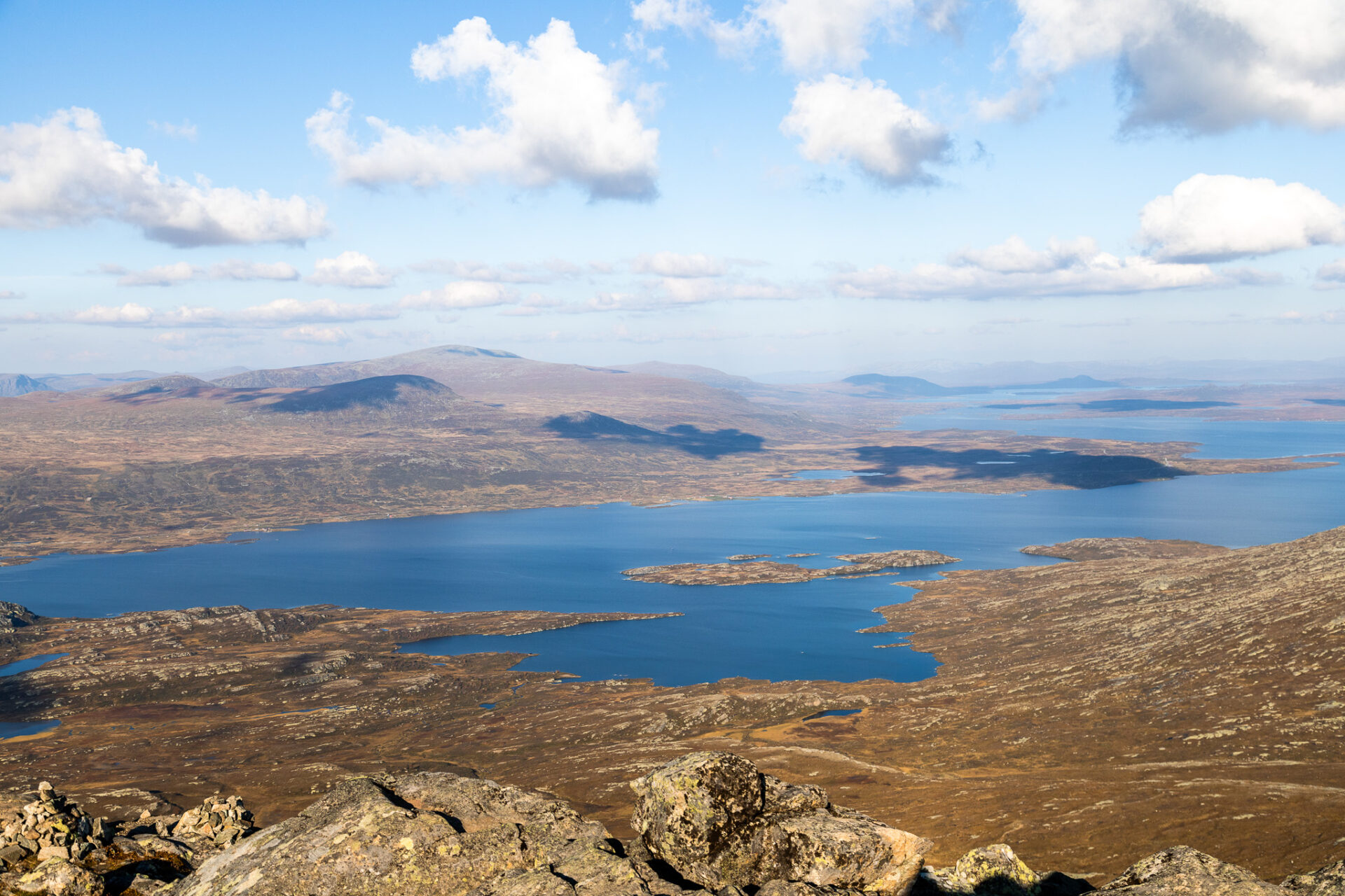
From the top of the Bitihorn hike you’ll be rewarded with sweeping views of Jotunheimen National Park, Bygdin and the Torfinnstindene to the northwest as well as the rolling, wooded hills to the east of Valdres. The star of the show is the magnificent view over the long-stretched Vinstervannet Lake.
There are multiple ways to complete the Bitihorn hike; from either trailheads in an out and back fashion or from trailhead to trailhead. Most people opt to hike in an out and back fashion from one of the trailheads because the distance in between trailheads is too great to walk. If you decide to do this you’ll need to hitchhike or do a car drop.
The trail from Bitihødn is almost double the distance and much muddier. This section of the Bitihorn hike follows a packed trail with lots of small streams and crosses a rocky section during the last stretch to the summit. Most of the rock is stable, but there are a few loose sections. Minor scrambling moves are required here and there.
The trail from Båskaret follows steep sherpa stairs to the summit. The stairs are a bit airy so those afraid of heights will prefer the Bitihorn hike from Bitihødn instead. The Bitihorn sherpa stairs can be slick in inclement weather and snow, so it’s recommended to hike in dry conditions.
Parking fees for both trailheads is 60kr/day and can be paid in exact cash or via Vipps (for Norwegian bank accounts only).
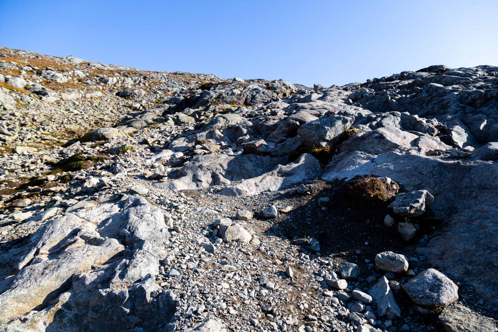
The Bitihorn hike is well marked by red dots and a handful of red “T.” It’s a well trafficked trail so you can expect to see lots of other faces on the Bitihorn hike. The Bitihorn summit is often windy so make sure you pack an extra jacket. If you’re looking for optimal lighting the Bitihorn hike at sunset is incredible.
Alltrails maps for the trails from
Hiking the Bitihorn Trail
As mentioned there are two ways to complete the Bitihorn hike; from Bitihødn or from Båskaret. You can hike from trailhead to trailhead or in an out and back fashion from either. I hiked out and back from Bitihødn so that’s what the perspective of this Bitihorn trail guide will be.
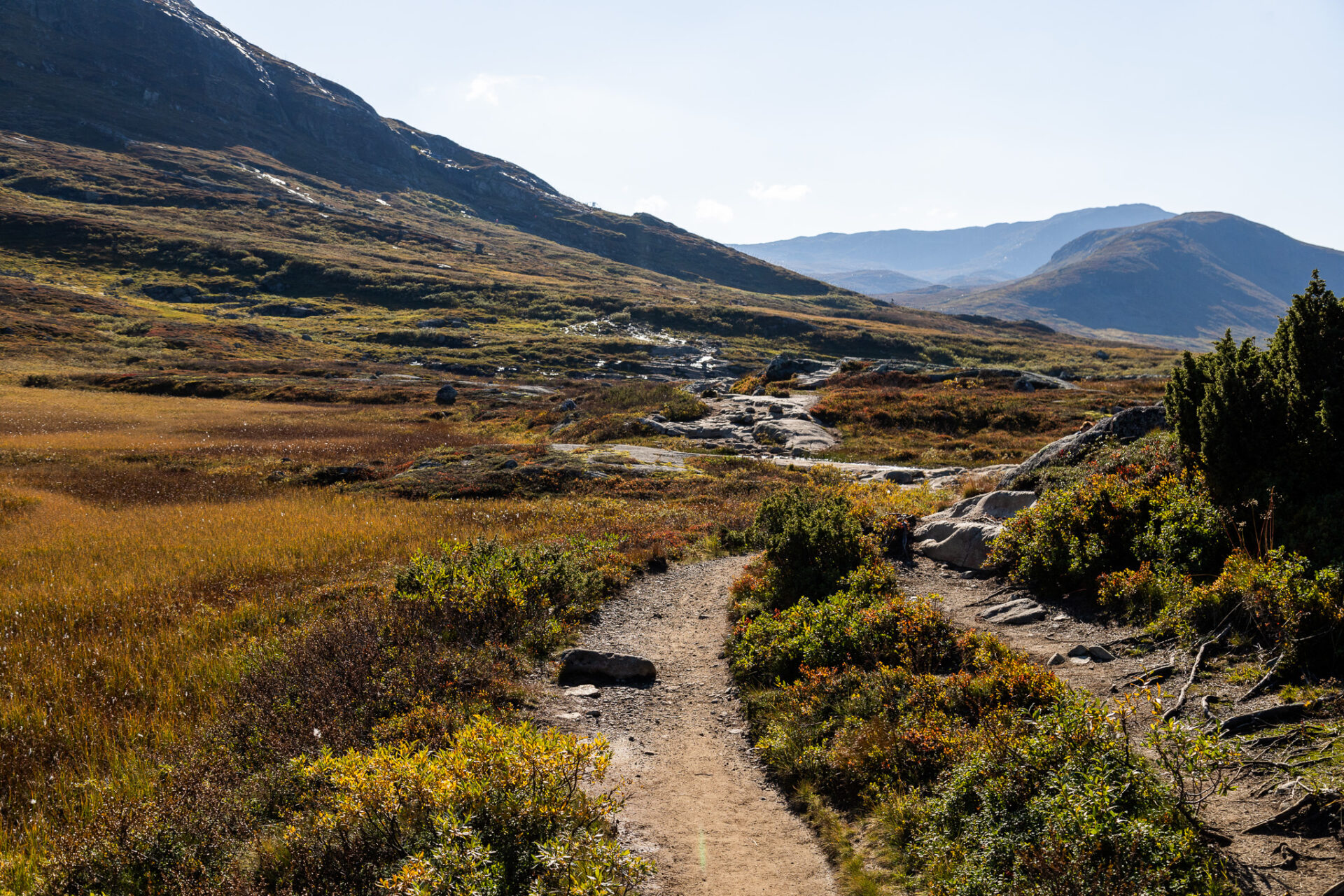
From the Bitihødn trailhead you’ll want to go to the end of the parking lot and start hiking left. This section of the trail follows a fairly flat alpine meadow which is typically muddy with large puddles and small flowing streams. Goretex boots recommended.
Once you get closer to the base of the mountain the trail starts to gain elevation – from this point you can expect steady elevation gain the rest of the hike. As you make your way around the back of the mountain views of the surrounding lakes and alpine meadows open up. Not long after the first section of elevation there’s one big move you’ll need to do where a big step and a handhold is required.
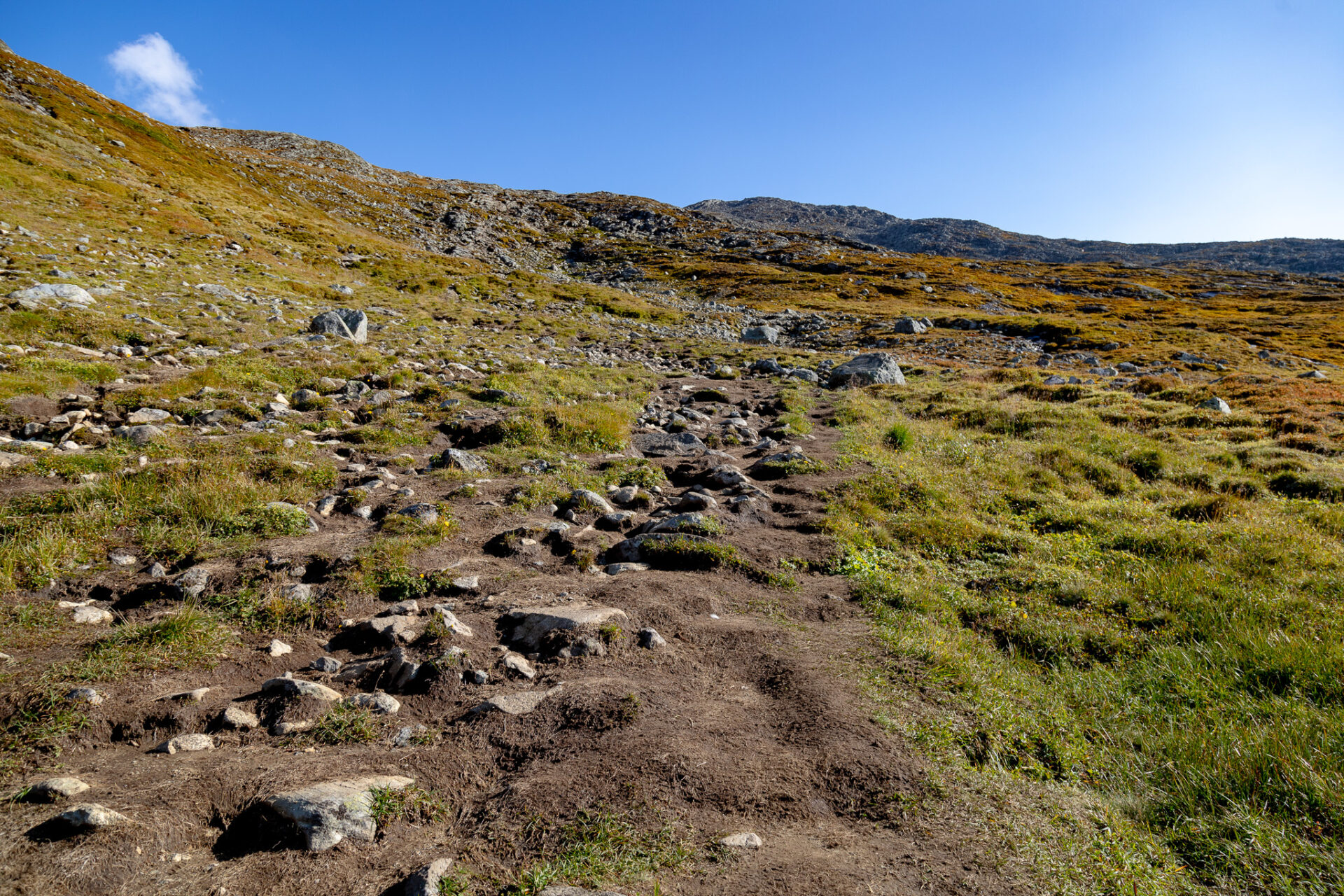
After following the packed, muddy trail for a while the Bitihorn hike transitions to a boulder field which seems never ending. There are a handful of white poles marking the way, stick to the right for the most part and keep your eye out for the red markers. Although long, this section is not difficult.
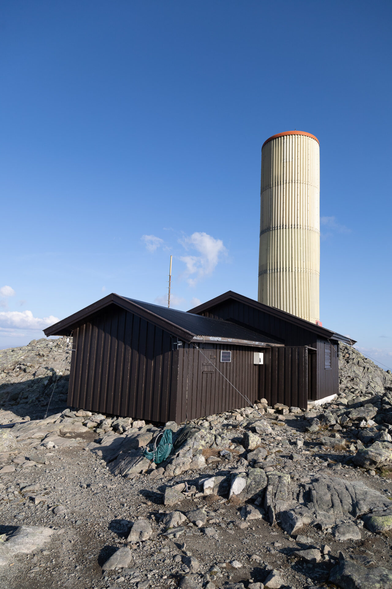
After the rock field you’ll reach the summit which stands at 1,607m. It’s a wide open, windy, cold space. There is however a large weather station you can sit behind and seek shelter when needed.
Norway Hiking Tips
Hiking season: is from June to September, but July and August are the most reliable months for good weather. You can hike in Norway in the winter months (October to May), but it can be challenging and dangerous.
- Be aware that avalanches can occur whenever there’s snow in Norway’s mountains. You can see avalanche ratings and warnings on this site.
Weather Changes Quickly: especially on the west coast and in the north. Always carry an extra layer. Packing a waterproof jacket and wearing Goretex boots is best practise as rain is frequent and trails are often muddy.
Safety: carry a satellite device. I use this one and purchase the corresponding annual Search & Rescue Insurance which covers helicopter rescue costs if accidents occur (no insurance company covers this). There is cell service on many Norway hikes – if you need to call emergency services in a cell service zone the number is 112.
Fees: there are usually parking fees at Norway’s trailheads. Payments can be made via Vipps (only for those with Norwegian bank accounts) or in cash. Carry small amounts of Norwegian kroner for this.
Trails: most trails are marked – look for the red “T.” Some “local” trails are not marked. Many Norway hikes are steep and demanding.
Wildlife: is usually not a problem in Norway, but there are sheep and goats everywhere. Make sure you close farmer gates after passing through.
Quick Norway Travel Guide
Travel Insurance: ALWAYS purchase reliable travel insurance before your trip. This insurance is trusted by backpackers and adventure sport enthusiasts around the world. You can also use my link to receive 5% off SafetyWing policies. Here’s a blog post with more trustworthy travel insurance options you can compare.
Currency is NOK (Norwegian Kroner); displayed as kr.
Visa: Generally not needed for stays up to 90 days; part of the Schengen Zone.
Phone: I purchased a MyCall local SIM card from Narvesen (convenience store) in the Oslo airport. They can also be found at 7Eleven. Please note you’ll have to show your passport and go through an approval process before your SIM is registered. You can only set up your SIM from Mon-Fri 9-5.
Norway is EXPENSIVE (obviously) and there’s limited infrastructure for backpackers. Plan your trip in detail and book everything (accommodations/activities) well in advance. Booking in advance will help you save a little $ too.
Public transportation is limited. Road tripping is the best way to see Norway’s beautiful nature. Getaround (car sharing platform) is the cheapest rental option in Norway. Use this link for $20 off your first rental.
Use Vy to find train schedules and NOR-WAY for bus schedules.
Make sure you purchase a travel adapter in advance; I like this one.
When to visit Norway: best for waterfalls in May and June, best hiking/camping in July and August, fall colours mid September to mid October, winter conditions November to April, polar nights (in the north) Dec 6 – Jan 5, northern lights are best in January and February. Weather is generally rainy in the shoulder seasons, especially in the west.
- Avalanche reports for hiking can be found here
Check out all my Norway travel guides and hiking resources.
Happy adventuring!
Taylor ♡
Like This Post?
Share with friends or save it for later!
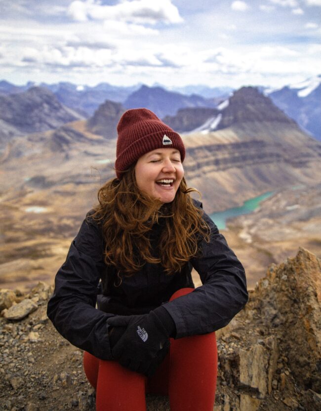
About the Author
HI, I’m Taylor – the voice behind The Holistic Backpacker.
After moving to Banff National Park in 2020 I became an outdoor adventure enthusiast and vowed to never stop exploring.
I now spend my days travelling the world, climbing mountains, and spending nights under the stars in the Canadian Rockies backcountry.
I created The Holistic Backpacker so I could share my adventures and help connect people like you with the same amazing experiences.